|
BOSTON: A GUIDE BOOK
I.
MODERN BOSTON
HISTORICAL
SKETCH
 HE
town of Boston was founded in 163o by English colonists sent out by
the “Governor and Company of the Massachusetts Bay in New England,”
under the lead of John Winthrop, the second governor of the Bay
Colony, who arrived at Salem in June of that year with the charter of
1629. It originated in an order passed by the Court of Assistants
sitting in the “Governor’s House” in Charlestown, on the
opposite side of the Charles River, first selected as their place of
settlement. This order was adopted September 17 (7 O. S.), and
established three towns at once by the simple dictum, “that
Trimountane shalbe called Boston; Mattapan, Dorchester; & ye
towne vpon Charles Ryver, Waterton.” “Trimountane” consisted of
a peninsula with three hills, the highest (the present Beacon Hill),
as seen from Charlestown, presenting three distinct peaks. Hence this
name, given it by the colonists from Endicott’s company at Salem,
who had preceded the Winthrop colonists in the Charlestown
settlement. The Indian name was “Shawmutt,” or “Shaumut,”
which signified, according to some authorities, “Living Waters,”
but according to others, “Where there is going by boat,” or “Near
the neck.” The name of Boston was selected in recognition of the
chief men of the company, who had come from Boston in England, and
particularly Isaac Johnson, “the greatest furtherer of the Colony,”
who died at Charlestown on the day of the naming. The peninsula was
chosen for the chief settlement primarily because of its springs, the
colonists at Charlestown suffering disastrously from the use of
brackish water. The Rev. William Blaxton, the pioneer white settler
on the peninsula (coming about 1625), then living alone in his
cottage on the highest hill slope, “came and acquainted the
governor of an excellent spring there, withal inviting him and
soliciting him thither.” HE
town of Boston was founded in 163o by English colonists sent out by
the “Governor and Company of the Massachusetts Bay in New England,”
under the lead of John Winthrop, the second governor of the Bay
Colony, who arrived at Salem in June of that year with the charter of
1629. It originated in an order passed by the Court of Assistants
sitting in the “Governor’s House” in Charlestown, on the
opposite side of the Charles River, first selected as their place of
settlement. This order was adopted September 17 (7 O. S.), and
established three towns at once by the simple dictum, “that
Trimountane shalbe called Boston; Mattapan, Dorchester; & ye
towne vpon Charles Ryver, Waterton.” “Trimountane” consisted of
a peninsula with three hills, the highest (the present Beacon Hill),
as seen from Charlestown, presenting three distinct peaks. Hence this
name, given it by the colonists from Endicott’s company at Salem,
who had preceded the Winthrop colonists in the Charlestown
settlement. The Indian name was “Shawmutt,” or “Shaumut,”
which signified, according to some authorities, “Living Waters,”
but according to others, “Where there is going by boat,” or “Near
the neck.” The name of Boston was selected in recognition of the
chief men of the company, who had come from Boston in England, and
particularly Isaac Johnson, “the greatest furtherer of the Colony,”
who died at Charlestown on the day of the naming. The peninsula was
chosen for the chief settlement primarily because of its springs, the
colonists at Charlestown suffering disastrously from the use of
brackish water. The Rev. William Blaxton, the pioneer white settler
on the peninsula (coming about 1625), then living alone in his
cottage on the highest hill slope, “came and acquainted the
governor of an excellent spring there, withal inviting him and
soliciting him thither.”
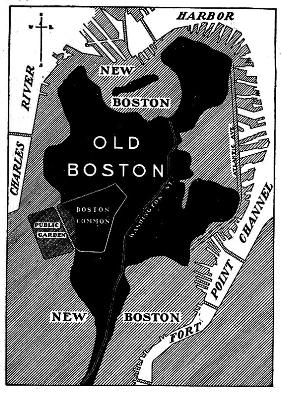
The
three-hilled peninsula originally contained only about 783 acres, cut
into by deep coves, estuaries, inlets, and creeks. It faced the
harbor, at the west end of Massachusetts Bay, into which empty the
Charles and Mystic rivers. It was pear-shaped, a little more than a
mile wide at its broadest, and less than three miles long, the stem,
or neck, connecting it with the mainland (at what became Roxbury) a
mile in length, and so low and narrow that parts were not
infrequently overflowed by the tides. By the reclamation of the broad
marshes and flats from time to time, and the filling of the great
coves, the original area of 783 acres has been expanded to 1801
acres; and where it was the narrowest it is now the widest.
Additional territory has been acquired by the development of East
Boston and South Boston, and by the annexation of adjoining cities
and towns. Thus the area of the city has become more than thirty
times as large as that of the peninsula on which the town was built.
Its bounds now embrace 27-251 acres, or 42.6 square miles. Its
extreme length, from north to south, is eleven miles, and its extreme
breadth, from east to west, nine miles. While the Colonial town was
confined to the little peninsula, its jurisdiction at first extended
over a large territory, which embraced the present cities and towns
of Chelsea and Revere on the north, and Brookline, Quincy, Braintree,
and Randolph on the west and south. So there was quite a respectable
“Greater Boston” in those old first days. The metropolitan
proportions continued till 1640, and were not entirely reduced to the
limits of the peninsula and certain harbor
islands till 1739.
East
Boston is comprised in two harbor islands: Noddle’s Island, which
was “layd to Boston” in 1637, and Breed’s (earlier Hog) Island,
annexed in 1635. South Boston was formerly Dorchester Neck, a part of
the town of Dorchester, annexed in 1804. The city of Roxbury (named
as a town October 8, 1630) was annexed in 1868; the town of
Dorchester (named in 1630 in the order naming Boston), in 1870; and
in 1874 the city of Charlestown (founded as a town July 4, 1629), the
town of Brighton (incorporated 1807), and the town of West Roxbury
(incorporated 1851) were by one act added. These annexed
municipalities retain their names with the term “ District “
added to each. Boston remained under town government, with a board of
selectmen, till 1822. It was incorporated a city, February 23 of that
year, after several ineffectual attempts to change the system.
BOSTON
PROPER
The
term “Boston Proper” is customarily used to designate the
original city exclusive of the annexed parts; but for the purposes of
this Guide we comprehend in the term the entire municipality, as in
business and social relations, but yet independent political
corporations. Together with the municipality these allied cities and
towns constitute what is colloquially known as Greater Boston. This
metropolitan community is officially recognized at present only in
two state departments: the Metropolitan Parks and the consolidated
Metropolitan Water and Sewerage Departments; and in part in the
Boston Postal districts the Metropolitan Parks District is the
largest, comprising Boston and thirty-eight cities and towns within a
radius of thirteen miles towns; the Metropolitan Sewerage District,
twenty-four; and the Boston Postal District, ten. The “Boston
Basin,” however, is regarded as constituting the true bounds of
“Greater Boston.” This includes a territory of some fifteen miles
in width, lying between the bay on the east, distinguished from the
allied cities and towns, closely identified with it District
established by the Post Office Department. Of these several from the
City Hall, having a combined population approximating 1,300,000. The
Metropolitan Water District includes seventeen cities and the Blue
Hills on the south, and the ridges of the Wellington Hills sweeping
from Waltham on the west around toward Cape Ann on the north. It
embraces thirty-six cities and towns. The population of Boston alone
(census of 1905) is 595,380.
The
present city is divided by custom long established into several
distinct sections. These are:
The
Central District or General Business Quarter
The
North End
The
West End
The
South End
The
Back Bay Quarter
The
Brighton District, on the west side
The
Roxbury District, on the south
The
West Roxbury District, on the southwest
The
Dorchester District, on the southeast
The
Charlestown District, on the north
East
Boston on its two islands, on the northeast
South
Boston projecting into the harbor, on the east
The
Business Quarters now occupy not only the Central District, but
extend over most of the North End, parts of the West End and of the
South End, and penetrate even the Back Bay Quarter, laid out in
comparatively modern times (1860-1886), where the bay had been, as
the fairest residential quarter of the city and the place for its
finest architectural monuments.
I.
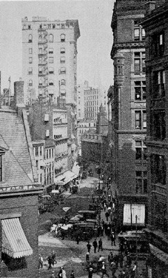
THE CENTRAL DISTRICT
The
Central District (see Plates II and III) is of first interest to the
visitor, for here are most of the older historic landmarks. This
small quarter of the present city, together with the North End,
embraces that part of the original peninsula to which the historic
town Colonial, Provincial, and Revolutionary Boston — was
practically confined. The town of 1630 was begun along
the irregular water front, the principal houses being placed round
about the upper part of what is now State Street, modern Boston’s
financial center, and on or near the neighboring Dock Square, back of
the present Faneuil Hall, where was the first Town Dock, occupying
nearly all of the present North Market Street, in the “Great Cove.”
The square originally at the head of State Street (first Market, then
King Street), in the middle of which now stands the Old State House,
was the first center of town life. At about this point, accordingly,
our explorations naturally begin.
State-Street
square and the Old State House. Our starting place is the square
at the head of State St., which the Old State House faces. This
itself is one of the most notable historic spots in Boston. For the
first quarter-century of Colony life the entire square, including the
space occupied by the Old State House, was the public marketstead.
Thursday was market day, — the day also of the “Thursday Lecture”
by the ministers. Early (1648) semiannual fairs here, in June and
October, were instituted, each holding a market for two or three
days. Here were first inflicted the drastic punishments of offenders
against the rigorous laws, and here unorthodox literature was burned.
The
Stocks, the Whipping Post, and the Pillory were earliest placed here.
When the town was a half-century old a Cage, for the confinement and
exposure of violators of the rigid Sunday laws, was added to these
penal instruments. In the Revolutionary period the Stocks stood near
the northeast corner of the Old State House, with the Whipping Post
hard by; while the Pillory when used was set in the middle of the
square between the present Congress Street (first Leverett’s Lane)
on the south side and Exchange Street (first Shrimpton’s Lane,
later Royal Exchange Lane) on the north. The Whipping Post lingered
here till he opening of the nineteenth century.
This
square continued to be the gathering place of the populace from the
Colonial through the Province period on occasion of momentous events.
It was the rendezvous of the people in the “bloodless revolution”
of April, 1689, when the government of Andros was overthrown. In the
Stamp Act excitement of 1765 a stamp fixed upon a pole was solemnly
brought here by a representative of the “Sons of Liberty” and
fastened into the town Stocks, after which it was publicly burned by
the “executioner.” On the evening of March 5, 1770, the so-called
Boston Massacre, the fatal collision between the populace and the
soldiery, occurred here, the site being indicated by a tablet on the
building at the Exchange Street corner, northwest.
On
the south side of the original marketstead, by the present Devon
shire Street (first Pudding Lane), where now is the modern Brazer’s
Building (27 State Street), was the first meetinghouse, a rude
structure of mud walls and thatched roof. This also served through
its existence of eight years for Colonial purposes, as the carved
inscription above the entrance of Brazer’s Building relates:
Site of the First Meetinghouse in
Boston, built A.D. 1632.
Preachers: John Wilson, John
Eliot,
John Cotton.
Used before 1640 for town meetings
and
for
sessions of the General Court of the
Colony.
At
the upper end of this side of the marketstead, extending to
Washington Street (first The High Street), were the house and garden
lot of Captain Robert Keayne, charter member and first
commander of the first “Military Company of the Massachusetts”
(founded 1637, chartered 1638), from which developed the still
flourishing “Ancient and Honor able Artillery Company,” the
oldest military organization in the country. A century later, on the
Washington Street corner, was Daniel Henchman’s bookshop, in
which Henry Knox, afterward the Revolutionary general and
Washington’s friend, learned his trade and ultimately succeeded to
the business. When the British regulars were quartered on the town,
in 1768-1770, the Main Guardhouse was on this side, directly
opposite the south door of the Old State House, with the two
fieldpieces pointed toward this entrance.
On
the west side of the marketstead, — the present Washington Street,
— nearly opposite Captain Keayne’s lot, was the second
meetinghouse, built in 1640, the site now occupied by the Rogers
Building (209 Washington Street). This was used for all civic
purposes, as well as religious, through eighteen years.
It
stood till 1711, when it was destroyed in the “Great Fire” (the
eighth “Great Fire” in the young town) of October that year, with
one hundred other buildings in the neighborhood. Its successor, on
the same spot, was the “Brick Meetinghouse” which remained for
almost a century.
North
of the second meetinghouse site, where is now the Sears Building (199
Washington Street), was the house of John Leverett, after ward
Governor Leverett (1673). On the opposite corner, now covered by the
Ames Building (Washington and Court streets), was the home stead
of Henry Dunster, first president of Harvard College.
On
the north side of the marketstead, near the east corner of the
present Devonshire Street, was the glebe of the first minister of
the first church, the Rev. John Wilson, with his house, barn, and two
gardens. His name was perpetuated in Wilson’s Lane, which
was cut through his garden plot in 1640, and which in turn was
absorbed in the widened Devonshire Street.
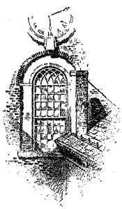
Doorway, Exchange Building |
Looking
again across to the south side, we see the site of Governor
Winthrop’s first house, covered by the expansive Exchange
Building (53 State Street). It stood on or close to the ground
occupied by the entrance hall of the building.
This
was the governor’s town house for thirteen years from the
settlement. Thence he removed to his last Boston home, the mansion
which stood next to the Old South Meetinghouse. The first General
Court — the incipient Legislature — ever held in
America, October 19, 1630, may have sat in the governor’s first
house, the frame of which was brought here from Cambridge, where the
governor first proposed building.
At
the corner of Kilby Street (first Mackerel Lane), where the Exchange
Building ends, stood the Bunch-of-Grapes Tavern of Provincial
times, with its sign of a gilded carved cluster of grapes, the pop
dated from 1711, and was preceded by a Colonial “ordinary,” as
taverns were then called, of 1640 date. In the street before the
Bunch-of-Grapes’ doors, the lion and unicorn, with other emblems of
royalty and signs of Tories that had been torn from their places
during the celebration of the news of the Declaration of Independence
in July, 1776, At the corner of Kilby Street (first Mackerel Lane),
where the popular resort of the High Whigs in the prerevolutionary
period. It were burned in a great bonfire.
|
The
Bunch-of-Grapes was a famous tavern of its time. In 1750 Captain
Francis Goelet, from England, on a commercial visit to the town,
recorded in his diary that it was “noted for the best punch house
in Boston, resorted to by most of the gentn merchts and masters
vessels.” After the British evacuation, when Washington spent ten
days in Boston, he and his officers were entertained here at an
“elegant dinner” as part of the official ceremonies of the
occasion. The tavern was especially distinguished as the place where
in March, 1786, the group of Continental army officers, under the
inspiration of General Rufus Putnam of Rutland (cousin of General
Israel Putnam), organized the Ohio Company which settled Ohio,
beginning at Marietta.
State
Street, when King Street, practically ended at Kilby Street on the
south side and Merchants Row on the north, till the reclamation of
the flats beyond, high-water mark being originally at these points.
“Mackerel Lane” was a narrow passage by the shore till after the
“Great Fire of 1760,” which destroyed much property in the
vicinity. Then it was widened and named Kilby Street in recognition
of the generous aid which the sufferers by the fire had received from
Christopher Kilby, a wealthy Boston merchant, long resident in London
as the agent for the town and colony, but then living in New York.
Nearly
opposite the Bunch-of-Grapes, at about the present No. 66, stood
the British Coffee House, where the British officers
principally resorted. It was here in 1769 that James Otis was
assaulted by John Robinson, one of the royal commissioners of
customs, upon whom the fiery orator had passed some severe
strictures, and thus through a deep cut on his head this brilliant
intellect was shattered.
At
the east corner of Exchange Street was the Royal Customhouse,
where the attack upon its sentinel by the little mob of men and boys,
with a fusillade of street snow and ice, and taunting shouts, led to
the Massacre of 1770. The opposite, or west, corner was
occupied by the Royal Exchange Tavern, dating from the early
eighteenth century, another resort of the British officers stationed
in town. It was here in 1727 that occurred the altercation which
resulted in the First Duel fought in Boston (on the Common),
when Benjamin Woodbridge was killed by Henry Phillips, both young men
well connected with the “gentry” of the town, the latter related
by marriage to Peter Faneuil, the giver of Faneuil Hall. Woodbridge’s
grave is in the Granary Burying Ground, and can be seen close by
the sidewalk fence.
It
was this grave which inspired those tender passages in the “Autocrat
of the Breakfast Table” describing “My First Walk with the
Schoolmistress.”
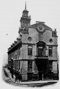
The
Old State House dates from 1748. Its outer walls, however,
are
older, being those of its predecessor, the second Town and Province
House, built in 1712-1713. That house was destroyed by fire, all but
these walls, in 1747, sharing very nearly the fate of its
predecessor, the first Town House and colonial building, which went
down in the “Great Fire” of 1711 with the second meetinghouse
and
neighboring buildings and dwellings. It occupies the identical site
in the middle of the market, stead chosen for the first Town House in
1657. It has served as Town House, Court House, Province Court House,
State House, and City Hall. As the Province Court House, identified
with the succession of prerevolutionary events in Boston, it has a
special distinction among the historical buildings of the country.
After its abandonment for civic uses it suffered many vicissitudes
and indignities, being ruthlessly refashioned, made over, and patched
for business purposes, that the city which owns it might wrest the
largest possible rentals from it; and in the year 188 its
removal was seriously threatened. Then, through the well-directed
efforts of a number of worthy citizens, its preservation was secured,
and in 1882 the historic structure was restored to much the
appearance which it bore in Provincial days. Further restorations
were made in 1908-1909.
|
In
both exterior and interior the original architecture is in large part
reproduced. The balcony of the second story has the window of twisted
crown glass, out of which have looked all the later royal governors
of the Province and the early governors of the Commonwealth. The
windows of the upper stories are modeled upon the small-paned windows
of Colonial days. Within, the main halls have the same floor and
ceilings, and on three sides the same walls that they had in 1748.
The eastern room on the second floor, with its outlook down State
Street, was the Council Chamber, where the royal governors and the
council sat. The western room was the Court Chamber. Between the two
was the Hall of the Representatives. The King’s arms, which were in
the Council Chamber before the Revolution, were removed by Loyalists
and sent to St. John, New Brunswick, where they now decorate a
church. The carved and gilded arms of the Colony (handiwork of a
Boston artisan, Moses Deshon), displayed above the door of the
Representatives Hall after 1750, disappeared with the Revolution. The
Wooden Codfish, “emblem of the staple of commodities
of the
Colony and the Province,” which hung from the ceiling of this
chamber through much of the Province period, is reproduced in the
more artistic figure (embellished by Walter M. Brackett, the master
painter of fish and game) that now hangs in the Representatives Hall
of the present State House.
|
Old State House
|
|
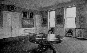
The
restored rooms above the basement are open for public exhibition,
with the rare collection of antiquities relating to the early history
of the Colony and Province, as well as the State and the Town,
brought together by the Bostonian Society, to whose control
these rooms passed, through lease by the city, upon the restoration
of the building. The collection embraces a rich variety of
interesting relics: historical manuscripts and papers; quaint
paintings, engravings, and prints; numerous portraits of old
worthies; and many photographs illustrating Boston in various
periods. In the Council Chamber is the old table formerly used by the
royal governors and councillors.
The
Bostonian Society, established here, was incorporated in 1881 “to
promote the study of the history of Boston, and the preservation of
its antiquities”; and in it was merged the Antiquarian Club,
organized in 1879 especially for the promotion of historical
research, whose members had been most influential in the campaign for
the preservation of this building. It has rendered excellent service
in the identification of historic sites and in verifying historical
records.
|
Council Chamber, Old
State House |
|
Deep
down below the basement of the building is now the State station of
the Washington Street Tunnel, and also the State Street
station of the East Boston Tunnel, which runs directly under
the ancient structure to Scollay Square, where it connects by
passageways with the Subway.
The
first Town House, completed in 1659, was provided for by the will of
Captain Keayne, the Ancient and Honorable Artillery
Company’s
chief founder (the longest will on record, comprising 158 folio pages
in the testator’s own hand, though disposing of only £4000).
Captain Keayne left £300 for the purpose, and to this sum was
added £100 more, raised by subscription among the townspeople,
and paid largely in provisions, merchandise, and labor. It was a
small “comely building” of wood, set upon twenty pillars,
overhanging the pillars “three feet all around,” and topped by
two tall slender turrets. The place inclosed by the pillars was a
free public market, and an exchange, or “walk for the merchants.”
|
Franklin Press,
Old State House
|
It
contained the beginnings of the first public library in America,
for which provision was made in Captain Keayne’s will. Portions of
this library were saved from the fire of 1711 which destroyed the
building; but these probably perished later in the burning of the
second Town and Province House.
The
second house, of brick, completed in 1713, also had an open public
exchange on the street floor. Surrounding it were thriving
booksellers’ shops, observing which Daniel Neal, visiting the town
in 1719, was moved to remark that “the Knowledge of Letters
flourishes more here than in all the other English plantations put
together; for in the city of New York there is but one book seller’s
shop, and in the Plantations of Virginia, Maryland, Carolina,
Barbadoes, and the Islands, none at all.” So, it appears, thus
early Boston was the “literary center” of the country, a fact
calculated to bring almost as great satisfaction to the complacent
Bostonian as that later-day saying in the “Autocrat” (in which
this stamp of Bostonian declines to recognize any satire), that
“Boston State-House is the hub of the solar system”
Down
State Street. Following State Street to its end, we shall come
upon Long Wharf (originally Boston Pier, dating from 171o), where the
formal landings of the royal governors were made, the main landing
place of the British soldiers when they came, and the departing place
at the Evacuation. At that time it was a long, narrow pier, extending
out beyond the other wharves, the tide ebbing and flowing beneath the
stores that lined it. Atlantic Avenue, the water-front thoroughfare
that now crosses it, and on which the elevated railway runs, follows
generally the line of the ancient Barricado, an early harbor
defense erected in 1673 between the north and south outer points of
the “Great Cove.” It connected the North Battery, where is
now Battery Wharf, and the South Battery, or “Boston
Sconce,” at the present Rowe’s Wharf, where the steamer for
Nantasket is taken. It was provided with openings to allow vessels to
pass inside, and so came to be generally called the “Out Wharves.”
Its line is so designated on the early maps.
|
In
the short walk down State Street are passed in succession on either
side of the way notable modern structures that have almost entirely
replaced the varied architecture of different periods, which before
gave this street a peculiar distinction and a certain picturesque
ness that is now wanting. The Exchange Building takes the
place of the first Merchants’ Exchange, a dignified building in its
day (1842 1890), covering a very small part of the ground over which
the present structure spreads. The Board of Trade Building, at
the east corner of Broad Street, is, perhaps, the most attractive in
design of the newer architecture. At the India Street corner, its
massive granite-pillared front facing that street, is the United
States Custom House (dating from 1847), in marked contrast
with its younger neighbors. This occupied several years in building,
and the transportation of the heavy granite columns, each weighing
about forty-two tons, which surround it on all sides, was a great
feat for the time. Its site was the head of Long Wharf, and the
bowsprits of vessels lying there, stretching across the street,
almost touched its eastern side.
|
Custom House |
On
India Street, a few rods south of this specimen of a past
architecture, is the modern Chamber of Commerce (built in
1902), also of granite. Viewed from a distance, its rounded front,
with turreted dormer windows and conical tower, has a unique
appearance. Opposite it opens Custom House Street, only a block in
length, where is still standing the Old Custom House, built in
1810, in which Bancroft, the historian, served as collector of the
port in 1838-1841, and which was the “darksome dungeon” where
Hawthorne spent his two years as a customs officer, first as a
measurer of salt and coal, then as a weigher and gauger.
Faneuil
Hall and its Neighborhood. From lower State Street we can pass to
Faneuil Hall by way of Commercial Street and the long granite Quincy
Market House, — the central piece of the great work of the
first Mayor Josiah Quincy, in 1825-1826, in the construction of six
new streets over a sweep of flats and docks, — or we may go direct
from the Old State House through Exchange Street, a walk of a few
minutes.
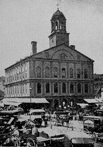
Faneuil
Hall as now seen is the “Cradle of Liberty” of the
Revolutionary period doubled in width and a story higher. The
enlargement was made in 1805, under the superintendence of Charles
Bulfinch, the pioneer Boston architect of enduring fame, whose most
characteristic work we shall see in the “Bulfinch Front “of the
present State House, The hall was built in 1762-1763, upon the brick
walls of the first Faneuil Hall, Peter Faneuil’s gift to the town
in 1742, which was consumed, except its walls, in a fire in January,
1762. Bulfinch, in his work of 1805, introduced the galleries resting
on Doric columns, and the platform with its extended front, with
various interior embellishments. In 1898 the entire building was
reconstructed with fireproof material on the Bulfinch plan, iron,
steel, and stone being substituted for wood and combustible
material
Faneuil Hall
|
Of
the fine collection of portraits on the walls many are copies, the
originals having been placed in the Museum of Fine Arts for
safe-keeping. The great historical painting at the back of the
platform, “Webster’s Reply to Hayne,” by G. P. A. Healy,
contains one hundred and thirty portraits of senators and other men
of distinction at that time. The scene is the old Senate Chamber, now
the apartment of the United States Supreme Court. The canvas measures
sixteen by thirty feet. The portrait of Peter Faneuil, on one side of
this painting, is a copy by Colonel Henry Sargent, from a smaller
portrait in the Art Museum, and was given to the city by Samuel
Parkman, grandfather of the historian Parkman. It takes the place of
a full-length portrait executed by order of the town in 1744, as a
“testimony of respect” to the donor of the hall, which
disappeared, and was probably destroyed, at the siege of Boston, —
the fate also of portraits of George H, Colonel Isaac Barré,
and Field Marshal Conway, the last two solicited by the town in
gratitude for their defense of Americans on the floor of Parliament.
The full-length Washington, on the other side of the great painting,
is a Gilbert Stuart. It, also, was presented to the town by Samuel
Parkman, in 1806. Of the portraits elsewhere hung, those of Warren,
Hancock, Samuel Adams, John Adams, and John Quincy Adams are all
Copleys. The General Harry Knox and the Commodore Preble are credited
to Stuart. The Abraham Lincoln and Rufus Choate are by Ames. The “war
governor,” John A. Andrew, is by William M. Hunt. The others —
Robert Treat Paine, Caleb Strong, Edward Everett, Admiral Winslow,
Wendell Phillips, and Anson Burlingame — are by various American
painters. The ornamental clock in the face of the gallery over the
main entrance was a gift of Boston school children in 1850. The
gilded spread eagle was originally on the façade of the United
States Bank which, erected in 1798, preceded the first Merchants’
Exchange on State Street. The gilded grass hopper on the cupola of
the building, serving as a weather vane, is the reconstructed, or
rejuvenated, original one of 1742, fashioned from sheet copper by the
“cunning artificer,” “Deacon” Shem Drowne, immortalized by
Hawthorne in “Drowne’s Wooden Image.”
|
The
floors above the public hall have been occupied by the Ancient and
Honorable Artillery Company for many years. Its armory is a rich
museum of relics of Colonial, Provincial, and Revolutionary times,
and is hospitably open to appreciative inspection. Among the
treasured memorials here are the various banners of the company, the
oldest being that carried in 1663. Eighteen silk flags reproduce
colonial colors and their various successors. In the London room are
mementos of the visit of a section of the company to England in the
summer of 1896, as guests of the Honourable Artillery Company of
London. On the walls of the main hall are portraits of one hundred
and fourteen captains of the company. On the street floor of the
building is the market, which has continued from its establishment
with the first Faneuil Hall in 1742. John Smibert, the Scotch
painter, long resident and celebrated in Boston from 1729, was the
architect of the first building.
Faneuil
Hall was instituted primarily as a market house, the inclusion of a
public town hall in the scheme being an afterthought of the donor.
Peter Faneuil’s offer to provide a suitable building at his own
expense upon condition only that the town should legalize and
maintain it, was at a time of controversy over the town market houses
then existing. Three had been set up seven years before, one close to
this site, in Dock Square; one at the North End, in North Square; the
third at the then South End, by the south corner of the present
Boylston and Washington streets. The Dock Square market was the
principal one, and this had recently been demolished by a mob
“disguised as clergymen.” The contention was over the market
system. One faction demanded a return to the method of service at the
home of the townspeople, as before the setting up of these market
houses; the others insisted upon the fixed market-house system. So
high did the feeling run that Faneuil’s gift was accepted by the
town by the narrow margin of seven votes.
The
building was completed in September, 1742. It was only one hundred
feet in length and forty feet wide. But it was of brick, and
substantial. The hall, calculated to hold only one thousand persons,
was pronounced in the vote of the first town meeting held in it as
“spacious and beautiful.” In the same vote it was named Faneuil
Hall, “to be at all times hereafter called and known by that name,”
in testimony of the town’s gratitude to its giver and to perpetuate
his memory. Then his full-length portrait was ordered for the hall;
and a year and a half later the Faneuil arms, “elegantly carved and
gilt” by Moses Deshon, the same who later carved the Colony seal
for the Town House, were added at the town’s expense.
The
first public gathering in the hall, other than a town meeting, was,
singularly, to commemorate Faneuil, he having died suddenly, March 3,
1743, but a few months after the completion of the building. On this
occasion the eulogist was John Lovell, master of the Latin School,
who in the subsequent prerevolutionary controversies was a Loyalist,
and at the Evacuation went off to Halifax. The Faneuils who succeeded
Peter, his nephews, were also Loyalists, and left the country with
the Evacuation.
The
second Faneuil Hall, embraced in the present structure, was built by
the town, and the building fund was largely obtained through a
lottery authorized by the General Court. The first public meeting in
this hall was on March 14, 1763, when the patriot James Otis was the
orator, and by him the hall was dedicated to the “Cause of
Liberty.” Then followed those town meetings of the Revolutionary
period, debating the question of “justifiable resistance,” from
which the hall derived its sobriquet of the “Cradle of American
Liberty.” In 1766 cm the news of the Stamp Act repeal the hall was
illuminated. In 1768 one of the British regiments was quartered here
for some weeks. In 1772 the Boston Committee of Correspondence, “to
state the rights of the colonists” to the world, was established
here, on that motion of Samuel Adams which Bancroft says “contained
the whole Revolution.” In 1773 the “Little Senate,” composed of
the committees of the several towns, began their conferences with the
“ever-vigilant” Boston committee, in the selectmen’s room.
During the siege the hall was transformed into a playhouse, under the
patronage of a society of British officers and Tory ladies, when
soldiers were the actors, and a local farce, “The Blockade of
Boston,” by General Burgoyne, was the chief attraction.
Since
the Revolution the hall has been the popular meeting place of
citizens on important and grave occasions, and a host of national
leaders, orators, and agitators have spoken from its historic
rostrum. In 1826 Webster delivered here his memorable eulogy on Adams
and Jefferson, in the presence of President John Quincy Adams and an
audience of exceptional character. Here in 1837 Wendell Phillips made
his first antislavery speech; in 1845 Charles Sumner first publicly
appeared in this cause; in 1846 the antislavery Vigilance Committee
was formed at a meeting to denounce the return of a fugitive slave;
in 1854 the preconcerted signal was given, at a crowded meeting to
protest against the rendition of Anthony Burns, for the bold but
fruitless move on the Court House (see p. 59) to effect the escape of
this fugitive slave.
|
Faneuil
Hall is protected by a provision of the city charter forbidding its
sale or lease. It is never let for money, but is opened to the people
upon the request of a certain number of citizens, who must agree to
comply with the prescribed regulations.
Faneuil
Hall occupies made land close to the head of the Old Town Dock. The
streets around the sides and back of the building constitute Faneuil
Hall Square. From the south side of this square opens Corn Court,
which runs in irregular form to Merchants Row. This space was the
Corn Market of Colonial times. A landmark of a later day here, which
remained till 1903, was an old inn long known as Hancock Tavern.
While not so ancient as it was assumed to be, nor occupying, as
alleged, the site of the first tavern in the town, it was an
interesting landmark with rich associations. It became the Hancock
Tavern when John Hancock was made the first governor of the
Commonwealth, and the swing sign displaying his roughly painted
portrait is still preserved. At other periods it was the Brazier Inn,
kept by Madam Brazier, niece of Provincial Lieutenant Governor
Spencer Phipps (1733), who made a specialty of a noonday punch for
its patrons. In this tavern lodged Talleyrand, when exiled from
France, during his stay in Boston in 1795; also, two years later,
Louis Philippe; and, in 1796, the exiled French priest, John
Cheverus, who afterward became the first Roman Catholic bishop of
Boston. An annex to a modern office building occupies its site.
|
The Adams Statue |
East
of Corn Court, near the east end of Faneuil Hall, also on land
reclaimed from the Town Dock, was John Hancock’s Store,
where he advertised for sale “English and India goods, also choice
Newcastle Coals and Irish Butter, Cheap for Cash.” West of Corn
Court opens Change Alley (incongruously designated as
“avenue”), a quaint, narrow foot passage to State Street, one of
the earliest ways established in the town. It was sometime Flagg
Alley, from being laid out with flag stones. Until the erection of
the great financial buildings that now largely wall it in, the alley
was picturesque with bustling little shops.
On
the west side of Faneuil Hall Square the triangle, covered with low,
old buildings, marks the head of the ancient Town Dock.
Old
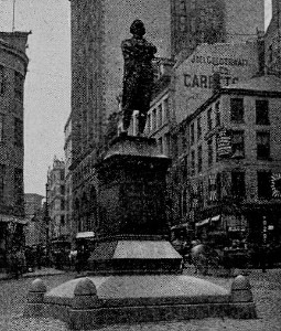
Dock Square makes into modern Adams Square (opened
in
1879), near the middle of which stands the bronze statue of Samuel
Adams, by Anne Whitney. This is a counterpart of the statue of
the revolutionary leader in the Capitol at Washington. It portrays
him as he is supposed to have appeared when before Lieutenant
Governor Hutchinson and the council, in the Council Chamber of the
Old State House, as chairman of the committee of the town meeting the
day after the Boston Massacre of 1770, and at the moment that,
having delivered the people’s demand for the instant removal of the
British soldiers from the town, he stood with a resolute look
awaiting Hutchinson’s reply.
The
principal architectural feature of this open space is the stone Adams
Square Station of the Subway.
Cornhill
and about Scollay Square. From the west side of Adams Square we
pass into Cornhill, early in its day a place of bookshops, and still
occupied by several booksellers at long-established stands. It is the
second Cornhill, the first having been the part of the present
Washington Street between old Dock Square and School Street.
Washington Street originally ended at Dock Square north of the
present Cornhill, and its extension to Haymarket Square (1872), where
it now ends, greatly changed this part of the town and obliterated
various landmarks. A little north of the present opening of Cornhill,
lost in the Washington Street extension, was the site of the dwelling
of Benjamin Edes, where, on the afternoon preceding the Boston Tea
Party of December 16, 1773, a number of the leaders in that
affair met and partook of punch from the punch bowl now possessed by
the Massachusetts Historical Society.
This
Cornhill dates from 1816, and was first called Cheapside, after the
London fashion. Then for a while it was Market Street, being a new
way to Faneuil Hall Market. From its northerly side was once an
archway leading to Brattle Street and old Dock Square, which also
disappeared in the extension of Washington Street. Midway, at
its curve toward Court Street, where it ends, it is crossed by
Franklin Avenue (another short passageway, or alley, with
this
ambitious title), at the Court Street end of which was Edes &
Gill’s printing office, the principal rendezvous of the
Tea-Party men, in a back room of which a number of them assumed
their disguise. This was on the westerly corner of the “avenue,”
then Dasset Alley, and Court, then Queen, Street. Earlier, on the
east corner, was the printing office of Benjamin Franklin’s brother
James, where the boy Franklin learned the printer’s trade as
his brother’s apprentice, and composed those ballads on “The
Lighthouse Tragedy” and on “Teach” (or “Blackbeard”), the
pirate, which he peddled about the streets with a success that
“flattered” his “vanity,” though they were “wretched
stuff,” as he confesses in his Autobiography. Here James Franklin
issued his New England Courant, the fourth newspaper that
appeared in America, which Franklin managed during the month in which
his brother was imprisoned for printing an article offensive to the
Assembly, and himself “made bold to give our rulers some rubs in
it”; and which, after James’s release inhibited from publishing,
was issued for a while under Benjamin’s name.
The
north end of Franklin Avenue, from Cornhill by a short flight of
steps, is at Brattle Street, a short distance above the site
of Murray’s Barracks, on the opposite side, where were
quartered the Twenty, Ninth, the regiment of the British force of
1768-1770 most obnoxious to the “Bostoneers,” and where the
fracas began that culminated in the Boston Massacre. The
Quincy House, nearer the avenue’s end, covers the site of the first
Quaker meetinghouse, built in 1697, the first brick meetinghouse
in the town. Opposite the side of the Quincy House, facing Brattle
Square, stood till 1871 the Brattle Square Church, which
after the Revolution bore on its front a memento of the Siege, in the
shape of a cannon ball, thrown there by an American battery at
Cambridge on the night of the Evacuation. This was the meetinghouse
alluded to in Holmes’s “A Rhymed Lesson,”
. .. that, mindful of the hour
When Howe’s artillery shook its
half-built tower,
Wears on its bosom, as a bride
might
do,
The iron breastpin which the ‘Rebels’
threw.
A
model of the church as it thus appeared is in the house of the
Massachusetts Historical Society, where also the cannon ball is
preserved. The quoins of the structure, of Connecticut stone, were
placed inside the tower of its successor on Commonwealth Avenue, Back
Bay, now the church of the First Baptist Society. Though new, and
“the pride of the town “at the time of the Revolution, having
been consecrated in 1773, it was utilized as barracks for the British
soldiers; and only the fact that the removal of the pillars which
embellished its interior would have endangered the structure,
prevented its use during the Siege as a military riding school, like
the Old South Meetinghouse (see p. 51). It was the church that
Hancock, Bowdoin, and Warren attended. Warren’s house, from
1764, was near by on Hanover Street, on the site now covered by the
American House.
Court Street |
At
the head of Cornhill, in front of Scollay Square, stood the
bronze statue of John Winthrop until its removal was
necessitated by the East Boston Tunnel work below it in 1903. It was
well worth a moment’s study, though the constant traffic of the
busy thoroughfare made its near neighborhood perilous. The Colonial
governor, clad in the picturesque costume of the period, is
represented as stepping from a gang board to the shore. In his right
hand he holds the charter of the Colony by its great seal; in his
left the Bible. Behind the figure appears the base of a newly hewn
forest tree, with a rope attached, significant of the fastening of a
boat. The statue is the work of Richard S. Greenough and is a copy of
the marble one in the Capitol at Washington. It was cast in Rome. It
was first erected in 1880, on the 250th anniversary of the settlement
of Boston. It now stands on Marlborough Street beside the First
Church.
About
where the Scollay Square Station stands, or a little north of its
site, was the first Free Writing School, set up in 1683-1684.
This was the second school in the town, the first being on School
Street, as we shall presently see. It continued in use till after the
Revolution (or about 1793), latterly known as the Central Reading and
Writing School.
Looking
down Court Street eastward, we have in near view the
somber-pillared front of the Old Court House, dating from 1836. It
was designed by Solomon Willard, the architect of Bunker Hill
Monument. Its exterior is of Quincy granite. The ponderous fluted
columns (originally eight in all, there having been a row on the rear
as well as in front) weigh each twenty-five tons. The first two were
brought over the roads from Quincy by sixty-five yoke of oxen and ten
horses, making a great street show. This building was the center of
the exciting scenes attending the fugitive slave cases in 1851 and
1854. Here is the main entrance to the East Boston Tunnel.
|
Here
occurred first, in February, 1851, the rescue of Shadrach, who had
been confined in the United States court room awaiting action upon a
process for his rendition. Six weeks later came the Thomas Sims
affair, when, to prevent the rescue of this slave, the building was
guarded and surrounded with chains breast high, under which the
judges and all others having business within were obliged to stoop to
reach the doors. Finally, in May, 1854, occurred the Anthony Burns
riot, on the evening of the 26th, with the failure of the rescue
planned by a number of the anti slavery “Vigilance Committee,”
when, in the assault made at the entrance on the west side of the
building, one of the marshal’s deputies was killed. It was after
this affair that indictments were brought against Theodore Parker,
Wendell Phillips, Thomas Wentworth Higginson, and several others, for
“obstructing the process of the United States.” For their defense
a formidable array of counsel appeared here, but the indictment was
quashed.
|
On
this same spot was the Colonial prison, its outer walls of
stone three feet thick, with unglazed iron-barred windows, stout
oaken doors covered with iron, hard cells, and gloomy passages, where
were incarcerated the Quakers and, later, victims of the witchcraft
delusion. Here also, after the overthrow of Andros in 1689,
Ratcliffe, the rector of the first Episcopal church, which Andros so
fostered (see King’s Chapel, p. 24), was confined with his leading
parishioners for nine months, till sent to England by royal command.
Another distinguished prisoner here, in 1699, was the piratical
Captain Kidd. It was this prison that Hawthorne fancifully describes
in “The Scarlet Letter.” The prison was first placed here in
1642, and gave to the street the name of Prison Lane, which it
bore through the seventeenth century. Then it became Queen Street,
and Court Street after the Revolution.
Looking
westward up Court Street to the upper side, called Tremont
Row, we may imagine the site of Governor John Endicott’s
house, where he lived after his removal from Salem to Boston, and
where, in 1661, Samuel Shattuck, bearing the order of the King
releasing the imprisoned Quakers, had audience with him, — the
event upon which Whittier’s “The King’s Missive” is founded.
This house is variously placed by local authorities on Tremont Row,
between Tremont Street and Howard Street, but the best evidence
appears to point to a situation toward the Howard Street end.
|
The Winthrop Statue
|
Tremont
Street and King’s Chapel. Now we take Tremont Street. From the
west side, at its beginning, opens the short way up to Pemberton
Square, at the head of which we see the façade of the
present County Court House (built 1887-1893). This is a long
granite structure in the German Renaissance style of architecture,
designed by George A. Clough. Its plan is on the system of open
courtyards: four are in the area of the general block. It covers
65,300 feet of land. The feature of the interior is the great hall,
broad and lofty, a flight of steps ascend ing to it from the front
entrance, and other flights ascending from it to the rear exit on
Somerset Street. Upon the faces of the cornices in the
vestibule at the main entrance are statuesque bas-reliefs of Law,
Justice, Wisdom, Innocence, and Guilt. On one side of the hall is the
bronze statue of Rufus Choate, the great lawyer of his day.
This is by Daniel C. French. It was placed in 1898. It was a gift to
the city, provided for in the will of a Boston public-school master.
The donor was some time master of the Dwight School for boys, and
afterward principal of the Everett School for girls.
Pemberton
Square marks the second highest peak of Beacon Hill. This
peak at first received the name of Cotton Hill, from the Rev.
John Cotton, the early minister of the First Church, whose house was
on its slope facing Tremont Street. The Cotton estate
originally spread over this peak, extending back across Somerset
Street to about the middle of Ashburton Place in the rear of the
Court House.
The
peak rose originally in irregular heights, the loftiest bluff being
at the southerly end of Pemberton Square, or on the west side of
Tremont Street about opposite the gate of King’s Chapel Burying
Ground. Against its slopes were early favorite places for house
sites.
John
Cotton’s house was set up in 1633, soon after his arrival in
the Griffin. It stood a little south of the entrance to
Pemberton Square. Next above, or adjoining it, was Sir Harry
Vane’s house. This was built by the young statesman a few
months after his arrival (October, 1635), he having at first been the
minister’s guest. It was Vane’s home when he was governor of the
Colony in 1636-1637. Later the Cotton house came into possession of
John Hull, the “mint master,” who made the pine-tree
shillings, the first New England money. In course of time it fell to
Chief Justice Samuel Sewall (one of the witchcraft judges
at
Salem in 1692), the diarist of early Boston, through his marriage
with the “mint master’s” daughter Hannah, whose wedding dowry,
tradition tells, was her weight in the pine-tree shillings.
|
About
on the site now occupied by the showy Beacon Theater, but back from
the street, was Richard Bellingham’s stone house, in which
he lived through his several terms as governor and till his death in
1672. He was dwelling here when, in 1641, he scandalized his brethren
by the manner of his marriage to Penelope Pelham, his second wife,
without “publishing” the marriage intention, and especially by
performing the marriage ceremony himself, being a magistrate, as
Winthrop relates in picturesque detail in his journal.
In
the next century the grand Faneuil mansion and terraced
gardens were here. This was the estate that Peter Faneuil inherited
in 1737 and was occupying when he built Faneuil Hall. It was
maintained in all its elegance by its several owners till some years
after the Revolution. At that time it was confiscated, its owner
being a Royalist, — William Vassal, uncle of the Colonel
John Vassal who built the Cambridge mansion now treasured as the
Longfellow house. Early in the nineteenth century it was joined to
the Gardner Greene estate, the finest in the town.
|
Old
Boston Museum
|
The
peak was finally cut down in the thirties, and Pemberton Square was
then laid out through the Greene estate as a place of genteel
residences in blocks, which character it sustained till the late
sixties.
On
the east side the Boston Museum, razed in 1903 to make way for
a modem business structure, long stood the oldest playhouse of the
city. For more than half a century it was a familiar landmark. At
first the museum proper, with its halls of marvelous curiosities, was
the chief feature of the institution, the performances being
subordinate to these attractions, and the theater being called “the
lecture hall,” to quiet the consciences of its patrons, who shied
from the openly pro claimed playhouse. William Warren, the “prince
of comedians,” as Bostonians delighted in calling him, was
identified with the Museum for forty years. Here Edwin Booth made his
first appearance on any stage.
From
King’s Chapel to Park Street Church. King’s Chapel Burying
Ground, adjoining the old stone church, is very nearly as ancient as
the town of Boston. The exact date of its establishment is not known,
but it was probably soon after the beginning of the settlement, for
this record appears in Winthrop’s journal: “Capt. Welden, a
hopeful young gent, & an experienced soldier, dyed at
Charlestowne of a consumption, and was buryed at Boston wth a
military funeral.” And Dudley wrote that the young man was “buryed
as a souldier with three volleys of shott.” The earliest interment
of record here was that of Governor Winthrop in 1649. It is believed
that his third wife, Margaret Winthrop, who followed him to New
England the year after he came out and who died two years before him,
was also buried here.
In
the same tomb are the ashes of other distinguished Winthrops — the
Massachusetts governor’s eldest son and grandsons: John Winthrop,
Jr., the governor of the Connecticut Colony, who died in 1676, and
John Jr.’s two sons, Fitz John Winthrop, governor of the United
Colonies of Connecticut (died 1707), and Wait Still Winthrop, chief
justice of Massachusetts and sometime major general of the forces of
the Colony (died 1717). A second Winthrop tomb contains the dust of
Professor John Winthrop of Harvard College, the friend of Franklin
and correspondent of John Adams (died in 1779).
The
first Winthrop tomb is seen not far from the middle of the ground.
Beside it is the tomb of Elder Thomas Oliver of the First Church,
which subsequently became the property of the church; and close to
this a horizontal tablet informs that “here lyes intombed the
bodyes of ye famous reverend and learned pastors of the First Church
of Christ in Boston, viz:” John Cotton, aged 67 years, died 1652;
John Davenport, 72 years, died 1670; John Oxenbridge, aged 66 years,
died 1674; and Thomas Bridge, aged 58 years, died 1715. Near by are
the modest gravestones of Sarah, “the widow of the beloved John
Cotton and excellent Richard Mather,” and of Elizabeth, widow of
John Davenport.
In
the middle of the ground is the marble monument to Colonel Thomas
Dawes, a leading Boston mechanic of his day, who died in 1809, and
near it the tomb of Governor John Leverett. A few steps distant is
that of the Boston branch of the Plymouth Colony Winslow family. Here
are the ashes of John Winslow, brother of Governor Edward Winslow,
with those of the former’s wife, who was Mary Chilton, one of the
Mayflower passengers, heroine of the popular but
apocryphal
tale of the first woman to spring ashore from the Pilgrim ship. In a
cluster of ancient tombs are those of Jacob Sheafe, an opulent
merchant of Colony times, in which was afterward buried the Rev.
Thomas Thacher, first pastor of the Old South Church (died 1678), who
married Sheafe’s widow; and of Thomas Brattle (died 1683), said
probably to have been the wealthiest merchant of his day, whose son
Thomas became a treasurer and benefactor of Harvard College. A tomb
of especial interest in this quarter is the Benjamin Church tomb, for
herein were deposited the remains of Lady Andros, the wife of
Governor Andros, who died in February, 1688, and of whose funeral in
the nighttime from the Old South Meetinghouse Sewall gives a quaint
account in his diary. Other tombs of note are those of Major Thomas
Savage, one of the commanders in King Philip’s War, and Judge
Oliver Wendell, grandfather of Oliver Wendell Holmes.
Many
of the old tombstones here have been shifted from their proper places
and made to serve as edge stones along the paths beyond the principal
gateway. This vandalism was the performance years ago of a
superintendent of burials who was possessed with an evil “eye for
symmetry.”
King’s
Chapel in part occupies the upper end of this burying ground,
which extended originally to School Street, the land having been
taken by Governor Andros in 1688 for the first Episcopal church, no
Puritan landholder being found who would sell for such a purpose.
This building dates from 1754 and is the second King’s Chapel on
the spot. Its aspect has been little changed, beyond the enrichment
of the interior, from Province days. The low solid edifice of dark
stone, with its heavy square tower surrounded by wooden Ionic
columns, stands as it appeared when it was the official church of the
royal governors. The stone of which it is constructed came from
Quincy (then Braintree), where it was taken from the surface, there
being then no quarries. It was built so as to inclose the first
chapel, in which services were held for the greater part of the time
consumed in the slow work, — about five years. Peter Harrison, an
Englishman who came out in 1729 in the train of Dean Berkeley to have
part in the dean’s projected but never established university, was
the architect. His model was the familiar English church of the
eighteenth century; so the visitor sees in the fashion of the
interior, its rows of columns supporting the ceiling, the antique
pulpit and reading desk, the mural tablets and the sculptured
monuments that line the walls, a pleasant likeness to an old London
church. Memorials of the first chapel are preserved in the chancel.
The communion table of 1688 is still in use. Several of the mural
tablets are of the Provincial period. On the organ are in their
ancient places the gilt miters and crown, which were removed at the
Revolution and deposited in a place of safety. Among the tablets on
the northern wall is one to the memory of Oliver Wendell Holmes. This
was placed in the autumn of 1895. The inscription was composed by
ex-President Eliot of Harvard University.
|
King's Chapel |
At
the Evacuation the venerable rector, Mr. Caner, fled with the
Loyalists of his parish, taking off with him to Halifax the church
registers, plate, and vestments, but most of these were in later
years restored.
The
last Loyalist service before the Evacuation was on the preceding
Sunday. In less than a month after the Evacuation the chapel was
reopened for the obsequies of General Joseph Warren, who fell at
Bunker Hill, and on that occasion the orator, Perez Morton, advocated
independence. For more than two years thereafter the chapel was
closed. Then it was opened to the Old South congregation, and it was
used by the latter for nearly five years, when their meetinghouse
was restored. In 1782 the remnant of the society renewed their
services with the Rev. James Freeman as “reader.” In 1787 Mr.
Freeman was ordained as rector, and at that time this first Episcopal
church in New England became the first Unitarian church in America. A
bust of Mr. Freeman is among the mural monuments.
|
The
original King’s Chapel of 1688 was a small wooden structure, built
at a cost of £284 16 s, contributed by persons throughout the
Colony, with subscriptions from Andros and other English officers.
For more than two years before its erection the Episcopal
congregation had joint occupancy of the Old South Church with its
proper owners, by order of Governor Andros against their earnest and
constant protest. The church organization was formed in 1686, under
the aggressive leadership of Edward Randolph, with the Rev. Robert
Ratcliffe as rector, who had come from England commissioned to
establish the Church of England in the Colony. The use of any of the
Congregational meetinghouses being denied them, the projectors of the
church founded it in the “library room” of the Town House. This
was their place of meeting till Andros ordered the Old South opened
to them. When Andros was overthrown the rector and his leading
parishioners were imprisoned till their return to England (see p.
19). The remnant of the congregation resumed services in the chapel,
which was finished a few months after Andros’s departure.
In
1710 the chapel was enlarged to twice its size. Then the exterior was
embellished with a tower surmounted by a tall mast half-way up which
was a large gilt crown and at the top a weathercock. Within the
enlarged chapel the governor’s pew, raised on a dais higher by two
steps than the others, hung with crimson curtains and surmounted by
the royal crown, was opposite the pulpit, which itself stood on the
north side at about the center. Near the governor’s pew was another
reserved for officers of the British army and navy. Displayed along
the walls and suspended from the pillars were the escutcheons and
coats of arms of the king, Sir Edmund Andros, Governors Dudley,
Shute, Burnet, Belcher, and Shirley, and other persons of
distinction. At the east end was “the altar piece, whereon was the
Glory painted, the Ten Commandments, the Lord’s Prayer, the Creed,
and some texts of Scripture.” The communion plate was a royal gift.
Less
than a block beyond King’s Chapel, on the opposite side of Tremont
Street, we come to the Granary Burying Ground, established only about
thirty years after the Chapel Burying Ground (in 1660), and of
greater historic interest, perhaps, because of the more numerous
memorials here.
On
the short walk from the Chapel we pass the site of the birthplace
of Edward E. Hale, covered by the upper part of the Parker House.
This hotel also covers, on its School Street side, the site of the
home of Oliver Wendell, the maternal grandfather of Oliver
Wendell Holmes, for whom he was named. On Bosworth Street, the first
passage opening from Tremont Street, opposite the burying ground, —
a courtlike street end ing with stone steps which lead down to a more
ancient cross street, — was Doctor Holmes’s home for
eighteen years from 1841, the “house at the left hand next the
farther corner,” which he describes in “The Autocrat.”
The
Tremont Temple, next above the Parker House, is the
building
of the Union Temple (Baptist) Church, founded in 1839, a free church
from its beginning. It is the fourth temple on this site, each of the
previous ones having been destroyed by fire. The first one was a
theater remodeled in 1843. The playhouse was the Tremont Theater,
first opened in 1835, one of the most interesting of its class and
time.
It
was here that Charlotte Cushman made her début, in April,
1835; that Fanny Kemble first appeared before a Boston audience; that
operas were first produced in Boston.
In
the large public hall of the second Tremont Temple Charles Dickens
gave his readings during his last visit to America, in 1868.
 |
The
large Tremont Building opposite occupies the site of the
Tremont House, a famous inn through its career of more than sixty
years from 1829, of which Dickens wrote, “it has more galleries,
colonnades, piazzas, and passages than I can remember, or the reader
would believe.” Preceding the inn, fine mansion houses with gardens
were here, one of them being the estate of Thomas Handasyd
Perkins, a genuine “solid man of Boston,” a benefactor of the
Boston Athenæum and of other Boston institutions.
On
the gates of the Granary Burying Ground, set in their high
ivy-mantled stone frame, are tablets inscribed with the names of many
of the notables buried here. They include governors of various
periods, — Richard Bellingham, William Dummer, James Bowdoin,
Increase Sumner, James Sullivan, and Christopher Gore; signers of the
Declaration of Independence, — John Hancock,
Samuel Adams, and Robert Treat Paine; ministers, — John Baily (of
the First Church), Samuel Willard (of the Old South Church), Jeremy
Belknap (founder of the Massachusetts Historical Society), and John
Lathrop (of the Second Church); Chief Justice Samuel Sewall; Peter
Faneuil; Paul Revere; Josiah Franklin and wife, parents of Benjamin
Franklin Thomas Cushing, lieutenant governor, 1780-1788; John
Phillips, first mayor of Boston, and father of Wendell Phillips;
and the victims of the Boston Massacre of 1770.
|
|
Besides
these, others of like distinction are entombed here, among them James
Otis; the Rev. Thomas Prince, the learned annalist; the Rev. Pierre
Daillé, minister of the French church formed by the Huguenots
who came to Boston after the revocation of the Edict of Nantes;
Edward Rawson, secretary of the Colony; Josiah Willard, secretary of
the Province; and John Hull, the “mint master” of 1652. General
Joseph Warren’s tomb was here (the Minot tomb, adjoining that of
Hancock) from after the obsequies in King’s Chapel in 1776 till
1825. Then his remains were removed to the Warren tomb under St.
Paul’s Church. In 1855 they were again removed, being finally
deposited in the family vault in Forest Hills Cemetery, Roxbury
District. Wendell Phillips (died 1884) was also temporarily buried
here, beside the tomb of his father, at the right of the entrance
gate. After the death of his widow, two years later, his remains were
removed to Milton and placed by her side.
The
most conspicuous monuments here, all in view from the side walk, are
the bowlders marking the tombs of Samuel Adams and James Otis, the
former near the fence, north of the entrance gate, the latter, also
near the fence, south of the gate; the monument to Benjamin
Franklin’s parents, in the middle of the yard; and the John Hancock
monument, in the southwestern corner. The inscriptions on the Adams
and Otis bowlders give these records:
|
Granary Burying Ground
|
Here
lies buried
Samuel
Adams
Signer
of the Declaration of Independence
Governor
of this Commonwealth
A
leader of men and an ardent patriot
Born
1722 Died 1803
Here
lies buried
James
Otis
Orator
and Patriot of the Revolution
Famous
for his argument
against
Writs of Assistance
Born
1725 Died 1783
|
 |
Adams’s
grave is in the Checkley tomb, which adjoins the sidewalk; Otis’s
is in the Cunningham tomb, bearing now the name of George Longley.
The bowlders were placed by the Massachusetts Society of the Sons of
the Revolution in 1898, as the inscriptions show.
The
epitaph on the Franklin monument was composed by Franklin, and first
appeared on a marble stone which he caused to be placed here. The
granite obelisk was provided by a number of citizens in 1827, when
the stone had become decayed, and the inscription was reproduced on
the bronze tablet set in its face:
 |
Josiah
Franklin
and
Abiah
his wife,
lie
here interred.
They
lived lovingly together in wedlock
fifty-five
years.
Without
any estate, or any gainful employment,
By
constant labor and industry,
with
God’s blessing,
They
maintained a large family
comfortably,
and
brought up thirteen children
and
seven grandchildren
reputably.
From
this instance, reader,
Be
encouraged to diligence in thy calling
And
distrust not Providence.
He
was a pious and prudent man;
She,
a discreet and virtuous woman.
Their
youngest son,
In
filial regard to their memory
Places
this stone
J.
F. born 1655, died 1744, Ætat 89.
A.
F. born 1667, died 1752, — 85.
|
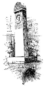
The
Hancock monument is a steel shaft, erected in 1895 close by the
Hancock tomb, set against the wall of one of the buildings which back
on the yard. It is simply inscribed:
Obsta
Principiis
This
memorial erected
A.D.
MDCCCXCV. By the Com
monwealth
of Massachv,
setts
to mark the grave of
John
Hancock.
Near
by the Hancock tomb is a dilapidated slate slab with the inscription,
“Frank, servant of John Hancock Esq’r, lies interred here, who
died 23d Jan’ry 1771, ætat 38.”
The
graves of the victims of the Boston Massacre are unmarked. Formerly a
beautiful larch tree grew over the spot. It is said to be twenty feet
back from the sidewalk fence and sixty feet south of the Tremont
Building.
The
grave of Benjamin Woodbridge, the young victim of the duel on the
Common in 1728, is midway between the gate and Park Street Church,
near the fence. The inscription on the upright stone informs us that
he was “a son of the Honourable Dudley Woodbridge Esq’r,” and
“dec’d July ye 3d, in ye 20th year of his age.”
|
Hancock Monument,
Granary Burying Ground |
 |
One
stone that many seek here, and some have seemed to identify, is not
to be found, if we are to accept the word of an authoritative
antiquary. This is the tablet marking the grave of “Mother Goose.”
According to the late William H. Whitmore, who, in his “Genesis of
a Boston Myth,” marshaled strong evidence to sustain his assertion,
“Mother Goose” was not Elizabeth Vergoose, the worthy
seventeenth-century matron, as has been alleged; nor was “Mother
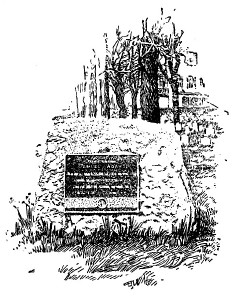
Goose” a name that originated in Boston.
In
this yard, as in King’s Chapel Busying Ground, many of the old
stones were years ago ruthlessly shifted from the graves to which
they belonged, which caused the remark of Dr. Holmes that “Epitaphs
were never famous for truth, but the old reproach of ‘Here lies’
never had such a wholesale illustration as in these outraged burial
places, where the stone does lie above and the bones do not lie
beneath.”
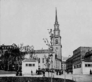
Park
Street Church, with its graceful spire, picturesquely finishing
the corner of Tremont and Park streets, dates from 1809. It is the
best example remaining in the city of the early nineteenth-century
ecclesiastical architecture. It was designed by an English architect,
Peter Banner, but the Ionic and Corinthian capitals of the steeple
were the work of the Bostonian Solomon Willard.
|
|
 It
was the first Trinitarian church established after the invasion of
Unitarianism in the Puritan churches, and the fervor with which the
unadulterated orthodox doctrine was preached by its earlier ministers
made its pulpit famous, and led the unrighteous to bestow upon the
point which it faces the title of “Brimstone Corner.” Its history
is notable. It is marked as the place in which “America” was
first publicly sung. The hymn was written by the Rev. Samuel F. Smith
to fit some music for Dr. Lowell Mason, music master of Boston, and
was given for the first time at a children’s celebration here on
July 4, 1832. Here on a preceding 4th of July (1829), William Lloyd
Garrison, then not yet twenty-four years old, gave his first public
address in Boston against slavery. In 1849 Charles Sumner gave his
great address on “The War System of Nations,” at the annual
convention of the American Peace Society, which that year began to
hold its sessions here. This remained the Peace Society’s regular
place of meeting for a long period. The patriotic sermons of the
Civil War preached here by Dr. A. L. Stone (minister of the church
from 1849 to 1866) have been called “a part
of Boston history.” It
was the first Trinitarian church established after the invasion of
Unitarianism in the Puritan churches, and the fervor with which the
unadulterated orthodox doctrine was preached by its earlier ministers
made its pulpit famous, and led the unrighteous to bestow upon the
point which it faces the title of “Brimstone Corner.” Its history
is notable. It is marked as the place in which “America” was
first publicly sung. The hymn was written by the Rev. Samuel F. Smith
to fit some music for Dr. Lowell Mason, music master of Boston, and
was given for the first time at a children’s celebration here on
July 4, 1832. Here on a preceding 4th of July (1829), William Lloyd
Garrison, then not yet twenty-four years old, gave his first public
address in Boston against slavery. In 1849 Charles Sumner gave his
great address on “The War System of Nations,” at the annual
convention of the American Peace Society, which that year began to
hold its sessions here. This remained the Peace Society’s regular
place of meeting for a long period. The patriotic sermons of the
Civil War preached here by Dr. A. L. Stone (minister of the church
from 1849 to 1866) have been called “a part
of Boston history.”
This
church occupies the site of the town granary, a grain house (first
set up on the Common, opposite, in 1737) from which grain was sold to
the needy by the town’s agents. It was from its proximity to the
granary that the old burying ground got its name.
|
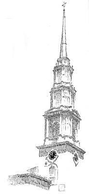 |
Looking
up Hamilton Place, opposite Park Street Church, we see the
side of the old Music Hall, now a theater. This is a building
of pleasant memories. It was erected in 1852, projected chiefly by
the Harvard Musical Association, then the representative of
classical orchestral music in Boston. Nearly thirty years later
(1881) the Boston Symphony Orchestra began its career here,
under the generous patronage of Henry L. Higginson. Once the hall had
in its “great organ” one of the largest and finest instruments in
the world, but this was permitted to be sold and removed at a time
when the hall was undergoing alterations. For some years, during the
latter part of his life, Music Hall was Theodore Parker’s
pulpit; and at a later period that of W. H. H. Murray,
after he had been a pastor of Park Street Church.
|
Boston
Common and its surroundings. Situated in the heart of the city,
the Common is unique among municipal public grounds. Its existence
and preservation are due to the wise forethought of the first
settlers of the town.
Its
integrity rests primarily on a town order passed in 1640, reserving
it as open ground, or common field. This was strengthened by a clause
in the city charter forbidding its sale or lease. Subsequent acts
prohibit the laying out of any highway or street railway upon or
through it, or the taking of any part of it for widening or altering
any street, without the consent of the citizens.
|
Beacon Street Mall |
It
dates actually from 1634, four years after the settlement of the
town, when it was laid out as “a place for a trayning field” and
for “the feeding of cattell.” A training field in part it has
remained to the present day, and cattle did not cease to graze on it
till the thirties of the nineteenth century. Originally it was larger
than it is now, extending to the Tremont Building on Tremont and
Beacon streets in one direction, and across Tremont Street to West
and Mason streets in another. The taking from the north end for the
Granary Burying Ground in 1660 was its earliest curtailment. On the
west side, where is now Charles Street, it at first met the Back Bay,
the waters of which came up to this line. Its present extent is 48
2/5 acres, exclusive of the old burying ground on part of its south
or Boylston Street side. Its surface has been much made over, but
without obliterating altogether its old-time contour. The broad
tree-lined malls which traverse it display the taste and
large-mindedness of the later town and earlier city fathers. Many
majestic elms which once embellished the place have been destroyed by
time and changes. The building of the Subway beneath the
Tremont Street mall removed the oldest row and some of the finest of
them; but there yet remain numerous stalwart specimens, with other
varieties of trees, shading and beautifying the several paths.
Soldier's' Monument |
Of
the monuments here the Army and Navy Monument, the granite
Doric column of which reaches above the trees, is most conspicuous.
This occupies the highest elevation in the inclosure, the point where
the British artillery were stationed during the Siege. It is the work
of Martin Milmore, and was erected in 1877. The statues on the
projecting pedestals of the plinth represent the Soldier, the Sailor,
the Muse of History, and Peace. The bas-reliefs between them depict
The Departure of the Regiment, The Sanitary Commission, The
Achievements of the Navy, and The Return from the War and Surrender
of the Battle Flags to the Governor. The figures on these bas-reliefs
are mostly portraits of soldiers or citizens prominent in the Civil
War period. The sculptured figures at the base of the shaft typify
the North, South, East, and West. The crowning statue represents the
“Genius of America.” The monument bears this inscription, written
by President Eliot of Harvard University: To the men of Boston who
died for their country on land and sea in the war which kept the
Union whole, destroyed slavery and maintained the Constitution, the
grateful city has built this monument that their example may speak to
coming generations.
At
the foot of this hill, on the east side, stood the “Great Elm”
till its fall in a windstorm in 1876, supposed to have been old when
the town was settled, and a scene of executions in early Colony days,
— per haps that of Anne Hibbens for “witchcraft” in 1656. An
iron tablet marks the spot. On a northerly side path is another elm
grown from a shoot of it. Not far from the “Great Elm” tradition
says the Quakers were executed; but the learned antiquary, M. J.
Canavan, fixes their gal lows at the South End. Beneath its branches
is supposed to have taken place the fatal duel in which young
Woodbridge was slain.
|
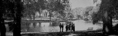
Frog Pond |
Near
by lies the historic “Frog Pond,” so called, as the town
wits have it, because it was never known to harbor a frog. The real
frog pond was the Horse or Cow Pond, a shallow pool where the cows
slaked their thirst or cooled their legs, which lay in the lowlands
about the present band stand. The present pond is the survivor of
three marshy bogs originally within the Common. It was the scene of
the formal introduction of the public water system in 1848, for which
celebration James Russell Lowell wrote his Ode on Water.
|
West
of the Frog Pond lies the Parade Ground, which represents, in
small compass, the original training field of the Colonial
trainbands. It has been the chief mustering place in war times from
Provincial to modern days. In 1775, when the Common was the British
camp, the force for Bunker Hill was arrayed here before crossing the
river to Charlestown. In the preceding April the detachment that
moved on Lexington and Concord started from near it, taking boats on
the bay. Now it is the place where the Ancient and Honorable
Artillery Company with great gravity go through their annual
time-honored evolutions, and the boys of the school regiments have
their clever May trainings.
The
granite shaft with its bronze figure of “Revolution,” which
stands in the green facing Lafayette Mall on the Tremont Street side,
commemorates the Boston Massacre of 1770, and is popularly called the
Crispus Attucks Monument. It is by Robert Kraus, and was
erected by the State in 1888. The bas-relief on the base reproduces a
crude con temporary picture of the scene published in London,
together with the “Short Narrative” authorized by the town. The
inscriptions are these words of John Adams and Webster:
On
that night the foundation of American
Independence
was laid. JOHN ADAMS.
From
that moment we may date the sever
ance
of the British Empire. DANIEL WEBSTER.
The
names of the victims are inscribed on the shaft.
The
promenade of Lafayette Mall is the finishing feature of the
Subway work on this side of the Common. It extends over
the
Subway between Park and Boylston streets, and at Boylston Street
joins a narrower walk which follows the Subway course on that side to
Charles Street, passing by the picturesque old Central Burying
Ground (established 1756) which has among its graves those of
Gilbert Stuart, the painter, and M. Julien, the restaurateur, whose
fame as the introducer of Julien soup survived him. While these walks
lack the fringes of noble English elms which characterized the
earlier malls here, especially the Tremont Street mall which once had
three magnificent rows, they have attractions in the bordering masses
of other trees and in their openness to the spacious street-ways free
from street-car tracks.
Being
in the heart of things Lafayette Mall is an animated thorough.
fare. Close by is the principal theater quarter of the
city. On the opposite side of the way are Keith’s Theater (fronting
on Washington Street, next east of Tremont) and the Tremont Theater
(near the site of the second playhouse built in Boston, — the
Haymarket of 1796). On Washington Street (with its rear entrance near
the West Street corner of Tremont) is the Boston Theater, and a
little way above this the Park Theater. On Tremont Street again, just
above Boylston Street, is the Majestic Theater, and a short block
above this the Shubert Theater. On Hollis Street, off Tremont, is the
Hollis Street Theater (its house including the brick walls of the
third Hollis Street Church, dating from 1808, the pulpit of John
Pierpont and Thomas Starr King, and the successor of the earlier
Hollis Street Church of Mather Byles, the “Tory, wit, and scholar,”
used, nevertheless, by the British for barracks during the Siege). On
Boylston Street, opposite the Boylston Street walk, is the Colonial
Theater (on the site of the first Boston Public Library building).
In
the same neighborhood is a notable group of hotels, including
the Touraine on Tremont and Boylston streets (occupying the site of
the mansion house of President John Quincy Adams, birthplace of
Charles Francis Adams, Sr.), the Brewster on Boylston Street, and the
Adams on Washington Street (covering the site of the
eighteenth-century Lamb Tavern, an early stagecoach starting place).
On Washington Street, opposite the opening of Boylston Street, is a
revolutionary land mark, — the site of the Liberty Tree, the
rallying place of the Sons of Liberty in the prerevolutionary period,
where the effigies were hung in the Stamp Act excitement. The
business building that now covers the spot displays on its front an
old tablet with a representation of a tree and beneath, these lines:
Sons
of Liberty, 1766
Independence
of their country, 1776.
The
adjacent hotel, popularly known as “Brigham’s,” stands in place
of the Liberty Tree Tavern, where the Liberty men refreshed
them selves after their meetings at the tree. “Brigham’s” was
originally the Lafayette Hotel, erected to mark the historical spot
in season for the great welcome to Lafayette on the
Frenchman’s memorable last visit to the country in 1824; and so was
named in his honor. It was in commemoration of this visit, very much
later — three quarters of a century afterward, — that Lafayette
Mall received its name.
The
selection is based on a pretty incident of that visit. On the
reception day the school children were lined up along Tremont Street
mall, and, as Lafayette was passing in the procession, they cast
bouquets in his path so that his progress was upon a carpet of
natural flowers.
|
Midway
up Boylston Street between Washington and Tremont streets is the
building of the Young Men’s Christian Union (instituted
1851) with its stone clock tower. On the Tremont Street corner facing
the Lafayette Mall is the white granite Masonic Temple (the
second on this site, built in 1898 1899), headquarters of the Grand
Lodge of Massachusetts, and housing thirteen lodges.
Occupying
the streets east of the mall is the heart of the retail shopping
quarter. Below the Temple Place corner, hedged in by great
stores, is St. Paul’s Church, the fourth Episcopal church in
Boston, dating from 1820, a Grecian-like temple of gray granite, the
hexastyle porticoes of Potomac sandstone. Solomon Willard carved the
Ionic capitals; Alexander Parris designed the whole. The pediment is
bare, the original design of a bas-relief of Paul preaching at Athens
never having been carried out. It was in one of the tombs beneath
this church that General Joseph Warren’s remains rested for
thirty years after their second removal. In another tomb Prescott
the historian was buried.
|
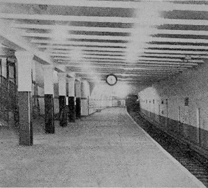
Milk Station, Washington
Street Station |
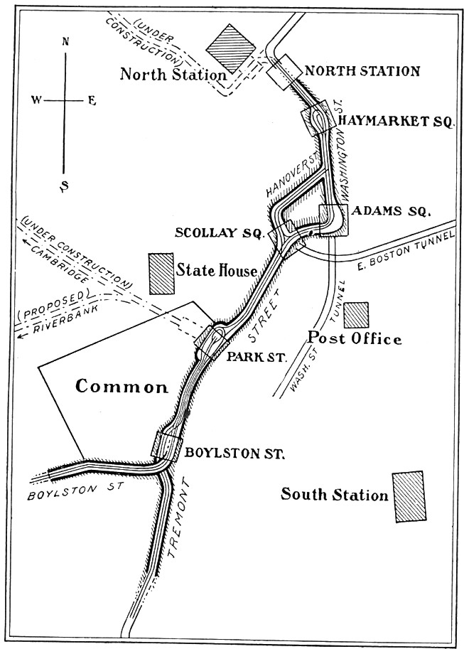 |
At
the head of the Park Street mall are the Park Street entrance and
exit stations of the Boston Subway. The upper west side
building is the entrance for west, and south-bound surface cars; the
upper east building is an exit only; the lower east building, an
entrance for north bound surface cars (North Station and
Charlestown); and the lower west building, entrance and exit for
west, and south-bound cars. Above the stairways of the Park Street
entrance a bronze tablet, placed in commemoration of the initial
opening of the Subway in 1897, gives the following data: This
Subway authorized by the Legislatures of 1893 and 1894. Hon. Nathan
Matthews, Jr., Mayor of the City of Boston. Built by the Boston
Transit Commission. Howard Adams Carson, chief engineer. Begun at the
Public Garden, 28 March, 1893, was opened to this point for public
travel 2 September, 1897. The work was completed throughout and
the entire Subway opened September 3, 1898. Its length is about one
and two-thirds miles. Its course is shown by the accompanying map.
The
surface cars coming from the west enter at the Public Garden and make
the loop at the Park Street station, whence they return and emerge at
the Public Garden. Those coming from the south and north use that
part of the Subway between Scollay Square and the North Station.
The
Subway is owned by the city and leased to the Boston Elevated Railway
Company for a term of years, at an annual compensation of “4 7/8
per cent of the net cost of the work.”
|
The
elevated trains use the Washington Street Tunnel, between
which and the Subway passengers transfer at the Haymarket Square
station. The Tunnel, connected with the Elevated system, passes under
Washington Street, and, including inclines, is 1 2/10 miles in
length. It is constructed on a generous plan and is attractively
finished at the several stations with tiling. The names of the
stations are given in order of direction of traffic: south-bound —
Friend, Milk, Winter, Boylston; north-bound — Essex, Summer, State,
Union. Each platform is three hundred and fifty feet in length and
will accommodate an eight-car train. This Tunnel was opened to the
public November 30, 1908. In the State station is placed a bronze
tablet bearing this inscription: Washington Street Tunnel,
authorized by the Legislature, 1902. W. Murray Crane, Governor;
Patrick A. Collins, Mayor of Boston. Opened November 30, 1908. Built
by the Boston Transit Commission [names of the commission].
Howard A. Carson, Chief Engineer.
This
Tunnel, like the Subway, is owned by the city and leased to the
Boston Elevated Railway Company. The lease runs for twenty-five
years, from the beginning of the use of the Tunnel, at an annual
rental “equal to 41/2 per cent of the net cost.”
|
At
the head of the Beacon Street Mall, opposite the State House, is the
Colonel Robert Gould Shaw Memorial, facing Beacon
Street,
between two majestic elms, the most imposing piece of out door
sculpture in the city. Colonel Shaw was the commander of the
Fifty-fourth Regiment of Massachusetts Infantry, composed of colored
troops, in the Civil War, and was killed at the head of his command
while leading the assault on Fort Wagner, July 18, 1863; and the
monument commemorates the colored soldiers in that event as well as
their leader. It consists of a statue of Colonel Shaw mounted, with
his men pressing close beside him, in high relief upon a large bronze
tablet. The sculptor was Augustus St. Gaudens, and the architect of
the elaborate stone frame was Charles F. McKim. The inscriptions are
unusually extensive and interesting, including verses of James
Russell Lowell and Emerson, and a memorial by ex-President Eliot of
Harvard.
The
monument was erected and dedicated in 1897. Its cost was met from a
fund raised by voluntary subscriptions.
On
the opposite side of Beacon Street, just below Hancock Avenue, —
the walk along the west side of the State House grounds, — is the
site of a long-cherished landmark that should have been preserved:
the mansion house of Hancock. It is marked by a modest bronze
tablet set in the low iron fence in front of the brownstone building,
the present publishing house of Messrs. Ginn and Company,
which now occupies the spot: Here stood the residence of John
Hancock, a prominent and patriotic Merchant of Boston, the first
Signer of the Declaration of American Independence, and First
Governor of Massachusetts, under the State Constitution.
At
the time of its demolition the mansion, besides being of exceptional
historic value, was a rare type of our provincial domestic
architecture, and was well fitted by situation and character for
preservation as the official dwelling of the governors of the
Commonwealth, as was proposed some years before. The main structure
was then nearly as in Governor Hancock’s day, when it was called
the “seat of his Excellency the Governor,” and it contained much
of the furnishings and appointments of his time, with the family
portraits by Copley and Smibert. A measure for its purchase by the
state for the governor’s house was reported to the Legislature in
1859 by an influential committee; but the project failed. At length,
in February, 1863, the land which it occupied was sold.
|
 |
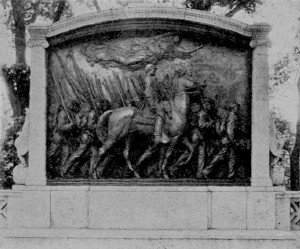
Shaw Monument |
For a while
thereafter it served as a museum of historical relics, and then, a
scheme for its removal and reërection elsewhere failing, it was
pulled down. Souvenirs of it were eagerly sought as it fell. The
knocker on the front door was given to Dr. Holmes, who placed it on
the door of the “old gambrel-roofed house” in Cambridge, where it
remained till that also was demolished. The flight of stone steps
which led up to the entrance are now in service on Pinebank, Jamaica
Park. The purchasers of the land, J. M. Beebe and Gardner Brewer, two
leading Boston merchants, erected the present stately double house
here for their occupancy. Messrs. Ginn & Company became
established in No. 29 in 1901, and their business offices fully
occupy the spacious interior.
|
|
The
old mansion was of Quincy granite obtained from the surface, as in
the case of King’s Chapel, squared and well hammered. The principal
features of the façade were the broad front door at the head
of a flight of stone steps, garnished with pillars and an ornamental
door head; and the ornamented central window over it. The high
gambrel roof with dormer windows showed a carved balcony railing
inclosing its upper portion. The interior comprised a nobly paneled
hall, having a broad staircase with carved and twisted balusters,
which divided the house in the middle and extended through on both
stories from front to rear. On the landing, part way up the
staircase, was a circular-headed window looking out upon the garden,
with a broad and capacious window seat. On the entrance floor, at the
right of the hall, was the great dining-room, seven teen by
twenty-five feet, also elaborately paneled from floor to ceiling.
Until the widening of Beacon Street the house stood well back from
the street on ground elevated above it. The approach was then through
a “neat garden bordered with small trees” and shrubbery. The
mansion then, also, had two large wings, one on the east side
containing a great ballroom, the other on the west side appropriated
to the kitchen and other domestic offices. Beyond the west wing was
the coach house, and adjoining that the stable.
|
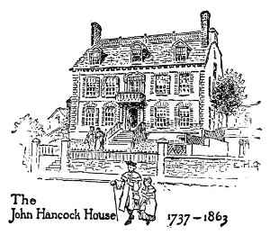 |
Behind
the mansion were the gardens and fruit-tree nurseries,
extending up the side of the then existing peak of Beacon Hill
where the State House Annex stands. The mansion with the estate came
to John Hancock in 1777, upon the death of Lydia Hancock,
widow of his uncle, Thomas Hancock, who built the house. The estate
then included the territory occupied by the State House, and extended
along Beacon Street to Joy Street. During the Siege Lord Percy
occupied the mansion for some time.
Let
us now step back to the opposite side of Beacon Street a moment and
take a sweeping survey of the fine line of Beacon Street houses
down the hill. Standing by the Joy Street steps to the Common,
which lead to the head of Holmes’s “Long Path” (the mall
running southward across the Common’s length to Boylston Street, —
the scene of the crisis in the “Autocrat’s” courtship of the
schoolmistress), we have the best point of view. Looking westward at
the lower corner of Walnut Street, the next opening below Joy Street,
we see the house in which Wendell Phillips was born. Lower
down is the Somerset Club, — the stone double-swell-front
house originally the “David Sears mansion,” — by the site of
the house in which John Singleton Copley lived when painting
his remarkable Boston portraits. Still farther down, below the next
side opening, we catch a glimpse of the painted brick “swell” of
the Prescott house (No. 55), the home of the historian William
H. Prescott through the last fourteen years of his life.
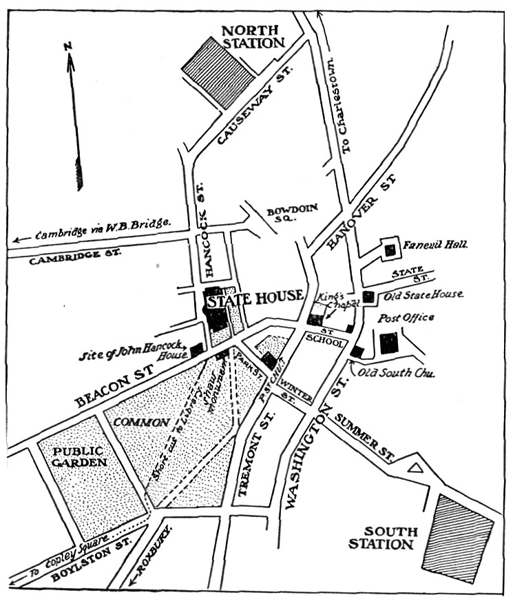 |
From
the State House to the Old South. The front of the State House,
with its terraced lawn, occupies the cow pasture of the Hancock
estate, comprising about two acres, which the town purchased of John
Hancock’s heirs for four thousand dollars and conveyed to the
Commonwealth. This is the historic “Bulfinch Front,”
designed by Charles Bulfinch and erected in 1795-1797. It alone
constituted the Massachusetts State House for more than half a
century. Then a new part, extending back upon Mt. Vernon Street,
was added (1853-1856), which came to be called the “Bryant
Addition,” from its principal architect, J. G. F. Bryant; and
finally the “State House Annex” was erected (1889-1895;
Charles E. Brigham, architect), extending back from the Bryant
Addition, with the archway over Mt. Vernon Street, to Derne Street,
in exterior design and ornamentation harmonizing with the Bulfinch
Front. Standing on the highest point of land in the city proper, the
yellow dome of the Bulfinch Front (the “Gilded Dome” since
1874, when gilt was first applied to it) is a familiar landmark in
every direction by day, while at night, lighted up by encircling rows
of electric lights, it is a glistening beacon visible for many miles.
Till
1811 the main peak of Beacon Hill rose directly behind the
Bulfinch Front, a grassy cone-shaped mound about as high as the dome.
On its broad, flat summit the Beacon was set up as early as
1634, from which the name of the entire hill came, it having earlier
been called Centry Hill, from a lookout established here.
The
Beacon was to warn the country on occasions of danger. It consisted
of an iron skillet filled with combustibles for firing, suspended
from an iron crane at the top of a high mast, with treenails in it
for its ascent. This and its successors stood for more than a century
and a half, but it never seems to have been fired for alarm. During
the Siege the British pulled the Beacon down and erected a fort in
its stead. It was reërected after the Evacuation and stood till
1789, when it was blown down in a gale.
|
After
the Revolution the first Independence monument in the country
was set up on this sightly peak (1790-1791), — a plain Doric column
of brick covered with stucco, on a base of stone, and topped with a
gilded wooden eagle supporting the American arms, — the work of
Bulfinch, now reproduced in stone and standing in the State House
Park on the east side of the long building. When the peak was cut
down (in 1811-1823, its earth going principally to fill the North
Cove which became the Mill Pond, now in small part covered by
Haymarket Square) this monument was destroyed, only the inscribed
tablets and the eagle being reserved. The tablets are inserted in the
base of the present monument. A wooden effigy of the eagle is now
over the President’s chair in the Senate Chamber.
The
main approach to the State House, up the long sweep of broad stone
steps from Beacon Street, leads to the spacious porch from which
opens Doric Hall, the main hall of the Bulfinch Front. The bronze
statues on the terrace lawn are: on the right as we
ascend,
Daniel Webster, by Hiram Powers, erected in 1859 by the
Webster Memorial Committee; on the left, Horace Mann, by Emma
Stebbins, erected in 1865, a gift from school children and teachers
of the state, who gave the fund for its execution in recognition of
Horace Mann’s service in developing the system of popular education
in Massachusetts.
In
Doric Hall we see the statue of Washington in
marble,
by Sir Francis Chantrey, given to the state in 1827 by the Washington
Monument Association; and the marble statue of John A. Andrew,
the “war governor,” by Thomas Ball, erected in 1871, the cost
being met from a surplus of $10,000 remaining from the fund
subscribed for the statue of Edward Everett in the Public Garden. Set
in a side wall near these statues are two memorials of the Washington
family, — facsimiles of the tombstones of the ancestors of
Washington, from the parish church of Brington, Northamptonshire,
England, given to the state by Charles Sumner in 1861, to whom they
were presented by Earl Spencer. Against the walls on either side of
the Washington statue are tablets to the memory of Charles
Bulfinch, and commemorating the “preservation and renewal of the
Massachusetts State House.”
On
the side walls are portraits of sixteen governors of Massachusetts.
Four brass cannon are placed against the wall, two of
them
consecrating the names of Major John Buttrick and Captain Isaac
Davis, heroes of the fight at Concord Bridge, April 19, 1775; the
other two cannon captured in the War of 1812.
From
Doric Hall we enter the passageway leading into the “Grand
Staircase Hall,” and from the latter pass into “Memorial
Hall,” the crowning feature of this floor. In the passageway a
large bronze case contains the colors carried by Massachusetts
soldiers in the Spanish War and returned to the custody of the
Commonwealth. They were deposited here July 31, 1901. The skylight in
the ceiling here, it will be observed, is decorated with a
representation of Liberty surrounded by the names of various
republics.
The
Grand Staircase Hall is an effective piece of marble work.
The
paintings on the north wall represent “Paul Revere’s Ride,”
“James Otis Making his Famous Argument Against the Writs of
Assistance in the Old Town House in Boston, in February, 1761,” and
“The Boston Tea Party,” all by Robert Reid. The staircases here
are of Pavonazzo marble. The balcony formed by the third-floor
corridor is surmounted by twelve Ionic columns. Its windows at the
south are emblematic of Commerce, Education, Fisheries, and
Agriculture. At the head of the stairs are the seal of the colony,
1628-1684, and the seal of the state carved in marble. Upon the
pillars of the entrance to Memorial Hall are bronze reliefs of Major
General Thomas G. Stevenson (by Bela L. Pratt), and Rear Admiral John
A. Winslow (by William Couper).
|
The
marble Memorial Hall in circular form rises to a dome with
bronze cornice environed by the eagles of the Republic, the crest of
the Com monwealth appearing above, in cathedral glass, surrounded by
the seals of the other twelve original states. The gallery is
supported by sixteen pillars of Sienna marble. The four niches with
glass fronts contain the battle flags carried by the Massachusetts
Volunteers in the Civil War, and in each niche is a framed extract
from the address of Governor Andrew upon receiving them (all but a
few which were returned later) on Forefathers’ Day, December 22,
1865. The bronze statue is of Major General William F. Bartlett, by
Daniel C. French, placed in 1904. The large paintings on the walls
are: north wall, “The Pilgrims on the Mayflower”; south
wall, “John Eliot Preaching to the Indians,” — both by Henry
Oliver Walker; west wall, “Concord Bridge, April 19, 1775”; east
wall, “The Return of the Colors to the Custody of the Commonwealth,
December 22, 1865,” — both by Edward Simmons.
|
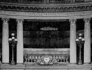
Representatives' Hall -
The Historic Codfish |
Beyond
Memorial Hall the main staircase leads to the floor upon which is
Representatives Hall. This chamber is finished in white
mahogany, with paneled walls. The coved ceiling is embellished with
frescoes by Frank Hill Smith. The historic codfish is
suspended opposite the Speaker’s desk between the two central
columns. In the lobby the statue of Governor Roger Wolcott (placed
1907) is by Daniel C. French. On the east side are the rooms of the
Secretary of the Commonwealth, in which are to be seen precious
documents incased in asbestos boxes, — the Colony Charter of 1628,
the Province Charter of 1692, the Explanatory Charter of George H,
and the original Constitution of the Commonwealth, with an attested
copy made in 1894, the original having become in part illegible. In
the archives, on the fourth floor, belonging to this
department are, with much other valuable historical material, the
military records of the Narragansett War, of the French and Indian
Wars, and the muster and pay rolls of the Revolution, the original
depositions and’ examinations of persons accused of witchcraft, and
manuscript papers of the Revolution.
In
the State Library, at the north end of the building, is to be
seen in a glass-covered case the famous Bradford Manuscript, the
“History of Plimoth Plantation” by Governor William Bradford,
popularly but erroneously called the Log of the Mayflower. This
is the volume which after various adventures found lodgment in the
Library of the Bishop of London’s Palace at Fulham, and was
returned to the Commonwealth by the Bishop of London through the
efforts of Senator Hoar of Massachusetts and the Hon. Thomas F.
Bayard, ambassador at the Court of St. James. It was received in
behalf of the Commonwealth by Governor Wolcott, May 26, 1897.
The State Library contains 125,000 volumes. Charles F. D. Belden is
the librarian.
The
Executive Department and the quarters of the Senate are in the
Bulfinch Front. The Council Chamber, fashioned in the Corinthian
order, has the old ornamentations designed by Bulfinch. In the
Governor’s Rooms are several portraits of note. In the
Senate Chamber, occupying niches, are busts of Washington, Franklin,
Lafayette, Lincoln, and distinguished Massachusetts men. The gilded
eagle above the President’s chair, with the national and State
flags, holds in its beak a large scroll inscribed, “God Save the
Commonwealth of Massachusetts.” In the Senate Reception Room are
numerous interesting relics. Among them are the first king’s arms
captured from the British, at Lexington, on the 19th of April, 1775,
and the fowling piece used that morning by Captain John Parker, the
commander of the minutemen there, — both gifts to the State from
his distinguished grandson, Theodore Parker, the preacher and
reformer. There are also a Hessian hat, sword, gun, and drum captured
at the battle of Bennington, August 16, 1777, which were presented to
the State by Brigadier General John Stark. On the walls are portraits
of twenty-two governors, including an original portrait of John
Winthrop.
The
State House Park, on the east side of the long building,
is a
spread ing lawn fringed with young trees, shrubs, and flowers, space
for which was obtained by discontinuing two or three fine old streets
and removing the well-favored dwellings that faced upon them. Beneath
a considerable part of it are great coal bunkers for the large supply
of coal required for the State House. The reproduced Bulfinch
Monument in stone occupies as near as may be the position of the
original one. It is an exact copy of that in dimensions, and the
eagle at its top follows the original drawing of Bulfinch’s bird.
The inscription on the bronze tablet in the base gives this concise
chapter of history: In 1634 the General Court caused a Beacon to
be placed on the top of this hill. In 1790 a brick and stone monument
designed by Charles Bulfinch replaced the Beacon, but was removed in
1811 when the hill was cut down. It is now reproduced in stone by the
Bunker Hill Monument Association. 1898. The old tablets of the
Bulfinch monument are set higher in the base.
The
statues in the lawns near by are of Major General Nathaniel P. Banks
(Governor, Congressman), by H. H. Kitson, placed 1908; and of Major
General Charles Devens (United States Marshal, United States
Attorney-General, and Justice of the Supreme Judicial Court of
Massachusetts), by Olin L. Warner, placed 1898. The equestrian statue
on the Beacon Street side of the park, set in the broad walk, is of
Major General Joseph Hooker, the figure by Daniel C. French, the
horse by Edward C. Potter. This was erected in 1903.
|
We
reënter Beacon Street by the arched way from this walk, opposite
the head of Park Street. Down Park Street we see, facing the
Common, a line of buildings, mostly dwellings reconstructed for
business purposes, several of which are interesting landmarks. The
upper one at the Beacon Street corner was, in part (that part
fronting on Park Street, a portion of the old iron-railed entrance
steps remaining), the home of George Ticknor, the historian (“History
of Spanish Literature”). The larger building below is the house of
the Union Club, established (1863) during the Civil War,
primarily as a political club in support of the Union cause. Edward
Everett was its first president. It occupies in part the residence of
Abbott Lawrence, a foremost Boston mer chant in his time. In No. 6
are the quarters of the Mayflower Club, of women. Below is
Goodspeed’s snug book shop. At No. 4 is the publishing house of the
Houghton Mifflin Company, occupying the old Quincy mansion house,
the winter home of the elder Josiah Quincy (whose statue we shall
presently see) through the last seven years of his long,
eventful, and useful life of nearly ninety-two years.
|
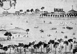
From an Old Print of
Boston Common |
Now
turning our steps down Beacon Street eastward, we pass in
close neighborhood the Unitarian Building, at the corner
of Bowdoin Street; directly opposite, the Congregational House;
and next to this the Boston Athenæum.
The
Unitarian Building, a low, Moorish-like structure of
brownstone (built 1885-1886), is the headquarters of the American
Unitarian Association, and the general denominational house, where
are the offices of various organizations, national, state, and local.
Channing Hall here, and neighboring rooms, are embellished with
portraits and busts of Unitarian leaders. The Congregational
House, a building of stone and brick, ornamented with sculptured
tablets (built 1897-1898), is the head quarters of the Congregational
Trinitarian denomination. The emblematic sculptures on the façade
represent respectively, from east to west: Law, depicting the Signing
of the Compact in the cabin of the Mayflower, November 21,
1620; Religion, the observance of Sunday on Clark’s Island on the
day before the landing at Plymouth; Education, the act of the General
Court of Massachusetts passed October 28, 1636, appropriating money
for a “schoole or colledge”; and Philanthropy, the preaching of
the apostle Eliot to the Indians at Waban’s wigwam on old Nonantum
Hill, Newton, October, 1646. In this building are established the
Congregational Library and the Missionary Library of the American
Board of Commissioners for Foreign Missions, with the remarkable
Pratt Collection, in the Bible Room, embracing Hebrew rolls, various
editions of the Scriptures, palm books, biblical and other charts,
relics, and antiquities. The head offices of the American Board are
here. Pilgrim Hall is in the rear from the main entrance.
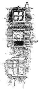
The
Boston Athenæum, presenting a classic front of brown
freestone, in marked contrast with its lofty neighbors, dates from
1849. The literary institution for which it was erected dates back to
1807. This had its origin in the Monthly Anthology, a magazine
first published in 1803, of which the Rev. William Emerson, father of
Ralph Waldo Emerson, was the principal editor. The persons who became
interested in that “journal of polite literature” —
a
remarkable set of cultivated young men — formed the “Anthology
Club,” and collected a library, which was incorporated in 1807 as
the Boston Athenæum. Quarters were first found in Congress
Street, then in a Pearl Street mansion house presented to the
institution (1821), and later this building was built by the
corporation. For many years the Athenæum had in connection with
its library a valuable art gallery, but the best paintings of its
collection have been transferred to the Museum of Fine Arts, Back
Bay. It now possesses over 240,000 volumes, many of them rare; a
large collection of Braun photographs and art works; files of early
newspapers; the Bemis collection of works on international
law, including state papers, etc., for the increase of which there is
a substantial fund; one of the very best sets of United States
documents in the country; the best collection in existence of books
published in the South during the Civil War; and a large part of
George Washington’s private library, with many works relating to
the first President. The Stuart portrait of Washington now at the Art
Museum is owned by the Athenæum.
The
Athenæum became early a center of the new literary and artistic
life which was to make Boston famous in Emerson’s time. From it
came, more or less directly, the old and scholarly North American
Review; and most of the literary societies and libraries of
to-day in Boston owe their origin entirely or in part to the
influence of the Athenæum and its founders. The institution is
managed by trustees elected by its 1049 shareholders, known as
“proprietors.” The income is derived from invested funds and from
an annual assessment upon each share in use. Some famous men of New
England have been among the proprietors, of the Athenæum,
including Daniel Webster, Charles Sumner, Holmes, Parkman, and
Prescott. William F. Poole, who originated Poole’s Index, was at
one time its librarian. Arthur Theodore Lyman is the present
president, and Charles Knowles Bolton is the librarian.
The
old-fashioned “swell fronts” above the bend of Beacon Street, at
the upper corner of Somerset Street, are the quarters of the Boston
City Club, a large social and business organization of citizens
“interested in the city of Boston and the problems of its growth.”
In
Somerset Street, a few steps from the corner, is the
former
general building of Boston University (chartered 1869, for
both sexes), occupied till 1908, when removal was made to Boylston
Street, Back Bay (see p. 81). It is now the house of the Boston lodge
of the Order of Elks. On Ashburton Place, opening just above,
is the Boston University School of Law. Within a ten-minute walk is
the School of Theology at 72 Mt. Vernon Street, West End; the other
department of the university, the School of Medicine, is at the South
End, on East Concord Street, adjacent to the Massachusetts
Homeopathic Hospital. Beyond the School of Law the upper end of
Ashburton Place is imposingly finished by the Ford Building,
erected for Baptist headquarters. Farther down Somerset Street, at
No. 16, is the house of the Boston Architectural Club. No. 18
is that of the New England Historic Genealogical Society
(founded 1844, incorporated 1845). In the latter institution is a
valuable library of more than 50,000 volumes and over 100,000
pamphlets, comprising the best known collection of genealogical
works, biographies, and histories, American and English. Many
visitors, students in genealogy and compilers, make daily use of this
extensive collection. The society also possesses numerous rare
manuscripts and historical relics. It publishes the “New England
Historical and Genealogical Register” (established 1847).
John
Ward Dean was for a long period the librarian of this society. The
present president is James Phinney Baxter, of Portland, Maine; the
recording secretary, John Albree; the corresponding secretary,
William R. Cutter; the librarian, William P. Greenlaw; and the editor
of publications, F. Apthorp Foster.
On
Beacon Street again, the modern office building occupying
the
corner of Tremont Place covers the site of a row of pleasant houses
which slowly changed from dwellings to business places. The corner
one was the sometime home of Nathan Hale, where Edward Everett
Hale passed his boyhood when he was attending the Latin School.
The end one in the row was latterly the publishing house of Ginn
and Company, from which they removed to the Hancock-house site,
29 Beacon Street.
|
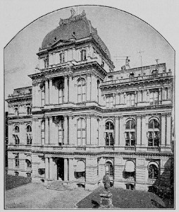
Boston City Hall
|
Crossing
crowded Tremont Street we enter more crowded School Street, one
of the most traveled and one of the shortest thoroughfares in the
city. Just below King’s Chapel we are at the site of the first
schoolhouse of the first public school, which is continued in the
present Public Latin School, now at the South End (Warren
Avenue, Dartmouth and Montgomery streets). A bronze tablet set on the
first stone post of the fence in front of the City Hall is inscribed
with its story: On this spot stood the First House erected for the
use of the Boston Public Latin School. This school has been
constantly maintained since it was established by the following vote
of the town: At a meeting upon public notice it was generally agreed
that our brother Philemon Pormont shall be entreated to become
schoolmaster for the teaching and nurturing of children with us.
April 13, 1635.
This
schoolhouse stood where the chancel and pulpit of King’s Chapel are
now. It gave the street its name.
|
It
was built in 1645 (previous to which the school was held in the
master’s house), and remained on this spot for upward of a
century. Then in 1748 another building was erected on the
opposite side where is now the Parker House. The present is the fifth
building of the school. In the long roll of Latin School pupils
appear the names of Franklin, Hancock, Samuel Adams, and Robert Treat
Paine; Cotton Mather, Henry Ward Beecher, James Freeman Clarke,
Edward Everett Hale, and Phillips Brooks; Ralph Waldo Emerson, John
Lothrop Motley, and Francis Parkman; Presidents Leverett, Langdon,
Everett, and Eliot of Harvard College; Charles Francis Adams, Sr.,
Charles Sumner, and William M. Evarts.
The
heavy granite City Hall (built 1862-1865), of elaborate
design, calls only for a passing glance. It succeeded a Bulfinch
building on the same site, — a Court House (predecessor of the
present “Old Court House”), refitted for a City Hall. The bronze
statues in the yard are more interesting. That of Benjamin
Franklin was the first portrait statue set up in Boston (1856).
It is the work of Richard Greenough. The fund for its erection was
raised by popular subscription. The four bronze medallions in the
sunken panels of the pedestal represent as many periods in Franklin’s
career.
The
other statue, of Josiah Quincy, is by Thomas Ball, and was
placed in 1879. It represents the elder Quincy as he appeared in
middle life when mayor of Boston. The base is a block of Quincy
granite. A marble statue by William W. Story, in Memorial Hall at
Cambridge, represents Quincy in later life, or when president of the
college.
We
may stop a moment at the building next beyond the foot passage by the
side of the City Hall (another court dignified with the term of
avenue), and observe the inscribed fire-back set in its
vestibule wall. The inscription relates that on this site from 1785
to 1815 was the dwelling of Dr. John Warren (brother of Joseph
Warren, killed at Bunker Hill), who was the first professor of
anatomy and surgery in Harvard University. The fire-back came from
the old house.
|
At
the end of School Street the ancient building long known as the “Old
Corner Bookstore” lingers a weathered old relic of the past in
one of the busiest quarters, although the booksellers finally left it
in 1903. It dates from 1712. It had been a book stand since 1828. Its
interest lies particularly in its literary associations, for in what
is regarded now as the golden age of Boston literary activity —
about the middle and third quarter of the nineteenth century — it
was the chief literary lounge and calling place of the city. This was
especially the characteristic of the “Old Corner” during the long
years of its occupancy by Ticknor & Fields and their immediate
successors.
The
“Curtained Corner” of James T. Fields in the back part of the old
book shop has been much discoursed upon. George William Curtis in the
“Easy Chair” called it “the exchange of wit, the Rialto of
current good things, the hub of the hub. It was a very remarkable
group of men, — indeed it was the first group of really great
American authors which familiarly frequented the corner as guests of
Fields.”
Previous
to this building there was here the Hutchinson Homestead, where
lived that colonial dame, Anne Hutchinson, strong of mind and
keen of wit, one of John Cotton’s old Boston-in England
parishioners, who became the central figure in the violent antinomian
controversy which tore the Colony in 1637-1638, and who was finally
banished for heresy. In her little home here she instituted the
weekly gathering of women to discuss the Sunday sermon after the
fashion of the men, and so she is credited with having set up the
first woman’s club in America.
|
Old Corner Bookstore
|
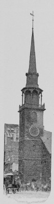 |
The
Old South Building opposite, the monumental business structure of
stone and steel spreading between Spring Lane and around the Old
South Meetinghouse to Milk Street, covers near its south east end
the site of Winthrop’s second mansion (where he died), which was
afterward and until the Revolution the parsonage house of the Old
South, and which the British demolished together with the shading row
of butternut trees before it, using them for firewood during the
Siege. The tall walls of the ornate building close against the plain
brick meetinghouse and reaching above its tower, dwarf the historic
structure, but add to its uniqueness. When the tower porch is arched,
as is proposed, for the sidewalk, which has been brought to the inner
line of the widened street at this point, its appearance will further
be improved.
The
Old South is now a loan museum of Revolutionary and other relics,
Colonial furniture, and portraits, open to the public for a modest
fee, which goes to meet the cost of its maintenance. The interior is
restored as far as possible to the aspect which it bore in the
prerevolutionary period, when it was the scene of those great town
meetings, too large for the old Faneuil Hall, which “kindled the
flame that fired the Revolution,” and in commemoration of which the
meetinghouse came to be called the “Sanctuary of Freedom.” The
tablet on the tower, over which the Boston ivy spreads, is inscribed
with these historic dates:
Old
South
Church
gathered 1669
First
House built 1670
This
House erected 1729
Desecrated
by British troops 1775-6
|
The
preservation of the meetinghouse is directly due to the efforts of an
organization of twenty-five Boston women, under the title of the “Old
South Preservation Committee,” formed in the centennial year of
1876, at a critical juncture, when its demolition was imminent
through the sale of the property for mercantile purposes. Public
interest was aroused, “preservation meetings” were held with
lectures, addresses, and poems by Emerson, Henry Lee, Lowell, Holmes,
and others; and finally this organization succeeded — Mrs. Mary
Hemenway contributing $100,000 — in purchasing the estate subject
to certain restrictions for $430,000. It is now used for the Old
South Lectures to Young People, instituted by Mrs. Hemenway to
promote among American youth a “more serious and intelligent
attention to historical studies, especially studies in American
History,” of which Edwin D. Mead is the director.
The
town meetings of greatest moment held here were those of June 14 and
15, 1768, upon the matter of the impressment of Massachusetts men by
the commander of his majesty’s ship of war Romney; the long
afternoon and early evening meeting of March 6, 1770, the day after
the Boston Massacre, which brought about the removal of the British
regiments from the town; and the anti, tea meetings between November
27 and December 16, 1773, culminating with the “Tea Party” and
the emptying of the cargoes of the tea ships into the harbor. The
series of orations commemorative of the Boston Massacre was delivered
here, Dr. Joseph Warren, three months before he was killed at Bunker
Hill, pronouncing the second one, upon which occasion he was
introduced through a window in the rear of the pulpit, the entrance
doors and the aisles, and even the pulpit steps, being occupied by
British soldiers and officers. During the Siege, when the
meetinghouse was used as a riding school by Burgoyne’s regiment of
light dragoons, the floor was cleared for their exercises, and cart
loads of earth and gravel were spread over it. The pulpit, the pews,
and all the inside structures except the sounding-board and the east
galleries were taken out and most of them burned for fuel. One
“beautiful carved pew,” with silken furnishings, was carried off
to a neighboring house and “made a hog stye” of. The east
galleries were fitted for spectators, and in one of them was a
refreshment bar. The south door was closed and a pole was fixed here
over which the cavalry were taught to leap their horses at full
speed. In the winter a stove was set up, in which were used for
kindling many of the precious books and manuscripts of the Rev.
Thomas Prince’s New England Library, then deposited in the
“steeple-room” of the tower. The manuscript of Bradford’s
“History of Plimoth” (see p. 43), and that of the third volume of
Winthrop’s Journal among them, were spared. In this tower study the
Rev. Jeremy Belknap, the historian and the recognized founder of the
Massachusetts Historical Society, did much work.
The
meetinghouse which preceded this, a “little house of cedar,” was
the one which Andros obliged the regular church organization to share
with the first Episcopal church (see p. 24). That, too, was the place
where Judge Samuel Sewall in 1697 published his “confession of
contrition” for his share as a witch craft judge in the
“blood-guiltiness” at Salem five years before. It was also the
meetinghouse where Benjamin Franklin was baptized on the day of his
birth, January 17 (6 O. S.), 1706.
In
the neighborhood of the Old South is the newspaper quarter, Newspaper
Row, extending below the curve of Washington Street, northward.
Near it, also on Washington Street and Bromfield Street, are popular
bookshops.
From
the Old South to the “Tea Party” Site. At the Old South we
turn into Milk Street, but before doing so we should identify the
site of the Province House, the official residence of the
royal governors, celebrated in Hawthorne’s “Legends of the
Province House.” This build. ing stood nearly opposite the
meetinghouse, well back from Washington Street, above a handsome lawn
ornamented by two noble oaks at the street front. A bit of its wall
yet remains backing upon Province Court, which is reached from
Washington Street by a foot passage.
It
was a stately house of brick, three stories, with gambrel roof, and a
high cupola surmounted by a figure of an Indian with drawn bow and
arrow, another specimen of the handiwork of “Deacon” Shuns
Drowne, maker of the grass hopper on Faneuil Hall. The approach was
by a high flight of stone steps leading to a portico, over which
appeared the royal arms in deal and gilt. It long outlived the
Province period. After the Revolution it served the Com monwealth a
while as the Government House, for the sittings of the governor and
council, and for state offices. Thereafter it fell to commercial
uses, and in its latter days it was a hall of negro minstrelsy. It
finally passed, all but the bit of wall, in a fire in 1864. It was
built originally for a dwelling by an opulent merchant, Peter
Sergeant, in 1667. The Province bought it for a governor’s house in
1715. The Indian was preserved and is now in the collection of the
Massachusetts Historical Society.
Province
Street and Province Court led to the rear grounds of the Province
House. After the Revolution Province Street was for some time called
the Governor’s Alley.
On
Milk Street we pass the site of Benjamin Franklin’s
Birthplace, covered by the building No. 17, nearly opposite the
side of the Old South, which bears on its front the legend
“Birthplace of Franklin,” with a bust of the philosopher.
A
little farther down, on the left, is the Federal Building,
including the Post Office and the Federal courts, a gloomy pile of
granite, chiefly interesting for its service in checking at this
point the sweep of the Great Fire of November 9-10, 1872, the gravest
of all great Boston fires. In the wall at the Milk and Devonshire
streets corner is a tablet commemorating that disaster, from which
the city was quick to recover. It states that this fire, “beginning
at the southeasterly corner of Summer and Kingston Streets, extended
over an area of sixty acres, destroyed within the business center of
the city property to the value of more than sixty million dollars,
and was arrested in its north easterly progress at this point. The
mutilated stones of this building also record that event.”
Federal
Street, next below Devonshire Street, southward, is one of the
main avenues to the South Station. It has two historic
sites covered by business buildings. These are at or about the
western corners of Franklin Street, the first street crossing
Federal. One (northwest corner) is the site of the Federal Street
Theater, the first regular playhouse in Boston, designed by Bulfinch
and erected in 1794. The other is that of the Federal Street Church,
the Boston pulpit of William Ellery Channing from 1803 till his death
in 1842.
We
continue two blocks farther down Milk Street to Pearl Street,
which opens from the lower end of Post Office Square, upon
which the Federal Building fronts. Near the north side of this square
is the site of the first office of the Liberator, the dingy
little attic room where, in 1831, William Lloyd Garrison began his
most aggressive antislavery editorial work. The building stood on the
northeast corner of Congress and Water streets until it was swept off
in the fire of 1872.
When
Garrison was mobbed in 1835, and was given refuge in the Old State
House, then the City Hall, the Liberator office was on
Washington Street in a building backing on Wilson’s Lane, now
Devonshire Street, where the attack upon him began.
Turning
into Pearl Street we follow it to its end at Atlantic Avenue, where
is the “Tea Party” site. Along the way we cross High Street,
and looking down this street eastward we see in the distance the
poplar trees of Fort Hill Square, which marks the site of Fort
Hill, one of the three original hills of Boston, which was leveled in
1867-1872. The hill got its name from the fort which was erected on
its summit in 1632, the first fort on the peninsula. It was then at
the eastern extremity of the town, directly opposite the harbor. In
the second fort here, built in 1687, Andros took refuge at the time
of the revolution which overthrew his government.
The
“Tea Party Wharf” was near the western line of the present
Atlantic Avenue, close by Pearl Street. The tablet which
we
see on the avenue front of the building occupying the northern corner
of the two streets marks the site as nearly as possible. The
inscription, beneath the model of a tea ship, tells the story of the
party concisely:
Here
formerly stood
GRIFFIN’S
WHARF
at
which lay moored on Dec. 16, 1773, three
British
ships with cargoes of tea. To defeat
King
George’s trivial but tyrannical tax
of
three pence a pound, about ninety
citizens
of Boston, partly disguised
as
Indians, boarded the ships,
threw
the cargoes, three hun,
dred
and forty-two chests
in
all, into the sea,
and
made the world
ring
with the patriotic
exploit
of the
BOSTON
TEA PARTY.
“No,
ne’er was mingled such a draught
In
palace, hall, or arbor,
As
freemen brewed and tyrants quaffed
That
night in Boston Harbor.”
At
this point we can take a surface car or, by walking to the next
station northward, an elevated train, and ride to the North End for
our exploration of that quarter. It is better, however, to take a
south bound car and return by way of Dewey Square (passing the South
Station) and Summer Street to Washington Street, making our entry
into the North End by the customary route from Scollay Square.
2.
THE NORTH END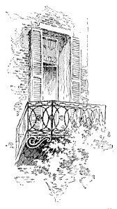
The
North End (see Plate III), though now bereft of many of the landmarks
that once gave it an antique flavor and a peculiar charm to seekers
of things old and historic, is yet a quarter to which the much, worn
term “unique “may justly be applied. There still remain a few
landmarks of great interest, and “historic sites” abound
in this
small and compact district. The first “court end” of the town,
where the gentry had their fine mansions beside the many quaint
humbler houses of the early Colonial period, it is now the foreign
quarter of the city, with foreign signs in dingy shops and a swarming
population of Russians, Armenians, Israelites, Norwegians, Poles,
Italians saluting our ears with a jargon of tongues.
We
approach the North End by way of Hanover Street, which runs
from Scollay Square to the Chelsea Ferry on the water
front.
At
Union Street, the cross street next below Washington
Street
extension, we come to two historic sites of first importance. One is
the site of the Green Dragon Tavern, the “headquarters of
the Revolution.” This stood on Union Street, a few steps off from
the left side of Hanover Street. The spot is marked by a business
building (No. 80), on the face of which for years was a stone effigy
of the tavern sign, — a sheet-copper, green-painted representation
of a creature of forked tongue and curled tail, which couched upon an
iron crane projecting over the entrance door. The tavern existed from
1680 or thereabouts, through Colonial, Provincial, and Republican
days, till the twenties of the nineteenth century, when the lane
which bore its name was widened to form the present street.
It
was at the Green Dragon that the prerevolutionary leaders held their
secret councils and formed their plans of campaign. Here the Tea
Party originated. It was the rendezvous of the night patrol of Boston
Mechanics, instituted to keep watch upon the British and Tory
movements. It was the chief meeting place of the “North End
Corcus,” one of the three clubs composed of patriot leaders and
followers, which added the word “caucus” to our political
nomenclature. It was also the first Free Masons’ hall, the pioneer
St. Andrews Lodge having been organized here in 1752, and in 1769 the
first Grand Lodge of the Province, with Dr. Joseph Warren as Grand
Master and Paul Revere a subordinate officer.
The
other site is that of Josiah Franklin’s dwelling and chandlery
shop, at “the sign of the Blue Ball,” the boyhood home of
Benjamin Franklin, where he worked for his father at candle-making
and tended the shop. Near by was the “salt marsh “by the Mill
Pond, on the edge of which he fished for minnows. The “Blue Ball”
stood near the south east corner of the junction of Union and Hanover
streets. It held its place till the middle of the nineteenth century,
when it was demolished in the widening of Hanover Street at this
point. Its site is included in the street way.
A
stone’s throw up Union Street (eastward) Marshall’s Lane
(now officially called street) opens from the left side, — one of
the alleys or “short cuts” of old Boston, through which we must
pass. It will bring us back to Hanover Street close to the cross
street next below Union Street.
As
we enter Marshall’s Lane from Union Street we cannot fail to notice
the low-browed brick building of eighteenth-century fashion which
occupies the upper corner of the lane and street. This is interesting
as the place where Benjamin Thompson of Woburn, who became Sir
Benjamin Thompson and then Count Rumford, was a clerk or
apprentice in his youth in Hopestill Capen’s shop, selling imported
stuffs to the fashionable folk of the provincial town. At the
outbreak of the Revolution the Massachusetts Spy, afterward of
Worcester, was printed on the upper floor of this building.
Soon
our lane makes a junction with another, — Creek Lane, which
originally led to the Mill Creek, where is now Blackstone Street, as
Marshall’s Lane first led to the Mill Bridge across the creek. Here
we see set against the base of a building a rough piece of stone with
a spherical one on top of it marked “Boston Stone, 1737.”
This is only the relic of a paint mill which a painter brought out
from England about 5700 and used in his shop close by. Perhaps he was
Tom Child by name, to whom Sewall alludes in his diary: “Nov. 10,
1706. This morning Tom Child the Painter died.” The monument was
set up here some time after the painter’s day, in imitation of the
London Stone, to serve as a direction for shops in the neighborhood.
A similar guide post, called the Union Stone, stood for some years at
the entrance of the lane by Hopestill Capen’s shop. In the front of
the building at the outlet of the lane, on Hanover Street, is a
carved reproduction of the London Painters’ Guild, which is said to
have been the sign of the painter who used the “Boston Stone.”
Opposite
this monument we see, in the worn old structure on the corner of
Creek Lane, the office of Ebenezer Hancock (brother of John
Hancock), deputy paymaster general of the Continental army, where
were deposited the funds in French crowns brought out by d’Estaing
from America’s ally, the king of France, which went to pay the
arrears of the officers of the Continental line. The block beyond,
facing Creek Lane, is “Hancock Row,” built for stores by
John Hancock after the peace.
Again
on Hanover Street, we cross to the other side and enter Salem
Street, which starts off obliquely from Hanover Street and then
runs parallel with it. Now we are fairly within the North End. It is
a curious street, with strange denizens. In early Colony days it was
fair Green Lane, upon which it was the dream of prospering Bostonians
to live At the corner of Stillman Street is the site of the first
Baptist meeting house, erected in 1679, on the border of the open
Mill Pond then on this side. This was the meetinghouse which was
closed against the pro scribed sect and its doors nailed up in 1680
by order of the court; when the undaunted society held their services
in the meetinghouse yard. Its descendant is the present First Baptist
Church on Common wealth Avenue, Back Bay. Prince Street,
intersecting Salem Street mid way, preserves more of the old-time
aspect than other streets of the quarter. This street (first in part
Black Horse Lane) was the direct way from the North End to the
Charlestown ferry (where is now the Charlestown Bridge), and after
the battle of Bunker Hill numbers of the wounded British were brought
here to houses which were turned into temporary hospitals. The most
important of these emergency hospitals was a fine new house near the
lower end of Prince Street at the corner of Lafayette Street. This
remained until the end of the nineteenth century, being occupied for
some years by a grandson of one of the Boston Tea Party. Another on
Prince Street, nearer Salem Street, is the so-called Stoddard house,
a narrow brick dwelling, still standing (No. 130). It is said that
Major Pitcairn was brought to this house and died here
from
his wounds. On the westerly corner of Prince and Margaret streets is
the house where long lived John Tileston, the school master,
the rigid but beloved master for two thirds of a century of the
oldest North End school, which became the Eliot School.
In
and about North Square. Taking Prince Street at the right we
cross Hanover Street and enter North Square. This squalid triangular
inclosure was the central point of the North End in its “elegant”
days, when it was adorned with trees and dignified by neighboring
mansions. It is now the heart of the Italian colony. At its outlet
upon North Street is the one landmark here of historic value. This is
the little low house of wood, hedged in by ambitious modern
structures, marked as the home of Paul Revere. It was the
versatile patriot’s dwelling from about 1770 through the Revolution
and until 1800, when, having prospered in his foundry, he bought a
finer house on Charter Street near by and there spent the remainder
of his days. This North Square house was old when Revere moved into
it from his earlier home on North Street (then Fish Street). It was
built soon after the great fire of 1676 in place of Increase Mather’s
house, the parsonage of the North Church, which went down with the
meetinghouse in that disaster.
It
was in the upper windows of this North Square house that on the
evening of the Boston Massacre Revere displayed those awful
illustrated pictures which, we read, struck the assembly of
spectators “with solemn silence,” while “their countenances
were covered with a melancholy gloom.” And well might they have
shuddered. In the middle window appeared a realistic view of the
“massacre” In the north window was shown the “Genius of
Liberty,” a sitting figure holding aloft a liberty cap and
trampling under foot a soldier hugging a serpent, the emblem of
military tyranny. In the south window was an obelisk displaying the
names of the five victims, in front of which was a bust of the boy
Snider, killed a few days before the “massacre” in a struggle
before a Tory shop which had been “marked” as one not to be
patronized; and behind the bust a shadowy, gory figure, with these
lines beneath:
Snider’s
pale ghost fresh bleeding stands
And
Vengeance for his death demands.
Just
below this house, at about the corner of North and Richmond streets,
stood the Red Lion Inn of early Colony days, kept by Nicholas
Upsall, befriender of the proscribed Quakers, — the “Upsall gray
with his length of days” of the “King’s Missive,” — who
suffered banishment and imprisonment for his friendly acts. On
Richmond Street was the birthplace of Charlotte Cushman (born
1816), whose name is perpetuated in the Cushman School near by.
At
the head of the square, on the north side, is the site of the Old
North Church, which the British pulled down and used for firewood
during the Siege. It stood between Garden Court and Moon streets. It
was the second meetinghouse of the Second Church in Boston
(instituted in 1649), built upon the ruins of the first one, burned
in the fire of 1676. It became popularly known as the Church of
the Mathers, from Increase, Cotton, son of Increase, and Samuel,
son of Cotton Mather, successively its ministers. In the
prerevolutionary period John Lathrop, a stanch patriot, was
its minister, and it was the church which Revere attended.
After
the Revolution the lot upon which it had stood was set apart for the
dwelling of Mr. Lathrop (who continued the minister till his death in
1816), and the society acquired the “New Brick Church” in the
near neighborhood on Hanover Street, the successor of whirls was the
Cockerel Church, so called from a copper weathercock
which
crowned its steeple — still another piece of “Deacon “Shem
Drowne’s clever work — and is now still doing service on the
steeple of the Shepard Memorial Church in Cambridge. Mr. Lathrop’s
house on the old church lot was large and comfortable in appearance,
with a row of poplars in the front yard, and on the Moon Street
corner a weeping willow. These were all blown down in the destructive
September gale of 1815.
The
descendant of the Old North is the ivy-clad Second Church on Copley
Square. Ralph Waldo Emerson was a minister of the Second
Church from 1829 to 1832.
In
Garden Court Street stood the stately mansion of Governor Thomas
Hutchinson (his birthplace), which was sacked and partly
destroyed with much of its contents by the anti-Stamp-Act mob on the
night of August 26, 1765. It was a house of generous proportions,
built of brick, painted “stone color,” and set in ample grounds,
the garden extending on one side to Fleet Street and back to Hanover
Street. The interior was rich in finish and adornments. It is well
pictured, although with fanciful touches, in Lydia Maria Child’s
early historical romance, “The Rebels, A Tale of the Revolution,”
published in 1852. It was here that Hutchinson wrote his “History
of Massachusetts.”
The
first volume was published in 1764. When the house was pillaged the
second volume lay in the rich library in manuscript almost ready for
the press. It was thrown out with other precious books and papers,
and “left lying in the street for several hours in a soaking rain.”
But most fortunately all but a few sheets were carefully collected
and saved by the Rev. Andrew Eliot, minister of the “New North”
Church, living near by on Hanover Street, and the author was enabled
to transcribe the whole and publish it two years later.
Hutchinson
and his family made their hurried escape from the house just before
the mob reached it, finding refuge in neighboring dwellings.
Hutchinson was first harbored in Samuel Mather’s house on Moon
Street, but was obliged to seek another refuge to avoid the
threatening mob.
Also
occupying Garden Court Street with the Hutchinson house, and of
similar elegance, was the Clark-Frankland mansion, so called
from William Clark, a rich merchant who built it, and Sir Harry
Frankland, who afterward lived in it. J. Fenimore Cooper pictured
this house in “Lionel Lincoln,” in his description of the
residence of “Mrs. Lechmere,” which he placed on Tremont Street;
and Edwin L. Bynner portrayed it in his novel of “Agnes Surriage.”
Both of these mansions lingered in picturesque decay till the
thirties of the nineteenth century, when the Bell Alley entrance to
the square was widened into Prince Street.
During
the Siege North Square was a military rendezvous with barracks
for the soldiers, their officers occupying the comfortable dwellings
about it. The building on the east side by Moon Street, now an
Italian church, was originally “Father Taylor’s Bethel,”
a sailors’ church, built in the early part of the nineteenth
century, long conducted by the Rev. Edward T. Taylor, one of nature’s
orators and a born minister to seafaring men.
Christ
Church and Copp’s Hill. Now we return to Salem Street, crossing
Hanover Street and passing through North Bennet or
Tileston
Street, either of which will bring us close to Christ Church and
Copp’s Hill, the predominating historic features of the North End
to-day. As we cross Hanover Street we should give a glance at a
little low house crowded back from the street line (a second story
and roof above a projecting store) on the west side, just below North
Bennet Street. This is a remnant of the house built in 1677 by
Increase Mather after the fire in North
Square. It was Dr. Mather’s home till his death in 1723. Afterward
it was long occupied by the Rev. Andrew Eliot and his son, John
Eliot, ministers successively of the New North Church. From these
ministerial occupants it is called the Mather-Eliot house. On
North Bennet Street was the first grammar school
in the
north part of the town, established in 1713, and on Tileston
Street (named for the old schoolmaster) was the first writing
school in the North End, begun in 1718. This street was at that
time Love Lane, so called not from any sentimental characteristic
that it possessed, but from a family by the name of Love who owned
property about it.
|
Christ Church,
Salem Street
|
Christ
Church is the oldest church edifice now standing in Boston, older
by six years than the Old South, and by thirty years than King’s
Chapel. It was the second Episcopal church established in Boston. The
corner stone was laid in April, 1723, when the Rev. Samuel Myles,
then rector of King’s Chapel, officiated, accompanied, says the
record, “by the gentlemen of his congregation.” The ceremony
closed with the prayer, “May the gates of Hell never prevail
against it.” It was certainly built well to withstand the assaults
of time. The stone side walls are two and a half feet thick, and the
construction throughout is substantial. The brick tower is of four
floors. The first spire was described as the “most elegant in the
town.” That was blown down in a gale in October, 1805, but the
present one, erected three years later, is said to be a faithful copy
of it, preserving its proportions and symmetry. This tower has
additional interest in that it was made from a model by Bulfinch.
The tower chimes of eight bells, still the most melodious of any in
the city, were first, hung in 1744. Each bell has an interesting
inscription.
The
tablet on the tower front bears this familiar legend: The signal
lanterns of Paul Revere displayed in the steeple of this church April
18, 1775, warned the country of the march of the British troops to
Lexington and Concord.
This
tablet was set in 1878, the statement it conveys being substantiated
by several local historical authorities. Other recognized
authorities, chief among them Richard Frothingham, the historian of
the Siege of Boston, place these signal lanterns on the tower of the
true Old North Church — the meetinghouse in North Square which the
British destroyed. That Gage witnessed the battle of Bunker Hill from
this tower is an undisputed statement.
The
interior of the church retains much of the old-time aspect. Among the
mural ornaments is Houdon’s bust of Washington, the first
monumental effigy of Washington set up in the country. It was placed
here only ten years after Washington’s death. The figures of the
cherubim in front of the organ and the brass chandeliers, destined
originally for a Canadian convent, were given to the church in 1758
by the master of an English privateer, who captured them from a
French ship on the high seas. An ancient “Vinegar Bible” and the
old prayer books are still in use. The silver communion service
includes several pieces bear ing the royal arms, which were gifts
from George H in 1733, at the instance of the royal Governor Belcher.
The clock below the rail has been in place since 1746.
|
Beneath
the tower are old tombs. In one of them Major Pitcairn was
temporarily buried. Some years later, when his monument was erected
in Westminster Abbey and his English relatives sent for his remains,
a box said to contain them was duly forwarded, but the grewsome tale
is told that the sexton was not sure of his identification. The
church is open to visitors for inspection upon application to the
sexton; fee, twenty-five cents.
A
block above, at the corner of Salem and Sheafe streets, is the site
of the home of Robert Newman. He was the sexton of Christ
Church in 1775 who, according to the tradition that its steeple was
the place of the Revere signals, hung them out at the instance of
John Puling, a warden of the church, and in Revere’s confidence. At
the time British officers were quartered in this house upon the
Newman family. It stood until 1889. Near by, on Sheafe Street, was
the birthplace of the Rev. Samuel F. Smith, author of
“America.”
Up
Hull Street, opening directly opposite Christ Church, a few steps
bring us to the main gate of Copp’s Hill Burying Ground, —
a mob of youthful guides of both sexes and various nationalities
pressing us along the way, rattling off with glib tongue the
“features” of the region, and offering to show them, all and
several, for a nickel. Hull Street perpetuates the name of
John Hull, the maker of the pine-tree shillings. It was originally
cut through Hull’s pasture (in 1701), and the land for it was given
by his daughter Hannah and Judge Sewall, her husband, on the happy
condition that it should retain this name “forever.” Of the few
old houses permitted to remain here, but one need engage our
attention. This one is on the south side, distinguished from its
neighbors in standing endwise to the street. It is the Galloupe,
or Gallop, house, so called, dating from 1722, which Gage’s
staff made their head, quarters during the battle of Bunker Hill. The
Gallops who occupied it through two generations were lineal
descendants of Captain John Gallop, the earliest pilot in Boston
Harbor, among the “first corners” of 1630, for whom Gallop’s
Island in the harbor is named. He also lived in the North End, “near
the shore, where his boat could ride safely at anchor.”
In
the Copp’s Hill of to-day we see only a small remnant
of the original eminence, the northernmost of the three hills of the
peninsula upon which Boston was planted. It now consists of an
embankment left after cuttings of the hill, protected on its steepest
sides by a high stone wall. At the time of the battle of Bunker Hill,
when its summit was occupied by the British battery whose shot, under
the direction of Burgoyne and Clinton, set Charlestown on fire, it
terminated abruptly on the northwest side, opposite Charlestown, in a
high cliff.
This
battery stood near the southwest corner of the burying ground on land
afterward cut down. Perhaps its site was the same as that of the
windmill of a century earlier, brought over from Cambridge and set up
here in 1653, to “grind the settlers’ corn,” thereby giving the
hill its first name of “Windmill Hill.” It got its name of Copp’s
from William Copp, an industrious cobbler, one of the first settlers,
who owned a house and lot on its southeast corner near Prince Street.
The
burying ground, which now goes under the general name of Copp’s
Hill, really comprises four cemeteries of different periods: the
North Burial Ground (established in 1660, the same year as the
Granary Burying Ground); the Hull Street (1707); the New North
(1809); and the Charter Street (1819). The oldest section is the
northeasterly part of the inclosure. It is the largest of the
historic burying grounds of the city, and is especially cherished as
a picturesque breathing place in a squalid quarter, as well as for
its associations.
Among
the noted graves or tombs which we may find here are those of
the Revs. Increase, Cotton, and Samuel Mather; of Nicholas Upsall,
the persecuted friend of the Quakers; Deacon Shem Drowne, the
“cunning artificer”; the Rev. Jesse Lee, early preacher of
Methodism in Boston, his first church being the Common, where
Whitefield had preached fifty years before; the Rev. Francis W. P.
Greenwood, rector of King’s Chapel 1824-1843; and Edmund Hartt, the
builder of the frigate Constitution. The tomb of the Mathers is near
the Charter Street gate. A large memorial stone with bullet marks on
its face attracts attention. It stands, as the inscription states,
above the “stone grave ten feet deep,” of “Capt. Daniel Malcom,
mercht, who departed this life October 23d 1769 aged 44 years: a true
Son of Liberty, a Friend to the Public, an Enemy of Oppression, and
One of the foremost in opposing the Revenue Acts in America.” This
stone was a favorite target with the British soldiers quartered in
the neighborhood during the Siege, and the bullet marks were made by
them. Another stone, which stands toward the northwest angle of the
ground, is also curiously marked. This commemorates “Capt Thomas
Lake, aged 61 yeeres, an eminently faithful servant of God & one
of a public spirit,” who was “perfidiovsly slain by ye Indians at
Kennibeck, Avgvst ye 14th 1676, & here interred the 13 of March
following.” A deep slit is across its face, into which the bullets
taken from the captain’s body were poured after being melted. The
lead was long ago all chipped out by vandals. Captain Lake was a
commander of the Ancient and Honorable Artillery Company in 1662 and
1674. Near the middle of the ground is the triple gravestone of
George Worthylake, first keeper of Boston Light in the harbor, his
wife and their daughter, all drowned while coming up to town in his
boat one day in 1718 — the mournful event that inspired Franklin’s
boyhood ballad of “The Lighthouse Tragedy” (see p. 17). A notable
monument is to Major Samuel Shaw, a Revolutionary soldier, ancestor
of Robert Gould Shaw. There are a number of vaults bearing sculptured
slabs and heraldic devices.
Here,
as in the other old burying grounds, acts of vandalism have been
committed in the past in the removal of several stones from their
proper places, while sacrilegious hands have changed the dates on
some tablets by transforming a 9 into a 2, as in 1620 for 1690, or
1625 for 1695. Others have taken stones away and utilized them in
chimneys or drains, and two or three tombs have been desecrated by
the substitution of other names for the rightful ones upon them. The
treatment of the tomb of the Hutchinsons with its armorial bearings,
where were deposited the remains of Elisha and Thomas Hutchinson,
grandfather and father, respectively, of Governor Hutchinson, has
been cited1 as a flagrant case of this sort. In place of
Hutchinson has been cut the name of Lewis, while the honored dust of
these Hutchinsons is said to have been “scattered before the four
winds of heaven.” It appears, however, from researches made in 1906
by a loyal descendant of Thomas Lewis, that this tomb was duly sold
to him in 1807 by a granddaughter of Thomas Hutchinson, the deed of
record bearing the signature of Hannah (Mather) Crocker, a daughter
of Rev. Samuel Mather and his wife, Thomas Hutchinson’s daughter.
It further appears that the
Hutchinson bones lay in a corner of the tomb till between 1824 and
1825, when a grandson of Thomas Lewis caused them to be placed in a
suitable box. Thomas Lewis was a deacon of the Second Church.
A
corner of the inclosure by Snowhill Street was originally used for
the burial of slaves. Near the Charter Street gate is the “Napoleon
willow,” grown from a slip from the tree at Napoleon’s grave.
|
North Station, Causeway Street
|
Copp’s
Hill Terraces, back of the burying ground, on Charter Street,
extending down to Commercial Street, with the North End Park and
Beach on the water front beyond, finish up rarely this fine open
space. The terraces and the park are parts of the beneficent Boston
City Parks System.
With
a short stroll along Charter Street back to Hanover Street and across
to the water front, our survey of the North End finishes. Charter
Street got its name in 1708 from the Province Charter of 1692.
Before that the street was a lane, and the lane was associated with
the Colony Charter, for it is said that that document was hidden
during the troublous days of 1681 in the house of John Foster, which
stood at the corner of this and Foster Lane (now Street). On the
westerly corner of Charter and Salem streets Sir William Phips,
the first royal governor, built his brick mansion house
when he
became prosperous, thus fulfilling his dream, when a poor ship
carpenter, of some day living on “the Green Lane of North Boston.”
Where is now Revere Place, off Charter Street near Hanover, was Paul
Revere’s last home. On Faster Street was his
foundry.
|
Taking
Battery Street from Hanover Street, we pass to Atlantic Avenue and
North Battery Wharf, the site of the North Battery.
Constitution Wharf, the next wharf north, marks the site of Hartt’s
shipbuilding yard where “Old Ironsides” was built; also
the frigate Boston. Lewis’s Wharf, southward, opposite the foot of
Fleet Street, marks in part (its north side) the site of Hancock’s
Wharf, upon which were Hancock’s warehouses.
On
Atlantic Avenue we can take an elevated train at the Battery Street
station (or surface cars, if we prefer) and return to our starting
point at Scollay Square.
1
Bridgman’s “Memorials of the Dead in Boston,” 1852.
3.
THE CHARLESTOWN DISTRICT
The
trip to Charlestown naturally follows the exploration of the North
End. If we start from the latter quarter, taking an elevated train
north (Battery Street station), we change at the North Station
station to a Sullivan Square train. If, however, we elect to go from
the business quarters, we have a choice of various trolley lines
besides the elevated: some in the Subway (from Scollay Square, Park,
or Boylston Street stations), others on the surface, several of the
latter passing through Adams Square. The Chelsea cars pass by the
Navy Yard.
The
elevated tracks, and surface tracks under them, pass over the new
Charlestown Bridge (completed in 1900; composed of steel and stone;
1900 feet long, including the approaches, and too feet wide; draw
operated by electricity; cost $1,400,000; built by the city of
Boston). Trolley lines also cross the Warren Bridge.
All
the “features” of Charlestown can be included within the com pass
of a short walk. Chief of them, of course, is Bunker Hill
Monument. This is only a block from the second station of the
elevated line in the district, — Thompson Square (the first station
being City Square, at the end of Charlestown Bridge), — and about a
ten-minute walk from City Square. The United States Navy Yard
(established in 1800), occupying “Moulton’s Point,” the
spot where the British troops landed for the battle, is next in
popular interest. The main gate is at the junction of Wapping and
Water streets, and Water Street opens from City Square. The yard is
open daily to visitors, admitted by passes which are to be obtained
at the main gate. It is an inclosure of nearly ninety acres,
attractively laid out, and with many interesting features. The marine
museum and naval library occupy the oldest building in the grounds
near the entrance gate. Another near-by point of interest is Winthrop
Square (about a five-minute walk from City Square), the early
Colonial training field, where are memorial tablets bearing the names
of the Americans who fell in the battle of Bunker Hill; also a
Soldiers’ Monument (Civil War) by Martin Milmore, sculptor of the
soldiers’ monument on Boston Common. On Phipps Street, off Main
Street, west side, near Thompson Square station of the elevated line,
is the ancient burying ground in which is the monument to John
Harvard, the first benefactor of Harvard College, designed by
Solomon Willard and erected by graduates of the college in 1828.
City
Square and “Town Hill,” which rises on its west side
behind the Charlestown Branch of the Public Library (the City Hall
when Charlestown was an independent city) are the parts in which the
first settlement was made in 1629. The “Great House” of
the governor, in which the Court of Assistants adopted the order
giving Boston its name in 1630, stood on the west side of the square.
The dwelling of the young minister, John Harvard, stood
near the opening of Main Street, his lot extending back over the
slope of “Town Hill.” The “spreading oak,” beneath
which the first church, which became the first church of Boston, was
organized by Winthrop and his associates, was on the easterly slope
of this hill. The first “palisadoed” fort, set up in 1629
and lasting for more than half a century, was on its summit. The
first bury ing ground, where it is supposed was the grave of John
Harvard, all traces of which long ago disappeared, was near its
foot, toward the northern end of the square.
The
present church on the hill, facing Harvard Street, is the lineal
descendant of the first meetinghouse of the Charlestown Church,
organized in 1632. An earlier church, on the same spot, was from 1789
to 1821 the pulpit of Rev. Jedidiah Morse, author of the first
geography of the United States, deserving of remembrance more
especially as the father of Samuel F. B. Morse, the inventor
of the electric telegraph and noted in art. When his distinguished
son was born, Mr. Morse was living temporarily in the house of a
parishioner, Thomas Edes, the parsonage near the church being in
building. This house is still standing, worn and dingy now, but
preserved as the birthplace of Morse. We may see it on Main
Street, above the Thompson Square station, marked with a tablet:
“Here was born Samuel Finley Morse, 27 April 1791, inventor of the
electric telegraph.” The room was the front chamber of the second
story on the right of the entrance door. This house was the first
dwelling erected after the burning of the town in the battle of
Bunker Hill.
|
Bunker
Hill Monument is on Breed’s Hill, where the battle was fought.
Monument Avenue, from Main Street, leads to the principal entrance of
the monument grounds. In the main path we are confronted with the
spirited statue of Colonel William Prescott in bronze,
representing the American commander repressing his impatient men, as
the enemy advances up the hill, with the warning words: “Don’t
fire till I tell you! Don’t fire till you see the whites of their
eyes!” This statue is by William W. Story, and was erected by the
Bunker Hill Monument Association in 1881. It is inscribed simply with
Prescott’s name and the date, “June 17, 1775.” It stands on or
close to the spot where Prescott stood at the opening of the battle
when he gave the signal to fire by waving his sword; but the statue
faces in a different direction.
The
obelisk occupies the southeast corner of the American redoubt, and
its sides are parallel with those of that structure, which was about
eight rods square. It is built in courses of granite, the stone
coming from a quarry in Quincy, whence it was carried to the shipping
point by the first railroad laid in the country. It is thirty feet
square at the base and two hundred and twenty feet high. Inside the
shaft is a hollow cone, around which winds a spiral flight of stone
steps, by which ascent is made to the top. Here is an observatory,
seventeen feet high and eleven feet in diameter, with windows on each
side. Before attempting the climb the visitor should consider the
task. The steps number nearly three hundred, — to be exact, two
hundred and ninety-five. There is reward, however, for the exertion
when the summit is reached, in the magnificent view which it commands
in every direction.
The
stone lodge at the base of the obelisk contains an interesting museum
of memorials of the battle and a fine marble statue of General Joseph
Warren by Henry Dexter (dedicated June 17, 1857). The spot where
Warren fell is marked by a low stone in the ground.
|
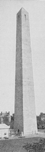
Bunker Hill Monument
|
The
monument was begun in 1825, when the corner stone was formally laid
by Lafayette, under the direction of the Massachusetts Grand Lodge of
Masons, and Daniel Webster delivered the oration. It remained
unfinished for nearly twenty years. Then, in 1840, largely through
the efforts of American women, the required funds for its completion
were raised. In July, 1842, the last stone was hoisted to its place,
one of the workmen riding upon it and waving an American flag. When
it was finally laid in cement the event was announced by a national
salute. The completed structure was dedicated on the 17th of June,
1843, when Webster was again the Orator, and President Tyler with
members of his cabinet was present. In the great throng that gathered
on this occasion were a few survivors of the battle. The sculptor
Greenough devised the monument, and Solomon Willard was the architect
who superintended its construction.
Bunker
Hill lies to the northward of Breed’s Hill, toward Charles town
Neck, where the Elevated line ends. Its summit, higher than Breed’s
Hill, is occupied by “Charlestown Heights,” overlooking the
Mystic River, one of the most attractive of the Boston City Parks
System. On Walker Street, on this hill, a short street extending from
Main up to Wall Street, is still standing the house where Thomas
Ball, the sculptor, was born.
4.
THE WEST END
The
West End (see Plate II) comprises that quarter of the city which lies
north of the Common and between Beacon, Tremont, and Court streets,
Bowdoin Square, Green Street and so northwest to the Charles River,
and Charles Street to Beacon Street at the foot of the Common. It
thus includes all of Beacon Hill. It is a fading quarter now, with a
number of old Boston institutions, some mellow old streets, others in
hopeless decay, and numerous landmarks, especially of literary
Boston. In its better parts it retains more distinctly than any other
quarter of the city the genuine Boston flavor.
The
most interesting part is the Beacon Hill section. We have seen its
southern boundary in the fine line of Beacon Street architecture
opposite the Common from the State House to Charles Street. Let us
enter it, therefore, above Beacon Street, — from the State House
Park through the archway to Mt. Vernon Street.
Although
“The Hill,” as this was called in its proud days, par
excellence, is not the oldest part of the West End, it has been
from its upbuilding the choicest, and accordingly its associations
are the richest. Up to the Revolution it was largely a region of
fields and pastures. Until near the opening of the nineteenth century
there were but two houses on the Beacon Street slope west of the
Hancock mansion. The greater part of the territory below the Hancock
holdings was the domain of John Singleton Copley, the painter
(after his fortunate marriage), from about 1769 to 1795. The bounds
of this “farm,” as Copley called it, although it was chiefly
pasture land, are indicated generally by the present Mt. Vernon and
Pinckney streets on the north, Walnut Street on the east, the Common
south, and the Charles River west. It included the homestead lot of
the first European settler, William Blaxton, — he who was here
before the Winthrop company, — with the “excellent spring” of
which he “acquainted” the governor when he invited him hither. It
was the acquisition of the Hancock pasture for the new State House, —
the Bulfinch Front, — in 1795, that gave the impulse to the
development in this quarter. Then a “syndicate “purchased the
Copley estate at a bargain (Copley was at that time living in
England), and in the course of a few years these now old streets
appeared, built up substantially, in place of the Copley pastures and
adjoining proper ties. A half-century after it was remarked that on
“the Copley estate live, or have lived, a large proportion of those
most distinguished among us for intellect and learning or for
enterprise, wealth and public spirit.”
On
Mt. Vernon Street from the archway we are passing through
what
were the Hancock gardens. Hancock Street, coming up the
hillside at our right, is the oldest of the streets here. It
originally ran by the side of the peak of Beacon Hill over to the
Common. It was given the governor’s name in 1788. Near its foot, on
the east side, is the Sumner house (No. 20) in which Charles
Sumner lived from 1830 to 1867. Along the same side, extending from
Derne Street nearly up to Mt. Vernon Street, stood from 1849 to 1884
the Beacon Hill Reservoir, a massive granite structure with
lofty arches piercing its front walls, notable as a superior piece of
architecture. Its service as a distributing reservoir closed some
time before its removal, clearing the way for the State House Annex.
Joy
Street, the first to cross Mt. Vernon, is next to Hancock Street
in age. It used to be Belknap Street, the principal way to the negro
quarters on the north slope of the hill. Midway in its descent to
Cambridge Street a dingy court opens, Smith by name, in which is a
landmark of antislavery days. This is the brick meetinghouse erected
for the first African church (built in 1806), now a Jewish synagogue,
which was used for abolition meetings. It was after a meeting held
here on the evening of December 3, 1860, commemorating the execution
of John Brown, that Wendell Phillips was assisted to his home, then
on Essex Street, by a volunteer guard of forty young men with locked
arms, pressed closely by a threatening mob. At the fairer end of this
street, near Beacon Street, is the Diocesan House (1 Joy
Street), the headquarters of the Protestant Episcopal Church. Here
are the offices of various church organizations, the parlors of the
Episcopal Church Association, and the library. Above (Nos. 3 and 4)
are the houses of the Twentieth Century Club, which concerns
itself with many reforms, and of the Massachusetts Civic League.
As
we proceed along Mt. Vernon Street, which grows in old-fashioned
stateliness as it advances over the hill, we come upon a succession
of houses with an interesting past. No. 49, on the north side, was
long the home of Lemuel Shaw, chief justice of the
Massachusetts Supreme Judicial Court for thirty years (1830-1860).
Its near neighbor (No. 53), now the house of the General
Theological Library, was once the dwelling of a merchant of
distinction. The library which has succeeded it is an unsectarian
institution established since 1860, for the purpose of “promoting
religious and theological learning,” having a collection of 22,000
volumes and some 5,000 pamphlets.
It
is a special library of standard and current theological books, that
term being used in its broad sense to cover works on sociology,
philosophy, comparative religions, and archæological research.
Its books are free to all New England clergymen; and beyond Greater
Boston they are furnished through the local public libraries.
The
head of the stately row of houses beyond, set back thirty feet from
the street (No. 57), was the town house of Charles Francis Adams,
Sr., during the latter years of his life. The next one in this
row (No. 59), with its classic doorway, is most interesting as the
last home of Thomas Bailey Aldrich, and associated with
his
ripest work. No. 65, transformed into an apartment house, so,
unhappily, breaking the symmetry of the row, was formerly the home
of Senator Henry Cabot Lodge, where some of his most notable
historical writing was done. No. 79 was the home of Horace Gray
during his long service on the Supreme bench of the State as justice
and chief justice, before he was made a justice of the United States
Supreme Court. The last house of the row (No. 83) was the last Boston
home of William Ellery Channing, whose study here was the
“Mecca of all sorts and conditions of men.”
On
the opposite side of the street the ornate brownstone houses with
lofty entrances, now the Theological School of Boston
University, were hospitable mansions erected in the fifties of the
last century by the brothers John E. and Nathaniel Thayer, eminent
merchants of their time and benefactors of Harvard University. No.
76, just below, was the home of Margaret Deland for a number
of years, during the period marked by her “Philip and His Wife.”
No. 88, on the lower corner of little Willow Street (which
connecting, nearly, with another little street across Chestnut Street
provides a “short cut” to the Common), was once the home of
Enoch Train, the projector of the line of fast clipper ships to
Liverpool, fine craft which came into successful competition with the
early ocean steamships. He was the father of Mrs. A. D. T. Whitney
of Milton, the favorite writer of girls’ stories. No. 92 was
the home and studio of Anne Whitney during the years that she
was modeling some of her most notable statues — the Samuel Adams
(see p. 15) and the Leif Ericson (see p. 79) among them.
Louisburg
Square, with its inclosed park of lofty trees and diminutive
Italian marble statues of Aristides and Columbus at either end,
suggestive of old London residential squares, connects Mt. Vernon
with Pinckney Street, the latter with an air of shabby
gentility yet borne with decorum. Blaxton’s spring is
believed to have been in the middle of this square. The point is
disputed by local historians, the popular location being in Spring
Lane, north of the Old South Meetinghouse; but the evidence in
support of the Louisburg Square situation is accepted as conclusive
by most authorities. The matter, however, is not of moment, for the
town was full of springs when Blaxton “solicited” Winthrop
hither.
Blaxton’s
orchard spread back up the hill slope toward this square. His
homestead lot of six acres, reserved after his sale of the whole
peninsula to the colonists for thirty pounds, occupied the
northwesterly slope of the hill, bounded southerly toward the Common
and westerly on Charles River, the water’s edge then being at the
present Charles Street. His cottage, with its rose garden, was on the
hill slope toward the Common, between the present Spruce and Charles
streets. He moored his boat on the river, presumably at a point which
jutted out from the bluff in which the hill ended, on the Charles
Street side.
At
No. 10 Louisburg Square was the last Boston home of Louisa M.
Alcott, where her remarkable father, A. Bronson Alcott, died
(1888) in his eighty-ninth year; her own death following the day of
his funeral. No. 4 was the home of William D. Howells in the
late eighteen-seventies, when he was a Bostonian editing the
Atlantic. No. 20 is interesting as the house where
Jennie
Lind was married in 1852.
On
the upper corner of the square and Pinckney Street are the main house
and the chapel of the Sisterhood of St. Margaret, Protestant
Episcopal, where is St. Margaret’s Hospital, one of the most
worthy institutions of the city. At No. 5, this side, lived John
Gorham Palfrey, the historian, in the eighteen-sixties.
Pinckney
Street extends from Joy Street to the river, with but two streets
crossing it. At the upper end was for forty years the home of
Edwin P. Whipple, the essayist: the plain brick house, No. 1.
Lower down, on the opposite side, the house No. 20 was the home of
the Alcott family in the fifties of the last century, the scene
of Louisa M. Alcott’s early struggle in authorship mingled with
domestic occupations. At No. 54, nearly opposite the opening of
Anderson Street, was the early home of George S. Hillard,
lawyer, critic, essayist, remembered especially through his
“Hillard’s Readers” of the mid eighteen-fifties. From this
house Hawthorne in 1842 wrote his little note to the Rev.
James Freeman Clarke requesting “the greatest favor which I can
receive from any man,” — the performance of the ceremony of his
marriage to Sophia Peabody. Hillard lived for a much longer period at
No. 62. On the lower slope of the street, below the square, at No.
84, was the first Boston home of Aldrich after his marriage,
where Longfellow got the inspiration for “The Hanging of the
Crane.” The “Story of a Bad Boy” issued from this house.
On
Mt. Vernon Street again we may see just below West Cedar Street the
first home of Margaret Deland in this quarter, — No. 112,
—
where her earlier books were written; and nearly opposite, at No. 99,
the home of John C. Ropes, in his day the authority on
Napoleonic literature. In West Cedar Street, No. 24, is the home
of Ferris Greenslet, litterateur, biographer of Lowell and
Aldrich.
By
West Cedar Street we cross to Chestnut Street,
possessing in its entirety, perhaps, more of the old Boston flavor
than the other streets of “The Hill.” In the short block of West
Cedar Street through which we pass, note should be taken on one side
of the town house of Percival Lowell (No. 11), the astronomer
and producer of notable books; on the other side that of Henry C.
Merwin (No. 3), the essayist and literary authority on the
American horse and the dog; and, at No. 1, the home of the Harvard
Musical Association, organized in 1837 “to promote the progress
and knowledge of the best music,” and from its establishment a
leading factor in the development of musical culture in Boston.
Up
Chestnut Street on one side and down on the other we shall pass a
series of historic houses. No. 50, on the south side, was the town
house of Francis Parkman, from 1864 until his death (1893)
identified with the most of his historical work in the preparation of
his “France and England in North America.” No. 43, nearly
opposite, was for upwards of forty years the town house of Richard
H. Dana, Sr., the poet; here he died (1896) at ninety-one. A
little way above, the house presenting a side bay to the street (No.
29) was the sometime home of Edwin Booth, the actor. Higher up
the street a group of three houses (Nos. 17, 15, and 13) arrest
attention as examples of the best type of early nineteenth-century
domestic architecture. The first was the long time home of Cyrus
A. Bartol, the “poet preacher” and essayist; the second is
the ancestral home of Dr. B. Joy Jeffries; the third was for
some years the home of Rev. John T. Sargent, the meeting place
of the Radical Club, renowned in its day, which came after the
Transcendental Club of wider fame. Mrs. Julia Ward Howe also lived
some years in this house.
On
Walnut Street, where Chestnut Street ends, — or, more
properly, begins, — was the historian Motley’s boyhood home,
in a pleasant house “looking down Chestnut Street,” now replaced
by a more modern dwelling. At 8 Walnut Street was Parkman’s
earlier house, from which he removed to 50 Chestnut Street.
Returning
now to the foot of the hill and taking Charles Street north ward
(once beautified by handsome trees, now all gone save one or two worn
remnants), we may pass the Charles Street houses once the homes of
Dr. Holmes, James T. Fields, and T. B. Aldrich (Nos. 164, 148,
and 131, respectively). On the way we should notice at the foot of
Mt. Vernon Street, corner of Brimmer, the Church of the Advent
(Protestant Episcopal), in the early English style of architecture,
with stone tower and steeple. In the tower is a chime of bells. The
church organization dates from 1844. No. 26 Brimmer Street is the
home of M. A. De Wolfe Howe, editor, biographer, and poet.
The
old literary homes of Charles Street are near together toward
Cambridge Street.
|
Holmes’s
life at No. 164 was between 1859 and 1871, covering the
period of
his “Professor at the Breakfast Table,” “Elsie Venner,” and
“The Guardian Angel,” his war poems and most noteworthy verses of
occasion. Aldrich moved into No. 131 from the Pinckney Street
house the year that Holmes moved from the street to 296 Beacon
Street. He remained here for about ten years and then moved to the
Mt. Vernon Street house. This Charles Street house is identified with
his “Marjorie Daw,” “Prudence Palfrey,” “The Queen of
Sheba,” and “ The Stillwater Tragedy,” and the beginning of his
editorship of the Atlantic Monthly. Fields was the earliest of
the three to come to Charles Street, and this remained his home until
his death (1881). It was long after maintained as the town home of
Mrs. Annie Fields and Sarah Orne Jewett. The
Fields
library is one of the richest in authors’ manuscripts. It has the
complete manuscript of “The Scarlet Letter.”
The
cross streets, Chestnut, Mt. Vernon, Pinckney, and Revere, lead to
the Riverbank, with its broad esplanade along the Charles
River basin, a favorite afternoon promenade. The finely designed
building on the Chestnut Street corner, facing the park, is the
clubhouse of the Union Boat Club, an organization dating back
to 1851.
|
Charlesbank
|
Across
Cambridge Street is the Charlesbank, the pleasant
park
with trees and shrubs and shaded seats, along the river front between
the Cambridge and Craigie bridges. It is especially designed for the
poorer classes living in the neighborhood.
The
successive institutions on the opposite side of the street are the
County Jail, generally called the Charles Street Jail, the
Massachusetts Charitable Eye and Ear Infirmary (incorporated
1827), and the Massachusetts General Hospital (incorporated
1811). The latter fronts on Blossom Street, and embraces a group of
noble buildings. The oldest, or central building, with porticoes of
Ionic columns and shapely dome, was designed by Bulfinch. In
the old operating room the first successful operation upon a patient
under the influence of ether was performed in October, 1846, by Dr.
W. T. G. Morton. This event is commemorated by the Ether
Monument, so called, in the Public Garden. At Dr. Morton’s
grave in Mt. Auburn, Cambridge, is also a monument. On North Grove
Street, at one side of the hospital, is the first Harvard
Medical School building (afterward the Harvard Dental School)
(see p. 91E), the scene of the Parkman murder in 1849, — the
killing of Dr. George Parkman by Professor John W. Webster. Both were
men of good social and professional standing, and the trial was one
of the most celebrated in Boston. Webster was executed the following
year.
The
only other object of interest in this older part of the West End is
the West Church, at the corner of Cambridge and Lynde streets,
now the West End Branch of the Public Library. It dates from
1806. Its predecessor was used for barracks during the Siege, and the
steeple was taken down because it had been used in making signals to
the Continental camp at Cambridge. The present house was long the
pulpit of Charles Lowell (father of James Russell Lowell) and
Cyrus A. Bartol.
The
ornamental Cambridge Bridge, of steel and masonry, dating from
1907, architect Edmund M. Wheelwright, replaces the West Boston
Bridge.
5.
THE BACK BAY
The
Public Garden below the Common, between Beacon, Charles, Boylston,
and Arlington streets, is the gateway to the Back Bay District (see
Plates I and H), the modern “court end” of Boston. Commonwealth
Avenue is its principal boulevard. Boylston Street to Copley Square,
and Huntington Avenue beyond, are its southern bounds; Beacon Street
and Charles River its northern bounds. Copley Square is its central
point. Massachusetts Avenue is its great western cross thoroughfare.
To this avenue the streets of the quarter — with the exception of
Huntington Avenue, which begins at Copley Square — run parallel to
or at right angles with Beacon Street on the Charles River side. The
cross streets, beginning with Arlington Street, are named in
alphabetical order, a disyllable alternating with a disyllable word.
Broad thoroughfares and imposing architecture characterize this
quarter. The streets north of Boylston Street between Arlington
Street and Massachusetts Avenue are free from car tracks.
Commonwealth Avenue, with its tree-lined parkway, broken here and
there by statues, is two hundred feet wide, or two hundred and twenty
feet from house to house, between Arlington Street and Massachusetts
Avenue. It extends beyond the original limits of the quarter, through
the Brighton district to the western boundary of the city at the
Newton line. Huntington Avenue, with a middle green occupied by
street-car tracks, is one hundred feet in width, or one hundred and
twenty feet from house to house. It extends to the Brookline line.
Massachusetts Avenue comes into the quarter from the Dorchester
District, where it begins at Edward Everett Square (so named from the
birthplace of Edward Everett, which stood at this point) and,
crossing Harvard Bridge, continues through Cambridge, Arlington, and
Lexington.
|
All
the territory of this district is “made land” in place of the bay
whose name it takes, a beautiful sheet of water that made up from
Charles River, and at flood time spread out from the present Charles
Street by the Common to the “Neck” (the narrow stem of the
original peninsula) and Roxbury, and toward the hills of Brookline.
The Public Garden was the “Round Marsh,” or “the marsh at the
bottom of the Common.”
|
Harvard Bridge
|
The
filling of the bay was planned in 1852 by a state commission, the Com
monwealth having the right to the flats below the line of riparian
ownership. At that time the bay was a great basin made by dams thrown
across it for the utilization of its water power by mills on its
borders. These dams were also used as causeways for communication
between Boston and Roxbury and the western suburbs. They were the
“Mill Dam,” now included in lower Beacon Street; the “Cross
Dam,” extending from the Roxbury side to the Mill Dam; and the
cause way, corresponding in part with the present Brookline Avenue
(earlier the Punch Bowl Road), which extends from the junction of
Beacon Street and Commonwealth Avenue southwest to the Brookline
line. The filling was practically begun in 1857 and finished in 1886.
It was done by the Commonwealth and the Boston Water Power Company.
The Commonwealth owned 108.44 acres of the territory. On its sales of
the land remaining after large gifts to institutions, and
reservations for the city of Boston, and for streets and passageways,
it made a net profit of upward of four million dollars. The avails of
the sale were applied to educational purposes and to the endowment of
several of the sinking funds of the state.
|
Bridge, Public Garden
|
The
Public Garden is the gem of the city parks, essentially a flower
garden, with rich verdure, a dainty foil to the plainer Common. The
artificial pond in the middle of the inclosure is so irregularly
shaped as to appear extensive, although its actual area is only three
and three quarters acres. The iron bridge which carries the main path
over the pond has been endowed by the local wits with the title of
the “Bridge of Size,” from its ponderous piers. The statues
and monuments here are:
|
|
On
the Beacon Street side: Statue of Edward Everett, of bronze,
by William W. Story. Erected in 1867. The cost met by a popular
subscription. The Ether Monument, commemorating the discovery
of anæsthetics, of granite and red marble, by J. Q. A. Ward.
Erected in 1868. The ideal figures surmounting the shaft illustrate
the story of the Good Samaritan; the marble bas-reliefs represent (1)
a surgical operation in a civic hospital, the patient being under the
influence of ether, (2) the angel of mercy descending to relieve
suffering humanity, (3) the interior of a field hospital, showing a
wounded soldier in the hands of the surgeon, (4) an allegory of the
triumph of science. This monument was a gift to the city by Thomas
Lee.
On
the Boylston Street side: Statue of Charles Sumner, of bronze,
by Thomas Ball. Erected in 1878. This was
provided for by popular subscription. Statue of Colonel Thomas
Cass (commander of the Ninth Regiment, Massachusetts Volunteers,
in the Civil War; killed at Malvern Hill, Va., July 1, 1862), of
bronze, by Richard E. Brooks. Erected in 1889. A gift to the city by
the Society of the Ninth Regiment.
|
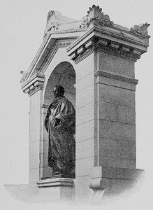
Channing Statue |
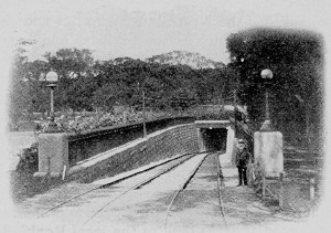
Entrance to Subway, Public Garden
|
On
the Arlington Street side: Statue of William Ellery Channing
(facing the Arlington Street Church on the opposite
side of the
street, the successor of the Federal Street Church, which was the
pulpit of Channing), of bronze, by Herbert Adams. The carved canopy,
of granite and marble, designed by Vincent C. Griffith, architect.
Erected in 1903. A gift to the city by John Foster. On the marble
columns of the canopy and on the marble stone at the back of the
monument are inscriptions. The equestrian statue of Washington (in
the main path, facing the Arlington Street gate), of bronze, by
Thomas Ball. Erected in 1869. Provided for by popular subscription.
The marble Venus in the fountain near by was the first work of art
placed in the Garden.
The
Arlington Street Church (Unitarian), which dignifies
the
corner of Arlington and Boylston streets, was the first church built
in this quarter (1860-1861). Its exterior design is broadly after old
London Wren churches. The steeple was the first in Boston to be
constructed entirely of stone. In its tower is a chime of sixteen
bells. The church organization dates from 1727.
|
|
On
the corner of Arlington Street and Newbury Street (the next street
north opening from Arlington Street) is the house of the New
Church Union, the headquarters of the New Jerusalem Church. Here
are established the New Church libraries and the business departments
of the Union, which is the business and financial representative of
the Massachusetts Association of the New Jerusalem Church.
Next
to this building, on Newbury Street (No. 2), is the house of the St.
Botolph Club, the representative literary and professional club
of the city, taking its name from St. Botolph in old Boston, England
(organized in 1880; Francis Parkman, the historian, the first
president). It possesses a silver-gilt “loving cup” which
formerly belonged to the corporation of the English Boston. In its
art gallery exhibitions of new work by artists are given during the
winter season. The picturesque church nearly opposite the St. Botolph
is Emmanuel Church (Protestant Episcopal). It is built of the
local Roxbury conglomerate stone. The church organization dates from
1860, and this edifice was erected two years later. No. 35 is the
present home of Margaret Deland.
Commonwealth
Avenue opens from the middle of Arlington Street, its parkway
being directly opposite the main path of the Public Garden, which
terminates at the Arlington Street gate. A lovely vista opens through
the long park of beautiful trees. The succession of statues down the
long walk are:
|
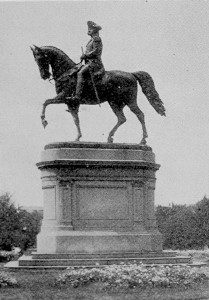
Washington Statue,
Public Garden |
Alexander
Hamilton, of granite, by Dr. William Rimmer. Erected in 1865. A
gift to the city by Thomas Lee, the same who gave the Ether Monument
in the Public Garden. This was the first statue in the country to be
cut from granite. The inscription characterizes Hamilton as “orator,
writer, soldier, jurist, financier. Although his particular province
was the treasury, his genius pervaded the whole administration of
Washington.”
General
John Glover of Marblehead, “a soldier of the Revolution,” of
bronze, by Martin Milmore. Erected in 1875. A gift to the city by
Benjamin T. Read. The inscription details the conspicuous features of
Glover’s military service with his marine regiment of Marblehead
men, notably his leadership in transporting the army across the river
from Brooklyn to New York and across the Delaware in 1776.
William
Lloyd Garrison, a sitting figure, of bronze, by Olin L. Warner.
Erected in 1886. The fund for this statue was raised by popular
subscription. Beneath the chair in which the figure is seated lies a
representation of a volume of the Liberator. The inscriptions are
quotations of the motto of the Liberator: “Our Country is the World
— Our Countrymen are Mankind”; and the declaration in Garrison’s
salutatory in his paper: “I am in earnest — I will not equivocate
— I will not excuse — I will not retreat a single inch — and I
will be heard.”
|
Leif
Ericson, the Norse discoverer, of the year 1000; an ideal figure,
of bronze, by Anne Whitney. Erected in 1886. The pedestal dis plays
reliefs, one representing a Norse scene, — a banqueting hall, with
Leif returned from his voyages relating his discoveries; the other
the fabled Norse landing on American shores. This statue is across
Massachusetts Avenue where the parkway ends.
On
Berkeley Street, at the corner of Marlborough
Street, a block
north of Commonwealth Avenue, is the beautiful stone edifice, with
corner tower and steeple, of the First Church of Boston
(Unitarian), fifth in succession from the rude little fabric of 1632
on the present State Street (see p. 5). It was erected in 1868,
succeeding the meetinghouse which stood on Chauncy Place (now
Street), off Summer Street, in the business quarter, for sixty years.
The Rev. William Emerson, father of Ralph Waldo Emerson, was the
minister of the church (his service being from 1791 to 1811) when
that meetinghouse was built in 1808.
On
Berkeley Street, at the corner of Newbury Street, south of the
avenue, is the Gothic Central Church (Congregational
Trinitarian), built in 1867. Like the First Church this is
constructed of the Roxbury rubble, with sandstone trimmings. Its fine
spire, two hundred and thirty-six feet high, is the tallest in the
city. This church (erected in 1867) is the successor of the first
meetinghouse of the society, which stood on Winter Street, in the
heart of the “down-town” shopping quarter, from 1841 to 1865.
|
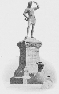
Leif Ericson Statue |
The
only church on Commonwealth Avenue is the notable structure
with its Florentine tower, at the western corner of Clarendon Street.
This is the First Baptist Church, descendant of the pioneer
Baptist meetinghouse at the North End which the then proscribed sect
built in 1679, and which not long after was nailed up by the court
officers (see p. 57). This edifice was originally erected (in 1873)
by the Brattle Square Church organization (Unitarian), to succeed the
historic meetinghouse in Brattle Square (see p. 17). It was purchased
by the Baptists after the dissolution of the Unitarian society and
the sale of the church property by auction. The massive square stone
tower, rising one hundred and seventy-six feet, with frieze of
colossal bas-reliefs, gives this structure an especial distinction in
the Back Bay architecture. The sculptured figures on the four sides
of the frieze represent the four Christian eras, — baptism,
communion, marriage, and death; the statues at the angles typify the
angels of the judgment blowing golden trumpets. These figures were
cut by Italian sculptors from designs by Bartholdi after the stones
had been set in place.
The
lower south corner of the avenue and Dartmouth Street is impressively
marked by the great marble hotel, the Vendome. Farther down,
on the north side, below Exeter Street, is the Algonquin
Clubhouse, a light stone building of striking façade,
sumptuously designed and arranged for the club’s uses. The
Algonquin (organized in 1885) is the representative business club of
the city, composed largely of active men of affairs. In near
neighborhood — on Beacon Street, nearly opposite the head of Exeter
Street — is the University Clubhouse. It is a rich dwelling
refashioned for club uses. It is especially favored by position with
an outlook at the rear over the river. This club (organized in 1892),
composed of college graduates resident in Boston and vicinity, is one
of the largest of its class in the country.
Below
Exeter Street, also on the favored water side of Beacon Street,
is the Holmes house (No. 296), the last town house of Dr. Holmes,
identified with the mellow productions of his latter years and old
age, — as “The Poet at the Breakfast Table,” “Over the
Teacups,” the grave and gay poems, “The Iron Gate,” and “The
Broomstick Train” on the advent of the trolley car. Farther down,
at No. 392, is the home of James Ford Rhodes, the historian of
the United States “from the compromise of 1850.” Above Exeter
Street, on the south side of Beacon Street (No. 241), is the
latter-day home of Julia Ward Howe.
Copley
Square and its Surroundings. Copley Square is at the junction of
Boylston Street, Huntington Avenue, Trinity Place, St. James Avenue,
and Dartmouth Street. The cross streets, Berkeley and Clarendon, are
near its eastern boundary; the thoroughfare of Dartmouth Street makes
its western bound. About the square and in its immediate neighborhood
are grouped some of the most important institutions of the city, with
noble buildings, beautiful churches, and attractive hotels. Bounding
the square are: the Public Library, occupying the entire west
side; the old Museum of Fine Arts (see pp. 91A-91D), the
Westminster Chambers (hotel), and Trinity Church on
the
south side; the Second Church on the north side; and the Old
South Church marking the northwest corner. On Boylston Street
east of the square, beginning at Berkeley Street, are: on the north
side, the Natural History Museum and the main buildings of the
Massachusetts Institute of Technology; on the south side,
the
Hotel Brunswick. On Boylston Street west of the square is
Jacob Sleeper Hall (dedicated March, 1908), the chief Boston
University building (see p. 47), next the Public Library and
extending to Exeter Street. On the lower corner of Exeter Street is
the Hotel Lenox. Nearly opposite, on Exeter Street, is the
Athletic Clubhouse, one of the largest of its class in the
country. On Dartmouth Street, north, next beyond the New Old South
Church, is the Boston Art Clubhouse, with entrance on Newbury
Street. Opposite the clubhouse, on Dartmouth Street, is the Hotel
Victoria. On Huntington Avenue, just outside the square, are the
Hotel Nottingham, the Hotel Oxford, and the Copley
Square Hotel. A short walk below, on Huntington Avenue, is the
great building of the Massachusetts Charitable Mechanic
Association, with its fine halls. From Copley Square Trinity
Place leads directly to the Trinity Place station of the New
York Central Railroad for outbound trains, and Dartmouth Street leads
to the Back Bay station of the New York, New Haven &
Hartford Railroad, From Huntington Avenue, at the corner of Irvington
Street, a block below the square, is the passage to the Huntington
Avenue station of the New York Central for inward-bound trains.
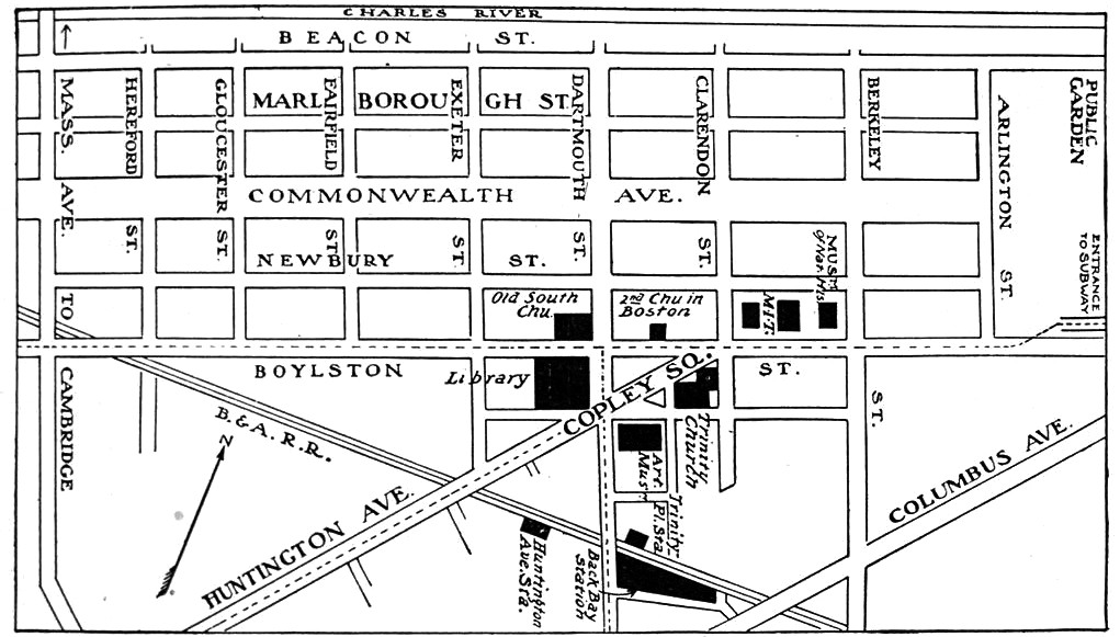
Copley Square and Vicinity
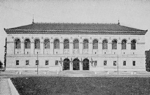
Public Library
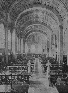
Bates Hall, Public Library |
The
Public Library building is one of the notable
architectural
monuments of its day. It is built of granite of a peculiar pinkish
white color, the façade classic in design. Its dimensions are
two hundred and twenty-five feet long by two hundred and twenty-seven
deep, and its height from the sidewalk to the top of the cornice is
seventy feet. It is quadrangular in shape, surrounding a court, and
covers with its broad entrance platform, exclusive of the court, an
acre and a half of ground. The elegance of its proportions and the
purity of its style are remarked as the chief architectural merits of
the work. The main entrance is topped with a round arch, over which
appears a medallion of the seal of the library by Augustus St.
Gaudens. Sculptures by Bela L. Pratt, “Science” and “Art,”
are ultimately to be set in the stone blocks of the platform by the
entrance doors. The vestibule, the entrance hall with high vaulted
ceiling, and the noble marble stair, case rising beyond are
impressive features of the first floor. In the vestibule is the
bronze statue of Sir Harry Vane, by Frederick
MacMonnies. The
artistically embellished bronze doors, admitting to the entrance
hall, were designed by Daniel C. French. In the ceiling of this hall
are wrought names of men identified with Boston, eminent in letters,
art, science, law, and public work. The great marble lions on
either side of the first landing of the staircase are by Louis St.
Gaudens. They were memorial gifts of the Second and Twentieth
Regiments, Massachusetts Volunteers, in the Civil War. The
decorations on the walls of the stairway and the
corridor
above are by Puvis de Chavannes. They represent, in separate panels,
Philosophy, Astronomy, History, Chemistry, Physics, Pastoral Poetry,
Dramatic Poetry, Epic Poetry, and finally, in one symbolic
composition, “The Muses welcoming the Genius of Enlightenment.”
The decorations of the Delivery Room, which opens from this corridor,
are by Edwin A. Abbey, and illustrate the legend of the Holy Grail.
The walls of the corridor of the upper floor, familiarly known as the
“Sargent Hall,” have in part the decorations by John S. Sargent
which in their completed form will represent the triumph of religion.
Only the panels of the east and west walls have yet been finished.
The subject of the first of these is the confused struggle in the
Jewish nation between monotheism and polytheism. That of the second
is the dogma of the Redemption. The ceiling of the second Children’s
Room, on the principal floor, carries a painting by John Elliott
representing the “Triumph of Time”; twelve female figures
symbolize the hours, and one male figure, Time. The Christian
centuries are typified by twenty horses arranged in rows of four
each. This decoration was given to the Library by citizens of Boston.
The decorations of the lobby leading to the Children’s Room from
the main corridor are by Joseph Lindon Smith, and were given by
Arthur A. Carey, a citizen of Boston. The lobby at the opposite end
of the corridor leading to the Delivery Room was decorated by Elmer
E. Garnsey. Besides its mural decorations the Library is rich in
memorial busts and other art objects.
|
The
principal reading room, known as Bates Hall (in honor of
Joshua Bates, who gave the Library at it beginning, in 1852, a fund
of fifty thousand dollars, besides an equivalent amount in books), is
in its dimensions and architectural features the most important
apartment in the building. It is two hundred and eighteen feet long,
forty-two and one half feet wide, and fifty feet high to the crown of
the arches. The barrel-arched ceiling is deeply paneled and
ornamented with rosettes. In this hall are collections of reference
books and works in general literature, accessible to the public on
open shelves. Readers are also served at the tables by runners, who
bring from the stacks such volumes as are requested for hall
use. The Children’s Rooms on this floor are entirely devoted
to the needs of young readers. Special attendants aid the children in
the selection of books, and instruct them in the use of the library.
Nine thousand volumes are placed on open shelves here, mainly the
better class of “ juveniles,” boys’ and girls’ fiction, and
books of travel and adventure written for the young. Large tables are
provided at which the children may read by themselves. The Children’s
Reference Room is a study room, and is equipped with books
intended to be used by young students. Children come here to write
compositions, to look up topics connected with their school work, and
to prepare their daily lessons. A collection of the text-books
used in the Boston public schools is an important feature of this
room, and the books contained in it are alike helpful to those who
have left school and to teachers from other places. General and
special reference hooks are also shelved here, duplicating in some
cases those kept in Bates Hall for older readers; and there is a
section of books on pedagogy and kindergarten methods for teachers.
In
connection with the work for children, the schools included among the
agencies of the Library (one hundred and twenty public and parochial
schools) must be mentioned. These are supplied with books either for
topical reference or miscellaneous reading, which are usually
delivered by the Library wagons and may be changed frequently. Each
set of books is made up for the occasion, and the teachers’
selection is followed as far as possible. The total number of volumes
sent to the schools from the Central Library and Branches in 1909 was
22,263. Each large Branch library, also, regularly supplies certain
neighbor ing schools. Applications for Library cards are taken by
Library employees in all the schools once a year.
On
the floor below are the Patent Room, with the best collection
of publications relating to patents to be found in the country,
except that at Washington; the Periodical Room, with a
complete file of current periodicals and magazines; and the Newspaper
Room, in which over three hundred newspapers from all parts of
the world are regularly received and placed on the reading files. The
Department of Documents and Statistics is in the rear part of the
building, approached through the arcade, across the courtyard from
the main-entrance corridor. It contains a large and constantly
increasing collection of statistical works, official publications,
and books relating to economic subjects; also many rare and valuable
historical manuscripts and broadsides.
On
the third floor are the Special Libraries, comprising the Fine
Arts Department, the Allen A. Brown Library of Music, and
the Barton, Barlow, Prince, Lewis, Bowditch, and Ticknor
collections. The collections shelved on this floor are mainly
intended for reference, and ample accommodation is provided for the
use of students and for research work. The Brown Library
contains more than eight thousand volumes relating to music; the
Barton Collection (fourteen thousand volumes) is
especially
rich in Shakespeariana, unequaled in the world, outside of two or
three great English libraries; and the Ticknor Library
includes nearly seven thousand volumes of Spanish literature. These
and the other collections designated by the names of the donors were
presented to the Library. All of them contain many rare and
exceedingly valuable books. The Fine Arts Department contains,
besides a carefully selected collection of books relating to
architecture, painting, and the allied arts, more than fifteen
thousand photographs from all over the world, besides six thousand
process pictures for the use of schools. Exhibitions are held
regularly in a room especially devoted to this purpose, and
collections of prints are sent to the schools and to the branch
libraries and deposit stations.
On
the north side of the building, opening from Boylston Street, a large
Lecture Hall is provided, in which lectures on educational
or
literary subjects are given during the winter season.
The
Boston Public Library system consists of the Central Library (this
Copley Square building); eleven Branch Libraries, in different parts
of the city, each having permanent collections of books; and
seventeen delivery stations (of which all are reading rooms, formerly
part service stations and shop stations). Regular de posits of books
are placed in one hundred and forty-nine schools and institutions,
and fifty-eight fire stations. In all, therefore, there are two
hundred and thirty, five agencies for supplying books to the public.
Regular daily wagon-delivery service is maintained between the
Central Library and the outlying agencies. The administration of the
Library is controlled by a board of five trustees appointed by the
mayor, a librarian and assistant librarian, and, including chiefs of
departments, a staff of two hundred and ninety employees for the
regular service, and ninety, four for the Sunday and evening service.
The Central Library is open daily from 9 A.M. to 10 P.M. (on Sunday
from 12 m.) in the winter, closing one hour earlier in the summer;
and the hours at the branches approximate this schedule, with some
variation during the period from June to September.
The
Library comprises a collection of nearly one million volumes. About
thirty thousand are annually added. It is a circulating library free
to every resident of Boston, and the use of the books within the
Library is open to all, whether resident of the city or not. It is
not only the largest circulating and reference library in the United
States, but it undertakes a greater variety of service than is
rendered by the noted libraries of the world. By means of an
interlibrary loan system it is serving scholarship throughout the
country, its recorded applications for books showing a wide range of
towns and cities and educational institutions. The annual circulation
for home use approximates one million six hundred and fifty thousand
volumes, including the circulation from the branches. Besides this
there is an extensive use of books in the Library itself of which no
statistical record is kept.
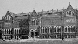
Old Museum of Fine Arts
Building |
The
Library maintains its own printing department and bindery. It issues
a Weekly Bulletin of new accessions, and from time to time special
bibliographies and other publications of importance. The annual
appropriation made by the city for the maintenance of the institution
is about $320,000. It also enjoys the income from about $385,000 of
invested trust funds. Horace G. Wadlin is the present librarian. The
architects of the Central Library were McKim, Mead & White. Its
total cost, including the land, was $2,500,000. It was opened to the
public in 1895.
The
old Art Museum building, of brick with terra-cotta
ornaments,
is in interesting contrast with the Public Library. It is now
utilized for occasional expositions.
|
|
Trinity
Church (Protestant Episcopal) is one of the richest examples of
ecclesiastical architecture in the city. It was the crowning work of
the architect, H. H. Richardson, and is called his masterpiece. Its
style as defined by him is the French Romanesque, as freely rendered
in the pyramidal-towered churches of Auvergne, the central tower
predominating. It is constructed of yellowish granite, with
brown freestone trimmings. The elaborate decorative work of the
interior is by John La Farge. The chapel, with open outside
stairway, is connected with the church by the open cloister, and here
are placed stones from the old St. Botolph Church in Boston, England,
presented by the authorities of that church. Trinity Church was
consecrated in 1877. Its predecessor was destroyed in the fire of
1872. That stood on Summer Street at the corner
of Hawley Street, a Gothic structure with massive stone walls and
tower. Phillips Brooks was rector of Trinity from 1869 to
1891, when he was made Bishop of Massachusetts. The Phillips
Brooks house near by, on the northeast corner of Clarendon and
Newbury streets, is the rectory of the church. Trinity, founded in
1728, is the third Episcopal church established in Boston.
|
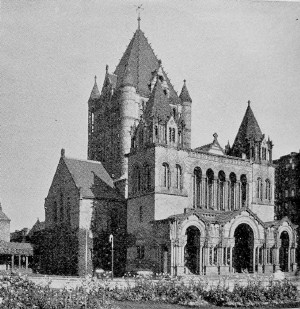 |
The
Phillips Brooks Memorial, in the green on the Huntington
Avenue side of this church, was erected by popular subscription of
citizens as a tribute to the beloved preacher, and passed to the care
and custody of the corporation of Trinity by deed from the committee
representing the subscribers. The statue is by Augustus St. Gaudens,
and the canopy by Charles F. McKim of McKim, Mead, & White. Both
are posthumous works, but the designs of both were practically
completed before the death of the sculptor and the architect. The
statue — of heroic size, representing the preacher in his pulpit
garb and attitude, and the hooded head of Jesus appearing back of the
figure, with the Saviour’s right hand on the preacher’s shoulder,
typifying the inspirer — exhibits St. Gaudens’ last and boldest
development of his scheme of the dual composition, the blending of
the realistic with the ideal, in outdoor statuary; and as such
invites and receives unusual attention. The memorial was formally
unveiled on January 22, 1910, at the conclusion of dedicatory
exercises within the church, attended by a distinguished audience,
when Henry L. Higginson, chairman of the committee of citizens, gave
the presentation address, and the gift was accepted for the
corporation by the Rev. Alexander Mann, present rector of Trinity.
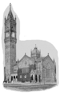
New Old South Church |
The
New Old South Church, so called to distinguish it
from its
still existing predecessor, the Old South Meetinghouse
(Congregational Trinitarian), is also, like Trinity, noteworthy for
richness of design and ornamentation in both the exterior and
interior of the structure. It is in the North Italian Gothic style,
and constructed mainly of the local Roxbury stone. The great tower
terminating in a pyramidal spire, composed of combinations of colored
stones, rises two hundred and forty-eight feet. The main entrance
through the front of the tower is richly decorated and recessed.
Delicate carvings of vines and fruits in a belt of gray sandstone
ornament the façade. In the beautiful arcade between the tower
and the south transept, across which are the words, “Behold I have
set thee an open door,” are inscribed tablets. One bears this
inscription: “1669. Old South Church. Preserved and blessed of God
for more than two hundred years while worshiping on its original
site, corner of Washington and Milk streets, whence it was removed to
this building in 1875, amid constant proofs of his guidance and
loving favor. Qui transtulit sustinet.” Cummings & Sears
were the architects of this church.
The
Second Church (Unitarian), descendant of the historic Old North
Church of North Square, founded in 1649, is built in large part from
the stones of the previous meetinghouse in Bedford Street, now in the
business quarter, which was taken down in 1872. It is a plain Gothic
exterior, beautified by a complete mantle of ivy. The interior is
broad and lofty, showing the open-timbered roof. Interesting
memorials of former pastors of distinction are here. In the transept
at the right of the pulpit is a bust of Ralph Waldo Emerson
(minister in 1829-1832) by Sidney H. Morse. On the other side of the
transept is a portrait of John Lathrop, the patriot minister
of the Revolutionary period. In front of the pulpit is Cotton
Mather’s pulpit chair.
|
The
two main buildings of the Massachusetts Institute of Technology
(founded by Professor William B. Rogers as a school of applied
science, and chartered in 1861) occupy, together with the Natural
History Museum, the entire square bounded by Boylston, Berkeley,
Newbury, and Clarendon streets. They are the Rogers Building,
dignified in design, with high portal approached by a noble flight of
broad stone steps, and the severely plain Walker Building. In
the former are the administrative offices of the institution and the
departments of mining, mathematics, drawing, history, economics, and
English; in the latter, the departments of physics and chemistry.
Other buildings, the Henry L. Pierce and Engineering
buildings, in which are the departments of civil and mechanical
engineering, architecture, naval architecture, biology, and geology,
are in Trinity Place; the Workshops are in Garrison Street,
off Huntington Avenue; and the Gymnasium is on Exeter Street.
The several buildings comprise, in addition to drawing, recitation,
and lecture rooms, eight laboratories or groups of laboratories.
In
the Rogers Building is Huntington Hall, in which the Society
of Arts, organized with the institute for the encouragement of
practical applications of the sciences, has its meetings. Here, also,
are given the free lecture courses of the Lowell Institute
(founded in 1839 by the will of John Lowell, Jr.). The Lowell
School of Practical Design, established by the trustees of the
Lowell Institute (1872) for the promotion of industrial art in the
United States, is maintained by the Institute of Technology in its
workshops. In the rear of the main buildings, on Newbury Street, is
the Technology Clubhouse.
|
The
Natural History Museum, sedate and elegant in style
and
finish, fronts on Berkeley Street. It is the building of the Boston
Society of Natural History, founded in 1831. It was erected in 1864.
Over the entrance door is carved the society’s seal, which bears
the head of Cuvier. On the keystones of the windows are carved heads
of animals, and a sculptured eagle surmounts the pediment. The
collections in the halls and galleries of this museum are interesting
and valuable, and are admirably arranged. Upon entering, in the first
hall are seen the introductory synoptical collection and sundry
important geological specimens. From the ceiling of the main hall is
suspended the large skeleton of a whale. In the library, which
contains from thirty to forty thousand volumes, much consulted by
students, are fine mineralogical, geological, and botanical
collections. On the second floor is a hall filled with stuffed
animals, geological, physiological, and fossil cases, and skeletons
of elephants and extinct fauna. Conspicuous is the skeleton of a
gorilla. In the galleries here are New England tree and shrub and
other botanical specimens; also conchological collections. On the
third and fourth floors are general ornithological and ethnological
collections, with the magnificent Lafresnaye Collection of birds,
nests, and eggs. Lecture halls and rooms are in the building, in
which instruction is given to classes of students. The museum is open
free on Wednesdays and Saturdays, and on Sunday afternoons. Other
days, entrance fee, twenty-five cents.
|
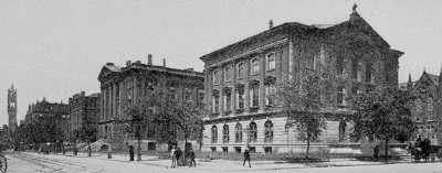
Natural History Museum
and Technology Buildings |
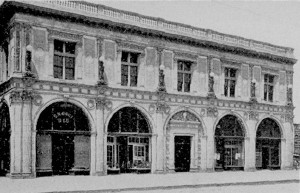
Chickering Hall |
Below
Copley Square, in the neighborhood of Huntington Avenue, are
other institutions of note. On Exeter Street, two blocks north, is
the Massachusetts Normal Art School (established by the State
in 1873), and on opposite corners the South Congregational Church,
long the pulpit of Edward Everett Hale, and the Boston Spiritual
Temple. On Irvington Street, south of the avenue, is the South
Armory, headquarters of the First Brigade, the First Coast
Artillery Corps, the First Squadron of Cavalry, and Battery A, Light
Artillery, of the State Militia. On St. Botolph Street, reached from
the avenue by Garrison Street, is the Massachusetts College of
Pharmacy (chartered 1852). Beyond the great exhibition halls
of the Massachusetts Charitable Mechanic Association, a few steps
from the avenue, on side streets — Falmouth, Norway, and St. Paul
streets — is the striking stone Christian Science Temple,
rising to the lofty height of two hundred and twenty feet, topped by
a magnificent dome, and with an auditorium of five thousand sittings.
It has a melodious chime of bells, which are rung with pleasing
frequency. This is The First Church of Christ, Scientist: The Mother
Church so called, generously endowed by Mrs. Eddy, the founder of
this denomination.
|
|
About
the Junction of Huntington and Massachusetts Avenues. In this
section are grouped more notable buildings, giving it a special
distinction. On the north side of Huntington Avenue, near the
junction, is Chickering Hall, with ornamented façade.
Next, at the east corner of the two avenues, is Horticultural
Hall, the fine building of the Massachusetts Horticultural
Society (organized 1829), in which great exhibitions of flowers and
fruits are held in their seasons. On the opposite corner is Symphony
Hall, successor of the old Music Hall as a “temple of music,”
where the concerts of the Boston Symphony Orchestra and the oratorios
of the Handel and Haydn Society are given.
Farther
down Huntington Avenue, on the corner of Gainsborough
Street, is the building of the New England
Conservatory of
Music (established in 1867), the greatest institution of its kind
in the country, embracing sixteen separate schools and training
students in every branch of the art. Opposite this are the buildings
of the New England Children’s Hospital (incorporated in
1869).
|
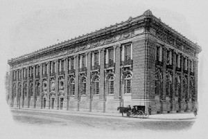
Horticultural Hall
|
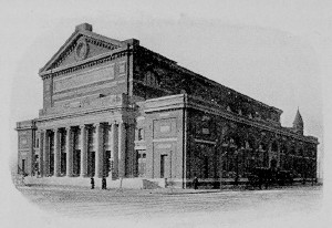
Symphony Hall |
Through
Westland Avenue, north of the junction of
Huntington and
Massachusetts avenues, the Fens, or Back Bay Park, may be
reached. At Hemenway Street is the Western entrance, with the
Memorial Fountain in commemoration of Ellen C.
Johnson,
superintendent of the State Reformatory School for Women at Sherborn,
who left by her will a fund for the erection of a drinking font for
animals at some public place in the city.
Continuing
along Huntington Avenue, we soon pass several buildings of note in
succession, and come upon a noble assemblage of institutions,
museums, colleges, schools, housed in monumental structures, facing
the thoroughfare, and backed upon or overlooking the upper Fens.
On
the right side is the Boston Opera House, with handsome,
dignified façade, a Boston institution for the presentation of
operas by its own organization throughout the regular season.
Opposite are the grounds and buildings of the Boston American
Baseball Club. Above, on the left side, No. 416, is the building
of the Tufts College Medical and Dental Departments: the seat
of Tufts College is on College Hill, Medford. Next above, on the
right side, is the impressive modern structure of the Boston Museum
of Fine Arts.
|
The
Museum of Fine Arts (incorporated 1870, first opened
1876),
with façade in classical style, marked by extreme simplicity
and dignity, is the second structure of the institution, erected in
1907-1909, and formally opened in November, 1909. In its general
scheme the building embodies the results of three years’ studies of
the principal museums of Europe and of modern museology, made by
advisory committees composed of artists and architects, in connection
with the director and the museum staff; and the principles governing
the arrangement of the rooms and exhibits, though not wholly new, are
applied with a consistency and thoroughness that are distinctly new.
The classification is by what is termed the dual system, providing a
compact exhibition in rooms on the main floor and reserved
collections for study on the floor below. Each department comprises a
series of rooms with independent approaches, and the arrangement of
the exhibits of each department is historical and chronological.
|
The
main floor is occupied by the galleries of five departments, —
Pictures, Egyptian Art, Classical Art, Western Art, Chinese and
Japanese Art, — and the Library. Waymarks of different colors, and
each with a section map, direct the visitor to the circuits in all
these departments, which begin in the corridors from the rotunda, to
the right and left, at the top of the main stairway. The department
of Paintings occupies the whole north side of the main floor (the
circuit beginning at the right of the rotunda through the corridor of
paintings and drawings), and one room, devoted to paintings on
panels, on the ground floor. On the walls of the corridor are water
colors by Burne-Jones, Troyon, Barye, Millet, and Joseph Lindon
Smith; drawings by Millet, Rodin, and others. At the left of the
corridor opens a small gallery, which, together with the east gallery
adjoining, is at present vacant. The East Gallery will be hung with
Impressionists and other pictures in high key. The gallery adjoining
the corridor, and the long gallery adjacent will contain the large
paintings by Le Rolle, Regnault, Lhermitte, and others, as well as
modern American paintings. Crossing the rotunda, the circuit enters
the Early American Room. Here are canvases by Copley, Stuart, West,
and Trumbull, including the familiar heads of “Washington and his
Wife,” originally in the Boston Athenæum, and the portraits
of Samuel Adams, Hancock, and General Knox, originally in Faneuil
Hall. In the next room are Roman interiors by Pannini, two paintings
by Boucher, — “Going to Market” and “The Return from Market”;
Turner’s “Slave Ship”; and examples of the work of Chardin,
Greuze, Duplessis, Philippe de Champaigne, Wilson, Sir Thomas
Lawrence, Constable, Romney, Opie, Leslie, Crome, Bonnington, Sir
Joshua Reynolds, and Sir Henry Raeburn. Next is the Flemish and Dutch
Seventeenth Century Room, showing Van Dyck’s “Charles I and
Henrietta Maria with their Children, afterwards Charles H and James
H,” and the “Portrait of Anna Maria de Schodt”; Rembrandt’s
“Danaë,” “Portrait of an Old Man,” and “Portraits of
Dr. and Mrs. Nicholas Tulp”; “Portrait of a Lady,” by Franz
Hals, and examples of the work of Santvoort, d’Hondecoeter, Van
Goyen, Peter de Hoogh, Molenaer, Huysum, Teniers, Willem Kalf, Maas,
Van Vliet, Ruysdael, Koninck, Thys, Rubens (“Marriage of St.
Catharine”), Metsu, Cuyp, Van der Velde, and Murant. The West
Gallery, devoted to Spanish and Italian sixteenth century paintings,
contains Borrasso’s “Coronation of the Virgin,” given by Dr.
Denman W. Ross in memory of the late Samuel Dennis Warren; Goya’s
“Portrait of a Man” (a recent gift); “The Philosopher,” by
Ribera; Velázquez’s “Philip IV of Spain” and “Don
Balthazar Carlos”; “Fray Feliz,” by El Greco; “Infanta Maria
Theresa,” by Carrero; “Portrait of the Artist’s Son,” by
Goya; “The Crown of Thorns,” by Ribera; “A Sibyl” and
“Justice” by Veronese; “The Scourging of Christ,” by Bassano;
“Apotheosis of a Poet,” by Tiepolo; and examples of the work of
Sustermans, Tinelli, Solario, and Moroni. In the Panel Room, on the
ground floor, we have Crivelli’s “Pietà”; an altarpiece
by Bartolomèo Vivarini; “St. Luke drawing the Portrait of
,he Madonna,” by Rogier van der Weyden; a triptych by Sano di
Pietro; and examples of the work of Gozzarelli, Peruzzi, Bellini,
Wohlgemuth, Timoteo della Vite, School of Botticelli, and the
Venetian School.
|
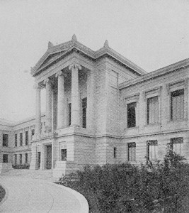
Museum of Fine Arts |
The
department of Egyptian Art, one of the largest of the
Museum,
occupies a series of rooms in the eastern wing, reached by a corridor
from the rotunda. The Hall of the Mastabas is first entered. Here are
objects of great interest from the Prehistoric and Old Empire Period,
and sculpture of the Middle and Early New Empire. The Mastaba
Chambers are from the group of tombs at Sakkara and are fine
specimens of the wall decorations of Dynasty V. From this hall opens
a room containing ,he Way Collection (given by C. Granville Way in
1872), comprising many small objects of great interest, among them a
series of scarabs classified according to subjects or dynasty. Next
is the New Empire Room, containing objects dating in general from the
Middle and New Empires. Thence the circuit passes into a small room
containing in a case a garment of cut leather dating from the reign
of Thothmes IV, 1436-1427 B.C. Next, the Ptolemaic Room, displaying a
varied collection, with examples of Coptic textiles. The department
of Classical Art adjoins that of Egyptian Art. At the north end
of the corridor leading to it is a colossal statue of Cybele. Its
circuit begins with the Archaic Room. This contains small bronzes,
vases of stone and pottery, terra-cotta figures of the sixth and
early fifth centuries representing scenes from daily life. Next, the
Fifth Century Room. This is so arranged as to lead up to one of the
Museum’s most prized objects, — the three-sided marble relief at
the end. Here are terra-cotta vases, gems and jewelry, superb bronze
vessels, one of them an early Greek basin with fine figures
constituting its handles. In connecting small rooms are the finer
marbles: the head of Aphrodite (of the Francis Bartlett collection,
the largest gift of works of art ever received by the Museum); the
youthful Hermes; the late Greek torso of a maid; and, exhibited under
glass, a beautiful head of a girl, found in Chios and conjectured to
have been possibly by Praxiteles. Next, the Fourth Century Room, the
chief exhibit of which is a series of small terra-cotta figures.
Finally, the Late Greek Room, with more terra-cotta figurines and
bronzes. In the balcony of the court stand marbles of the Græco-Roman
period.
The
department of Western Art occupies a series of galleries
beginning with the Western Art Corridor at the left of the staircase
and continuing through the Nearer Orient Room, the Tapestry Gallery,
the Sixteenth, Seventeenth, and Eighteenth Century rooms, the
Eighteenth Century Vestibule, and the Library Corridor, and including
the Bremgarten and Lawrence rooms on the ground floor. The collection
em braces specimens of all the arts developed in Europe and the
Nearer Orient, or under European influence since classical times.
Objects of aboriginal American and African workmanship are also
included. The department of Chinese and Japanese Art is in the
west wing, reached by the Japanese Corridor. The museum collection of
this class is the largest and finest in the world, and only a small
proportion can be exhibited here at one time, the bulk being stored
on the floor below. In the Japanese display are rich specimens of
metal work, ivory and wood carving, costumes, and lacquer, the latter
being especially noteworthy. The elaborate Morse Collection of
Japanese Pottery, which gives a more complete representation of
the fictile art of Japan than all other exist ing collections
combined, occupies a gallery by itself at the left of the main
entrance of the building.
The
Library, dignified, in virtue of its endowment by a generous friend,
by the title of the “William Morris Hunt Memorial Library,” is
a beautiful hall, its upper walls hung with tapestries and adorned
with pictures, notably the large “Boar Hunt” by Snyders. Next to
the Reading Room is the Photograph Collection, including some
thirty thousand photographs representing the sculpture, painting, and
architecture of Europe, the Nearer Orient, and Japan. The Print
Department occupies a suite of rooms on the ground floor, with a
Study Room ad joining. Selections from the Museum’s great
collection of Casts are shown in the two large courts and adjacent
rooms. In the basement of the west wing is a public restaurant. The
Museum School is housed in a separate building of a single
story, built around two courtyards. Here all the classes and
departments are together under one management. The entrance corridor
is hung with envois from students who have held the Paige Travelling
Scholarship which entitles the holder to two years’ study of art in
Europe.
The
Museum School gives instruction in drawing and painting, in modeling
and design, with supplementary courses in artistic anatomy and
perspective. The first suggestion of a public establishment in Boston
to be devoted wholly to the fine arts was the result of a wish to
make more accessible to the public several collections of works of
art already existing in the Athenæum, at Harvard College, and
at the Massachusetts Institute of Technology.
The
Museum has been wholly dependent upon private liberality for its
creation and maintenance. It is managed by a board of thirty
trustees, of whom three are appointed by Harvard College, three by
the Boston Athenæum, and three by the Massachusetts Institute
of Technology. There are five ex-officio members, of whom three,
including the mayor, represent the city of Boston. The remainder of
the board are those first named in the act of incorporation and those
chosen by the board to fill vacancies in its number. The president of
the corporation is Gardiner M. Lane; director of the Museum, Arthur
Fairbanks. The Museum is open every day in the year excepting the
Fourth of July, Thanksgiving Day, and Christmas; on week days, 9 A.M.
to 5 P.M. (November to March 1, 4 P.M.); Sundays, 12 M. to 5 P.M.
Admission is free on every Saturday and Sunday and on public
holidays. On other days the entrance fee is twenty-five cents.
The
present building is only a part of the structure as planned. The
architect was Guy Lowell.
The Gardner Museum of Art
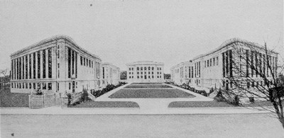
Harvard Medical School |
Just
beyond the Art Museum, reached from Huntington Avenue by Ruggles
Street, is Fenway Court, which contains the rich collection of works
of art belonging to the Isabella Stuart Gardner Museum
corporation. Next beyond this Venetian structure are the buildings of
Simmons College (chartered 1899), established by the
will of
John Simmons, a Boston merchant, to furnish instruction in “such
branches of art, science, and industry” as will “best enable
women to earn an in, dependent livelihood.”
Back
of Fenway Court, facing the Fenway road at its junction with
Huntington Avenue, is the fine cluster of Boston school buildings of
the higher grade, — the Girls’ Latin, the Boston
Normal, and the High School of Commerce. On Longwood
Avenue, here opening from Huntington Avenue, is the Harvard
University Dental School and hospital, a dignified building of
brick with stately marble entrance porch; and immediately beyond
this, the noble group of five marble structures constituting the
Harvard University School of Medicine, the central,
white-pillared administration building facing an open court and
reached from the Longwood Avenue entrance by broad terraced stone
walks on either side. The four other buildings are designed for
laboratory purposes and are all constructed on one general plan, —
two parallel wings united by an amphitheater. The rear entrance is
from grounds opening upon a proposed Avenue Louis Pasteur. In the
administration building is the Warren Anatomical Museum, the
original collection of which was given by Dr. John Collins Warren,
professor of anatomy and surgery in the School from on one general
plan, — two parallel wings united by an amphitheater. The rear
entrance is from grounds opening upon a proposed Avenue Louis
Pasteur. In the administration building is the Warren Anatomical
Museum, the original collection of which was given by Dr. John
Collins Warren, professor of anatomy and surgery in the School from
1815 to 1847, succeeding his father, who was the first to hold that
position upon its establishment.
|
|
We
may return by way of Brookline Avenue, taking an Ipswich Street car,
and pass on this side of the Fens. The church suggestive of colonial
architecture, on Peterborough and Jersey streets, is the Church of
the Disciples (Unitarian), successor of the meetinghouse at the
South End of the city, for nearly fifty years the pulpit of James
Freeman Clarke, who founded this church in 1841 as a free church, all
expenses to be met by voluntary subscriptions. We should leave the
car at its entrance upon Boylston Street from Ipswich Street, and
pass, a short block westward, to the Fenway, the east and south
border of the Fens.
|
Westland Avenue Entrance
to the Fens |
On
the Fenway near Boylston Street is the handsome house of the
Boston Medical Library (founded in 1874), ornamenting the
street. The principal reading room is Holmes Hall, named for
Dr. Oliver Wendell Holmes and adorned with mementos of him. His own
valuable medical library is preserved in the general collection of
this library, the fourth in size of the medical libraries of the
country. There is here the Storer collection of medical medals,
remarkable in its variety and extent.
At
the corner of the Fenway and Boylston Street, facing the latter, is
the house of the Massachusetts Historical Society (founded in
1791), the oldest historical society in the country, and probably in
the world. This distinguished building was designed by Wheelwright
&
Haven, and was erected by the society in 1897-1899. It contains the
society’s rare library of forty-three thousand volumes, enriched
with historical documents and manuscripts. Over the entrance to
the Dowse Library are the crossed swords which used to rest
above the library of William H. Prescott, and to which Thackeray
alludes in the opening of “The Virginians.” The cabinet museum
of curios contains numerous interesting objects, among them the
wooden Indian which topped the old Province House and the cannon ball
which struck the Brattle Square Church during the Siege. The model of
the historic meetinghouse is in the upper hall. The museum is open on
Wednesday afternoons only, from 2 to 5. The chief function of this
society is to publish, and it has issued infinitely more publications
than any other historical society in this country, and more than all
the other societies combined, the number approaching two hundred.
Charles Francis Adams is the present president of the society, and
Dr. Samuel A. Green has long been the librarian. The American
Academy of Arts and Sciences (founded in 1780) is also
established in this building.
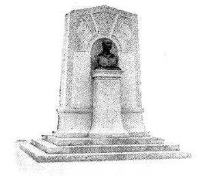
John Boyle O'Reilly Monument |
Near
by, in the Fens, is the monument to John Boyle O’Reilly,
the Irish poet, editor, and athlete. We may pass along the Fens
northward by a circling course to Charlesgate and finish
our tour in the newer residential part of this quarter, with its
broad streets and fine dwellings, locally termed the “New Back
Bay.” Charlesgate is the passage through which Muddy River empties
into the Charles River. Near the Fenway, on Commonwealth Avenue, is
the memorial to Patrick A. Collins, another worthy Irish-American,
orator and statesman. This is by Mr. and Mrs. Henry H. Kitson, and
was placed in 1908. Bay State Road, making off from
Charlesgate West to the riverside, is especially noticeable for its
display of domestic architecture. On Charlesgate East and
Commonwealth Avenue is the sumptuous Hotel Somerset. On
Commonwealth Avenue near Massachusetts Avenue is the equally
sumptuous Hotel Puritan.
|
6.
THE SOUTH END
The
South End is now a faded quarter. Like the Back Bay it is composed
largely of “made land.” It was developed from the narrow neck
connecting the old town with Roxbury, and was planned and built up on
a generous scale to become the permanent fashionable part of the
city. Such favor it was enjoying when the lavish development of the
Back Bay began, and fashion was not long in turning from it and
moving westward. With all its air of having seen better days,
however, this quarter still has attractions. Its streets are broad,
some are shaded with fine trees; numerous small parks are scattered
through it; many of the houses are yet substantial dwellings, with a
look of roominess within; and various important institutions are
established within its borders. The latter most interest the visitor.
|
Among
the most noteworthy of these institutions are the Public Latin and
English High Schools, on Warren Avenue, Dartmouth and Montgomery
streets; the Girls’ High School, West Newton Street; the
Boston College (Roman Catholic, founded in 1860),
Harrison
Avenue (No. 761), near East Newton Street; the great Boston City
Hospital, with its twenty, six buildings (a group of nineteen
constituting the City Hospital proper, and a group of seven, in the
South Department, for infectious diseases), occupying lands bounded
by Harrison Avenue, East Concord Street, Albany Street, and
Massachusetts Avenue; and the group of buildings of the Massachusetts
Homeopathic Hospital, with the School of Medicine
(connected with Boston University), on East Concord Street and
Harrison Avenue.
|
A Typical Children's Playground |
Of
the churches of the quarter the stone Cathedral of the Holy Cross
(Roman Catholic), on Washington Street, at the corner of Malden
Street, is the greatest. It is the largest Catholic church in New
England, and in some respects the finest. It is in the early English
Gothic style. The interior is richly designed and embellished. The
arch of the front vestibule is constructed of bricks from the ruins
of the Ursuline Convent on Mount Benedict
(now leveled) in Somerville, which was burned by a mob on the night
of August 11, 1834. In the front yard of the edifice is the bronze
statue of Columbus, by Alois Buyens (a replica of the San
Domingo monument), erected in 1892. In the rear, on the corner
of Union Park Street and Harrison Avenue, are the chief offices of
the archdiocese. The archbishop’s house is on Bay State Road, Back
Bay District. Another South End Catholic church of note is the Church
of the Immaculate Conception, on Harrison Avenue and East Concord
Street (by the side of Boston College). The interior of this church
is also rich in ornamentation.
Of
the older Protestant churches several have become “institutional
churches,” with numerous helpful activities. Such are the Berkeley
Temple, on Berkeley near Tremont Street, in association with the
Union Church on Columbus Avenue and West Newton Street;
the
Shawmut Church, on Tremont Street; and the Warren
Avenue
Baptist Church, on Warren Avenue and West Canton Street. The
Denison House (College Settlement) is at 93 Tyler Street,
and
the South End House at 20 Union Park Street. Among the
churches still retaining the old parish methods are the Second
Universalist Church and the First Presbyterian Church,
both on Columbus Avenue; the Clarendon Street Baptist Church,
on Clarendon and Tremont streets; and the Tremont Street Methodist
Church, on Tremont and Concord streets. On Berkeley Street, No.
41, is the admirable Franklin Union, with its trades school.
The
East Armory (East Newton Street), housing the Ninth
Regiment
of Infantry, and the Cadet Armory (Columbus Avenue), First
Corps of Cadets, are in this quarter.
Washington
and Tremont streets and Shawmut and Columbus avenues are the great
thoroughfares generally north and south through this quarter.
Columbus Avenue opens at Park Square (from Boylston Street opposite
the Common). Here is the Emancipation Group, commemorating the
freeing of the slaves by President Lincoln, an interesting piece of
statuary by Thomas Ball, erected in 1879. It was a gift to the city
by Moses Kimball, long the owner of the old Boston Museum.
7.
THE OUTLYING DISTRICTS
East
Boston on its islands is a place of steamship docks and of great
manufactories. In the days of wooden ships it was a center of ship
yards, whence fine craft were launched. Here were built splendid
clipper ships for the California service in the gold-digging days.
Now its at tractions for the visitor are slight, although several of
its hill streets are pleasant, and wide harbor views open from
various points. Belmont Square, on Camp Hill, marks the site
of the fort erected in the Revolutionary period, and perhaps also the
site of the fortified house of Samuel Maverick, the earliest
white settler, in 1630. Wood Island Park, of the Metropolitan
Parks System, lies on the harbor or south side of the main island.
Castle Island, Marine Park
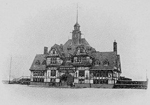
Head House, Marine Park |
South
Boston has also become a great industrial center and a place of
shipping docks. Its points of popular interest to-day consist of the
remnant of Dorchester Heights, — Telegraph Hill, — upon
which is the monument “perpetuating the erection of American
fortifications that forced the British to evacuate Boston, March 17,
1776”; the Perkins Institution for the Blind, the beneficent
institution founded by Dr. Samuel G. Howe in 1829; and the beautiful
water-front esplanade, the Marine Park, of the Boston Public
Parks System. These are all at the east end of the district locally
known as “The Point”; South Boston cars marked “City Point”
reach them all. In the Marine Park is the admirable statue of
Farragut, in
bronze, by H. H. Kitson. This was erected in 1893. The Point is a
favorite yachting station, and several yacht clubhouses are situated
here. In the lower part of the district the Lawrence schoolhouse
on West Third Street marks the site of Nook Hill, the historic
interest of which is disclosed in the inscription on a tablet here.
|
|
The
Roxbury District also has
interesting landmarks of the Revolution. These are the Roxbury
forts, near Highland Street, in the neighborhood of Eliot Square,
with its century-old meetinghouse of the “First Religious Society
in Roxbury” (dating from 1632), on the site of the first rude
structure in which John Eliot preached for more than forty years.
Roxbury Upper Fort is marked by the lofty ornate white water pipe, on
the hill of Highland Park, between Beach Glen and Fort avenues. The
lines of the fort are indicated, and it is fittingly marked by a
tablet. The site of the Lower Fort, a short distance northward, is
pointed out in the yard of a dwelling on Highland Street. These
forts, built by General Harry Knox, under the direction of General
Thomas, crowned the Roxbury lines of investment during the Siege of
Boston. Highland Street, which leads from Eliot Square, is
most interesting as the last home of Edward Everett Hale, in a
broad, roomy, old-time house (No. 39). On this street also was
“Rockledge,” the home of William Lloyd Garrison through
his later years. On Warren Street, not far from the Dudley
Street station, is the site of the birthplace of General Joseph
Warren, now covered by a stone house built in 1846 by Dr. John
Collins Warren “as a permanent memorial of the spot.” In the
neighboring square is the statue of Warren, by Paul W.
Bartlett, placed in 1904. Near by, on Kearsarge Avenue, was the home
of Rear Admiral John A. Winslow of the Kearsarge which
destroyed the Alabama in the Civil War. H ere also is the
Roxbury Latin School, only ten years the junior of the Boston
Latin School, having been established in 1645. Of this school Warren
was a master when he was but nineteen years old. Near the old Boston
line, at the corner of Washington and Eustis streets, is the ancient
burying ground in which are the tombs of John Eliot and of the
Dudleys, — Governor Thomas Dudley (died 1653), Governor Joseph
Dudley (1720), Chief Justice Dudley (1752), and Colonel William
Dudley (1743). In the western part of this district is Franklin
Park, the largest single park in the Boston City Parks System.
|
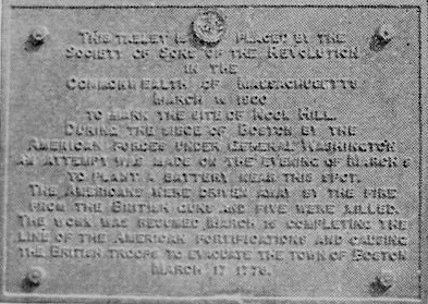
Tablet at "Nook Hill"
Path in the Wilderness, Franklin Park |
The
West Roxbury District
contains memorials of Theodore Parker,
and embraces “Brook Farm,” the place of the experiment in
socialism by the Brook Farm Community of literary folk in 1841-1847,
and the scene of Hawthorne’s “Blithedale Romance.” The old
First Parish meetinghouse with its Wren tower, locally known as the
Theodore Parker Church from Parker’s nine years’ ministry
here, is still standing, though unused and dismantled. It is on
Centre Street, close by the Bellevue station of the railroad (Dedham
Branch). Electric cars from Forest Hills pass its neighborhood. In
front of its successor, a little farther up Centre Street, is a fine
bronze statue of Parker. Farther along this main street, at
the corner of Cottage Avenue, Parker’s residence also
remains, — now occupied as the parish house of a neighboring
Catholic church. Brook Farm is but little changed in its
outward aspect. It lies about a mile distant from Spring Street
station on the railroad (by way of Baker Street). The Stony Brook
Reservation of the Metropolitan Parks System is in this district.
Forest Hills Cemetery, one of the most beautiful of modern
burying grounds, is in another part of the district, close by the
terminus of the Forest Hills lines of electrics and the Forest Hills
station of the railroad. Here are the graves or tombs of General
Joseph Warren, Rear Admirals Winslow and Thacher, William Lloyd
Garrison, John Gilbert, the actor, Martin Milmore, the sculptor, and
many others of distinction. At Milmore’s grave is the monument
representing the Angel of Death staying the hand of the sculptor, an
exceptionally fine piece of sculpture by Daniel C. French. Jamaica
Plain, in which are the Arnold Arboretum and Olmsted Park
of the Boston City Parks System, is a part of this district.
The
Dorchester District is
now essentially a place of homes. It
embraces a series of hills, several of them commanding pleasant water
views. Meetinghouse Hill, in the southern part, is crowned
with a fine example of the New England meetinghouse of the early
nineteenth century, in direct descent from the first meetinghouse of
1631. At Upham’s Corner, on Dudley Street and Columbia Road, is the
ancient burying ground, one of the most interesting in the
country. Among the distinguished tombs here are those of Lieutenant
Governor William Stoughton, chief justice of the court before which
the witchcraft trials at Salem were held, and Richard Mather, the
founder of the Mather family in New England. Many of the inscriptions
on the stones are quaint, and there are a number of imposing tablets.
Looking Down Commonwealth
Avenue |
The
Brighton District
was once the great cattle mart of New
England, and famous also for its extensive market gardens and
nurseries. A few of the latter remain, but the district is mainly a
residential section so closely associated with newer Boston as to be
a component part of it.
|
|


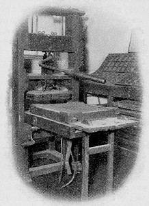
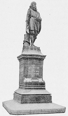
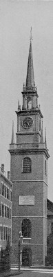
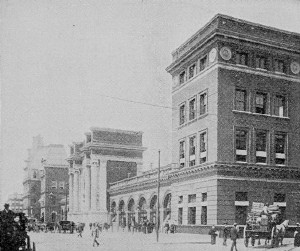
 Click the book image to turn
to the next Chapter.
Click the book image to turn
to the next Chapter.