 copyright, Kellscraft Studio
1999-2003 (Return to Web Text-ures) |
Click Here to return to |
|
|
copyright, Kellscraft Studio 1999-2003 (Return to Web Text-ures) |
Click Here to return to |
|
Rambles Around Old Boston
I
THE STORIED TOWN OF ōCROOKED LITTLE STREETSö
WE were three Ś a visiting Englishman, the Artist, and Antiquary. The Artist and Antiquary were the gossiping guides; the Englishman the guided. The Englishman would ōdoö Old Boston exclusively. He had ōdoneö the blend of Old and New, and now would hark back to the Old and review it in leisurely strolls among its landmarks. He had asked the Artist and Antiquary to pilot him companionably, and they would meet his wishes, and gladly, for the personal conducting of a stranger so saturated with Old Boston lore as he appeared to be could not be other than agreeable.
Beyond the few treasured historic memorials, the landmarks he especially would seek were many of them long ago annihilated in those repeated marches of progress or of improvement common to all growing cities, or effaced in the manifold makings-over of the topography of the Old Town, than which none other in Christendom has undergone more. Still, if not the identical things, the sites of a select number of them could be identified for him, and their story or legend rehearsed, while the ArtistÆs pencil would reproduce yet remaining bits of the Old jumbled with the New.
So we sauntered, we three, through the crowded old streets of the modern city, imaging the Old Town of the past.
Properly our initial ramble was within the narrow bounds of the beginnings of the Puritan capital, the ōmetropolis of the wildernessö, hanging on the harborÆs edge of the little ōpear-shapedö, be-hilled peninsula, for which the founders, those ōwell-educated, polite persons of good estateö, took Old Boston in England for its name and London for its model. The Lincolnshire borough on the Witham was to be its prototype only in name. The founders would have their capital town be to New England in its humble way what London was to Old England. So Boston was builded, a likeness in miniature to London.
This London look and Old England aspect, we remarked, remained to and through the Revolution; and in a shadowy way remains to-day, as our guest would see. It was indeed a natural family likeness, for, as the record shows, Boston from the beginning was the central point of the most thoroughly English community in the New World. There was no infusion of a foreign element of consequence until the end of the Colony period and the close of the seventeenth century. Then the French Huguenots had begun to appear and mingle with the native Puritans. But while early in the Province period this element became sufficient in numbers to set up a church of its own, and to bring about some softening of the old austerities of the Puritan town life, it did not impair the English stamp. These French Huguenots easily assimilated in the community, which welcomed them, and in time these competent artisans and merchants, the Bowdoins, the Faneuils, Chardons, Sigourneys, Reveres, Molineuxes, Greenleafs, became almost as English, or American-English, as the rest. Nor was the stamp impaired by the infusion of Scotch and Irish into the Colony in increasing numbers during the latter half of the seventeenth and the early eighteenth centuries; nor by the floating population of various nationalities naturally drawn to a port of consequence, as Boston was, the chief in the colonies from the outset. These floaters, coming and going, merely lent variety and picturesqueness Ś or brought temporary trouble Ś to the sober streets. Up to the Revolution the population remained homogeneous, with the dominating influences distinctively of English lineage. When with the Revolution the English yoke was thrown off and the ōBostoneersö tore down every emblem of royalty and every sign of a Tory and burned them in a huge bonfire in front of the Old State House, and afterward re-named King Street ōStateö, and Queen Street ōCourtö, they could not blot out its English mark. And well into the nineteenth century, when in 1822 Boston emerged from a town to a city, the population was still ōsingularly homogeneousö; it came to cityhood slowly and somewhat reluctantly after repeated attempts, the first early in the Colony period. Edmund Quincy, in his fascinating life of his distinguished father, Josiah Quincy, writing of the municipality in 1823 during Josiah QuincyÆs first administration as mayor Ś he was the cityÆs second mayor Śobserves: ōThe great Irish and German emigration had not then set in. The city was eminently English in its character and appearance, and probably no town of its size in England had a population of such unmixed English descent as the Boston of that day. It was Ang1is ipsis Anglior Ś more English than the English themselves. The inhabitants of New England, at that time were descended, with scarcely any admixture of foreign blood, from the Puritan emigration of the seventeenth century.ö
This complexion remained untarnished for a decade or so longer. The infusion of foreign elements that changed it began about the latter eighteen-thirties and the early forties, with the development of large New England industries, of which Boston was the financial center Ś the building of canals, turnpikes, railroads, factories; the expansion of commerce with the advent of steamships. It came rapidly, too, this change in complexion, when fairly begun. Lemuel ShattuckÆs census of Boston for 1845, a local classic in its way, disclosed a state of affairs which astonished the self-satisfied Bostonian of that day in its demonstration that the native born comprised only a little more than one third of the population, ōthe remainder being emigrants from other places in the United States or from foreign countries.ö Within the next half-century the proportion had become one third of foreign birth, and another third of foreign parentage. Yet withal, the old English likeness was not shattered; it was but dimmed.
As the founders and settlers brought with them all their beloved old-home characteristics and would transplant them, as was possible, in their new home, so we find their earliest ōcrooked little streetsö with old London names. So the earlier social life, grim though it was with its puritanical tinge, is seen to have been old English in a smaller and narrower way. So were the manners and customs. The taverns were named for old London inns. The shop signs repeated old London symbols.
And to-day, as we ramble about the shadowy precincts of the Colony Town, we chance delectably here and there upon a twisting street yet holding its first-given London name Ś a London-like old court, byway, or alley; a Londonish foot-passage making short cut between thoroughfares; an arched way through buildings in old London style. So, too, we find yet lingering, though long since in disuse, an old, London-fashioned underground passage or two between courts or one-time habitations, suggestive of smuggling days and of romance. Such is that grim underground passage between old Province Court and Harvard Place, issuing on Washington Street opposite the Old South Meeting-house, which starts in the court near a plumbing shop and runs alongside the huge granite foundations of the rear wall of the old Province House, seat of the royal governors, now long gone save its side wall of Holland brick, which still remains intact. This passage must have eluded Hawthorne, else surely it would have figured in one of his incomparable ōLegendsö of this rare place of Provincial pomp and elegance. Then there was, until recent years, that other and more significant passage, opening from this one, and extending under the Province House and the highway in front, eastward toward the sea. Gossip Tradition has it, or some latter-day discoverer has fancied, that by this passage some of HoweÆs men made their escape to the waterfront at the Evacuation. Others call it a smugglerÆs passage. In that day the water came up Milk Street to the present Liberty Square, and southward to old Church Green, which used to be at the junction of Summer and Bedford streets. An explorer of this passage Ś the engineer of the tavern which now occupies the site of the Province House orchard (a genuine antiquaryŚ this engineer, who, during service with the tavern from its erection, has delved deep into colonial history of this neighborhood), says that its outlet apparently was somewhere near Church Green. It was closed up in part in late years by building operations, and further by the construction of the Washington Street Tunnel.
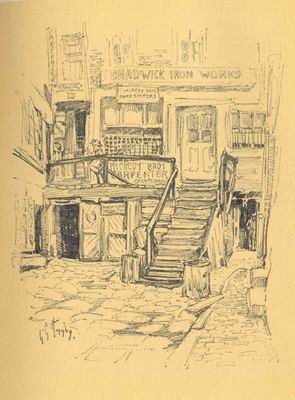
Harvard Place
The peninsula as the colonists found it we recalled from the familiar description of the local historians. It was a neck of land jutting out at the bottom of Massachusetts Bay with a fine harbor on its sea side; at its back, the Charles River, uniting at its north end with the Mystic River as it enters the harbor from the north side of Charlestown; its whole territory only about four miles in circuit; its less than eight-hundred acres comprising several abrupt elevations, with valleys between. The loftiest elevation was the three-Peaked hill in its heart, which gave it its first English name of Trimountain, and became Beacon, on the river side; the next in height, on the harbor front, were the north and south promontories of a great cove, which became respectively CoppÆs Hill and Fort Hill. This peninsula was sparsely clad with trees, but thick in bushes and reeds, the surface indented by four deep coves, inlets of ocean and river, and by creeks and ponds; and with sea margins wide, flat, oozy. The original area, our guest was told, was expanded to more than eighteen hundred acres in subsequent periods in the nineteenth century by the filling in of the coves, creeks, and ponds and the reclamation of marshes and flats.
The Town was begun round about the Market Place, which was at the head of the present State Street, where is now the Old State House. About the Market Place the first homes were built and the first highways struck out. Thence meandered the earliest of those legendary ōcow paths,ö the lanes from which evolved the ōcrooked little streetsö leading to the home lots and gardens of settlers. State Street and Washington Street were the first highways, the one ōThe Great Street to the Seaö, the other ōThe High Waye to Roxberrieö, where the peninsula joined the mainland, perhaps along Indian trails. At the outset the ōHigh Wayeö reached only as far as School and Milk streets, where is now the Old South Meeting-house, and this was early called Cornhill. Soon, however, a further advance was made to Summer, this extension later being called Marlborough Street, in commemoration of the victory of Blenheim. In a few years a third street was added, toward Essex and Boylston streets, named Newbury. The ōseaö then came up in the Great Cove from the harbor fairly close to the present square of State Street, for high-water mark was at the present Kilby Street on the south side and Merchants Row on the north side. The Great Cove swept inside of these streets. Merchants Row followed the shore northward to a smaller cove, stretching from where is now North Market Street and the Quincy Market (the first Mayor QuincyÆs monument) and over the site of Faneuil Hall to Dock Square, which became the Town Dock. Other pioneer highways were the nucleus of the present Tremont Street, originally running along the northeastern spurs of the then broad-spreading Beacon Hill and passing through the Common; Hanover Street, at first a narrow lane, from what is now Scollay Square, and Ann, afterward North Street, from Dock Square, both leading to the ferries by CoppÆs Hill, where tradition says the Indians had their ferry. Court Street was first Prison Lane, from the Market Place to the prison, a grewsome dungeon, early set up, now stands the modern City Hall Annex. In its day it harbored pirates and Quakers, and Hawthorne fancied it for the opening scenes of his ōScarlet Letter.ö School Street took its name the first schoolhouse and the first school, sprang the Boston Latin School, which felicitates itself that it antedates the university at Cambridge and ōdandied Harvard College on its knee.ö Milk Street, first ōFort Laneö, was the first way to Fort Hill on the harbor front. Summer Street, first ōMylne Laneö, led to ōWidow TuthillÆs Windmillö, near where was Church Green, up to which the water came. ōCow Laneö, now High Street, led from Church Green, or Mill Lane, to the foot of Fort Hill. Essex Street was originally at its eastern end part of the first cartway to the Neck and Roxbury, a beach road that ran along the south shore of the South Cove, another expansive indentation, extending from the harbor on the south side of Fort Hill to the Neck. Boylston Street, originally ōFrog Laneö, and holding fast to this bucolic appellation into the nineteenth century, was a swampy way, running westward along the south side of Boston Common toward the open Back Bay Ś the back basin of the Charles Ś then flowing up to a pebbly beach at the CommonÆs western edge and to the present Park Square.
Here, then, on the levels about the Great Cove, in the form of a crescent, facing the sea and backed by the three-peaked hill, the Town was established.
The first occupation was within the scant territory bounded, generally speaking, on the east by State Street at the high-water line of the Great Cove; northerly by Merchants Row around to near the site of Faneuil Hall; northwesterly by Dock Square and Hanover Street; westerly by the great hill and Tremont Street; southerly by School and Milk streets; and Milk Street again to the water, then working up toward the present Liberty Square at the junction of Kilby, Water, and Batterymarch streets. Soon, however, the limits expanded, reaching southward to Summer Street, and not long after to Essex and Boylston streets; eastward, to the harbor front at and around Fort Hill; westward and northwestward, about another broad cove Ś this the North Cove, later the ōMill Coveö with busy mills about it, an indentation on the north of Beacon Hill by the widening of the Charles River at its mouth, and covering the space now Haymarket Square; and northward, over the peninsulaÆs North End, which early became the seat of gentility.
No further expansion of moment was made through the Colony period, and the extension was slight during the Province period. Beacon Hill, except its slopes, remained till after the Revolution in its primitive state, its long western reach a place of pastures over which the cows roamed, and the barberry and the wild rose grew.
The foot of the Common on the margin of the glinting Back Bay was the TownÆs west boundary till after the Revolution and into the nineteenth century. Till then the tide of the Back Bay flowed up the present Beacon Street some two hundred feet above the present Charles Street. The TownÆs southern limit, except a few houses toward the Neck on the fourth link of the highway to Roxbury (called Orange Street in honor of the House of Orange), was still Essex and Boylston streets. The one landway to the mainland, till after the second decade of the nineteenth century, remained the long, lean Neck to Roxbury. The only water way, at the beginning of the Town, was by means of shipsÆ boats, afterward by scows. No bridge from Boston was built till the Revolution was two years past.
So the ōstoried townö remained, till the close of the historic chapter, a little one, the built-up territory of which could easily be covered in a stroll of a day or two.
From its establishment as the capital, BostonÆs history was so interwoven with that of the Colony that in England the Colony came early to be designated the ōBostoneersö, and the charter which the founders brought with them and for the retention of which the colonists were in an almost constant struggle, was termed the ōBoston Charter.ö
Click  to continue to the
next chapter
to continue to the
next chapter
